Hike from the old Cooper Mill through the Black River Gorge and a pine forest, with a side trip to the ruins of Kay’s Cottage.
7.2 miles, or variations below. Roots, minor rocks, and some moderately steep sections.
| 7.2 miles, or less | This hike guide: Detailed instructions, photos, and video follow below. 7.2 miles: Full route. 3.8 miles: Black River Trail to Kay Environmental Center and back. 1.4 miles: Just to the spillway and back (noted below). |
| Shorter | 4.1 – Shorter version of this hike, only to Kay’s Cottage Ruins and back. |
| Nearby | Hacklebarney; Schooley’s Mountain; Jockey Hollow – Grand Loop; Jockey Hollow – Grand Parade Loop. |
Our two cents:
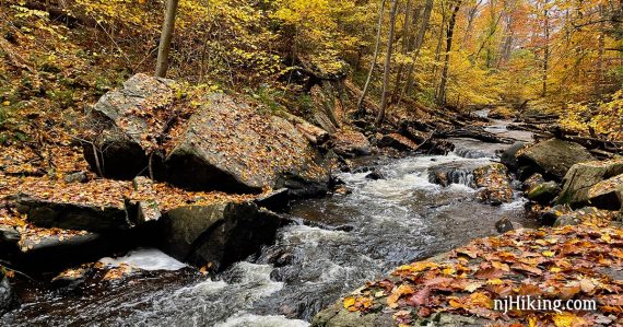
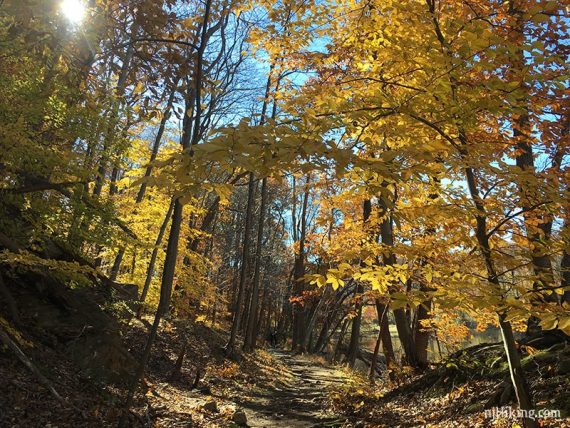
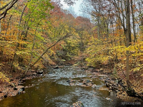
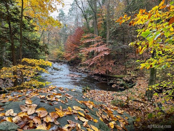
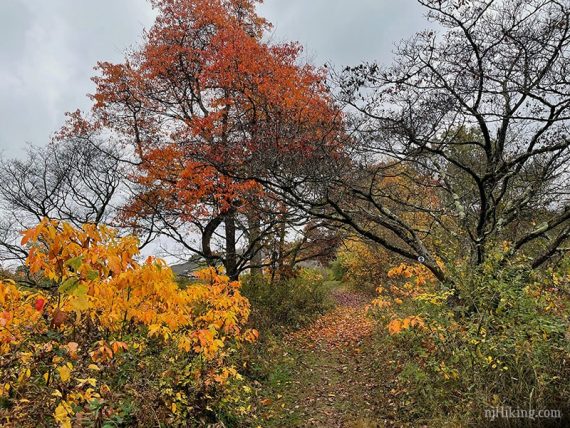
Along the river is especially stunning in fall foliage season. The loop can be done in either direction, but this way puts the most scenic – and harder – sections in the beginning when you’re fresher.
Requires a short bit of walking along Pottersville Road (little traffic). The shorter version to just Kay’s Cottage is still a solid hike just with less distance.
Updated: 9/2025 – Minor edits, re-hiked variation of shorter Kay’s hike. Older change log at page bottom.
Hike Info:
Map:
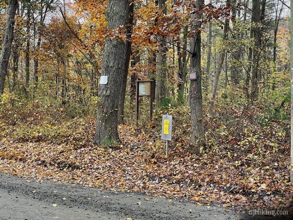
Print ahead. Didn’t notice any paper maps in the kiosk. Follow along on your smartphone with our Interactive Map link above.
Also Note: The trail names (i.e. Black River, Bamboo Brook) no longer referenced on trail maps but they may still be on trail signs. The Patriot’s Path tree+path marker is on some trails.
Books:
Hiking the Jersey Highlands, Hike of the Week, and 60 Hikes Within 60 Miles: New York City have this route in the other direction, and without the side trip to Kay’s ruins.
50 Hikes in New Jersey has a different route; a shuttle option (or a 13.2 mile out-n-back) to Bamboo Brook. Hiking New Jersey (2023) has a shorter route.
Parking: N40 46.698 W74 43.217
Cooper Gristmill, 66 Route 24, Chester Township, NJ 07930. Large dirt lot adjacent to the Cooper Grist Mill.
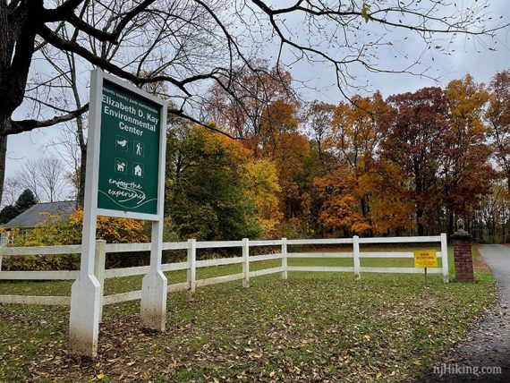
Parking is also available at Kay’s Environmental Center which is passed on this route.
Restrooms:
Portable toilets in the parking lot. Multiple stores in Chester.
Refreshments:
In fall there are several farm markets in the area. We are are partial to Hacklebarney Farms Cider Mill (cider donuts, baked goods, cider hot dogs, PYO, corn maze) but there’s also Alstede Farms (market, farm animals, activities) and Stony Hill Farms (market, PYO, activities).
Year-round, Chester’s Main Street has shops, restaurants, ice cream, and the nostalgic Black River Candy Shoppe.
Hike Directions:
Overview: BLUE (Black River Trail) – GREEN – ORANGE – GREEN DOT (BLK DOT on GREEN) – GREEN – RED (Conifer Pass) – BLUE (Bamboo Brook) – BLUE (Black River Trail)
From the parking lot, walk towards the Mill.
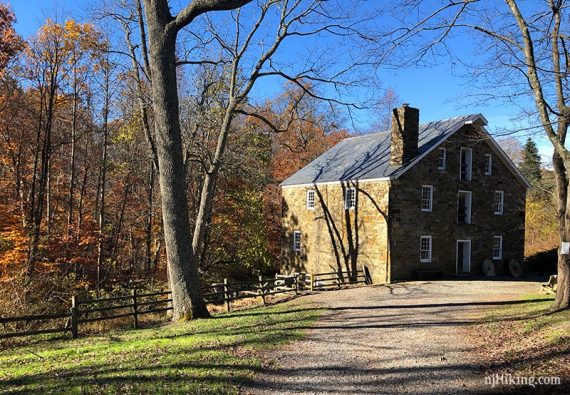
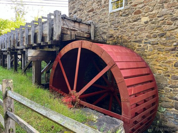
0.0 – Walk down the steps next to the mill.
Check out the water wheel at the base of the mill.
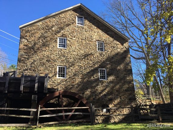
In May of 2024 a new waterwheel was installed at the Grist Mill and is a historically accurate and nearly identical reproduction of the 1927 Fitz. The photo above is before the replacement.
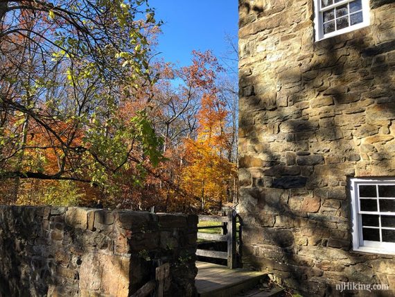
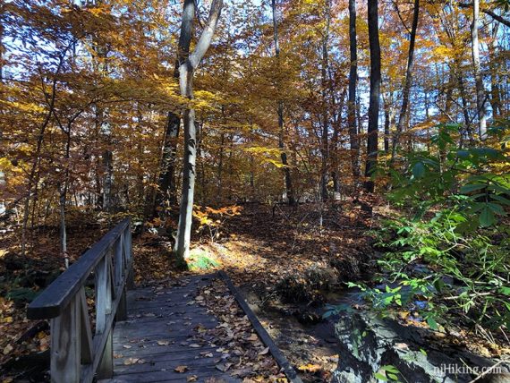
Cross a small footbridge and follow BLUE.
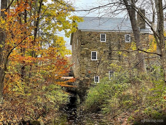
View of the mill along BLUE.
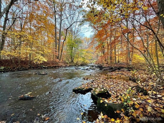
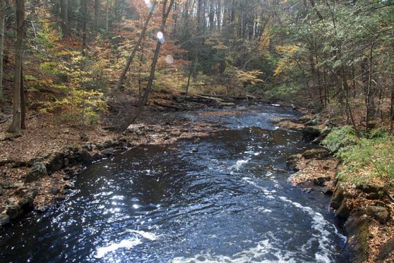
The trail follows the Black River and passes a fenced-in area of the old Hacklebarney mine.
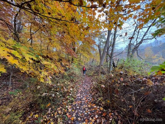
BLUE is generally level but rooty as it follows the water.
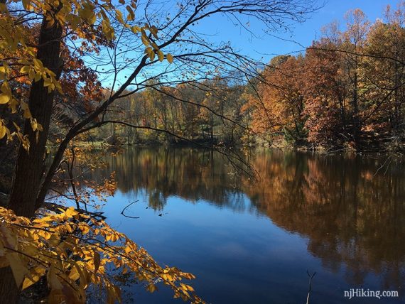
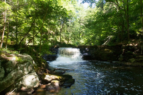
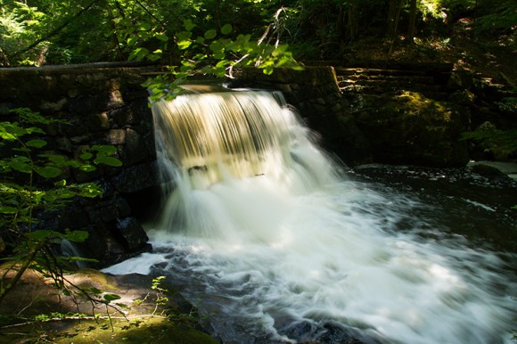
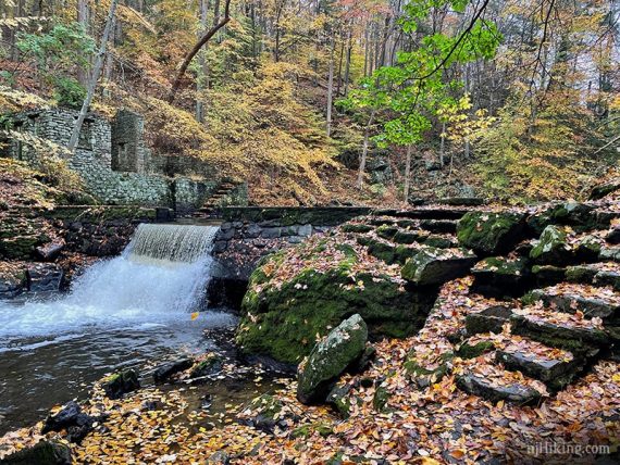
Continue on BLUE as it passes Kay’s Pond.
0.7 – The spillway at the end of Kay’s Pond:
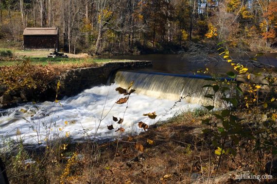
// Shorter option, 1.4 miles: Retrace the route back from here. //
Continue following BLUE along the Black River.
1.2 – Turn RIGHT to now follow GREEN at a marker post.
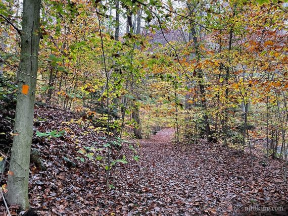
1.4 – Turn RIGHT to now follow ORANGE on a wide path. Markers might not be noticeable right away. [GREEN continues ahead].
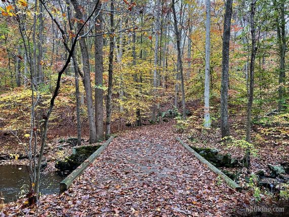
Cross the Black River on a wooden bridge with views of the river on either side. Continue following ORANGE as it heads uphill.
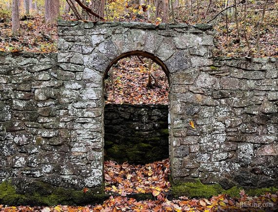
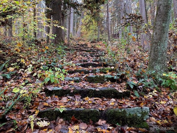
The river will come into view, keep an eye out on the left for stone steps leading down to Kay’s Cottage.
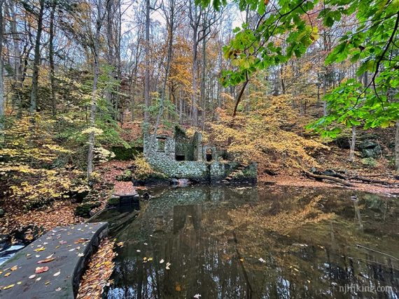
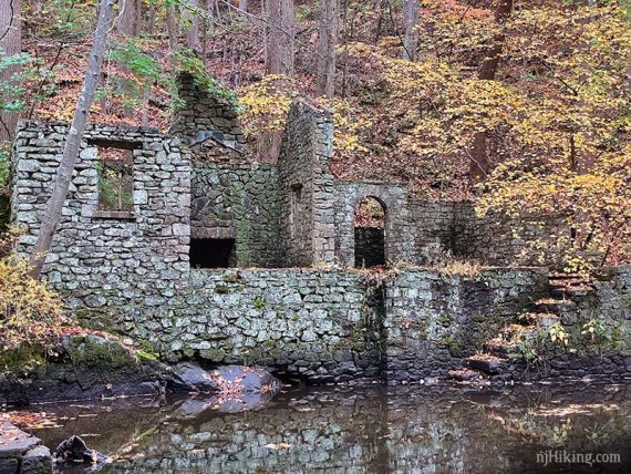
1.8 – Take the steps downhill to the ruins of Kay’s Cottage next to a dam (Optional: Continue to the path’s end a little bit further down, past the cottage).
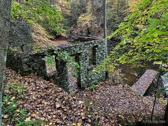
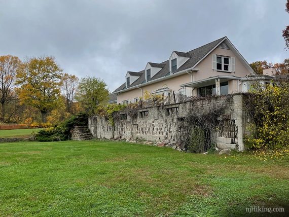
Kay’s Cottage History, part 1: Elizabeth D. Kay (1894-1987) and her husband Alfred owned Hidden River Farm on this property before it was a park. They created carriage roads throughout in addition to a summer cottage by the Black River. [Source: Morris County Parks website].
Inside the remains of Kay’s Cottage:
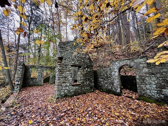
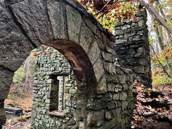
Kay’s Cottage History, part 2: The summer cottage had changing rooms, showers, a fireplace, and a terrace. They built a dam to create a pool in front, complete with diving board. Only the stone foundation and pool remain. [Source: Morris County Parks website].
The Black River spills over a dam near Kay’s Cottage.
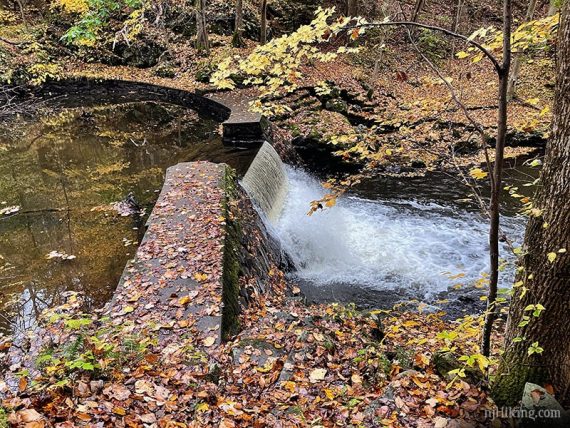
There is a wide gap in the concrete edge of the dam where the water flows through, so crossing here isn’t viable despite what we’ve seen on some maps. The trail mapping app GAIA, for instance, shows this as a trail.
Trying to leap across, or wading through, is definitely in the “not worth it” department in our opinion so our hike guide takes trails around to the other side of the river.
When ready climb back up the stone steps and retrace the route to the bridge.
2.1 – Just after crossing the bridge, turn RIGHT to now follow GREEN DOT.
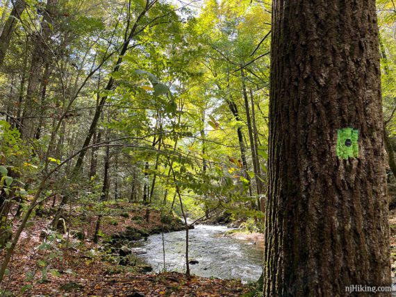
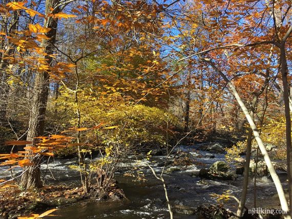
GREEN DOT hugs the river on a sometimes narrow trail with rocks and roots. While not exactly challenging, it isn’t an easy or beginner trail in spots.
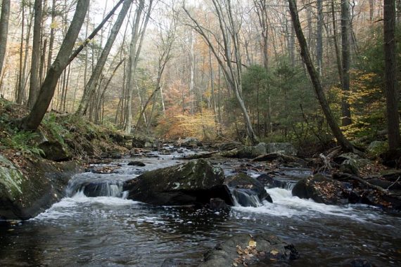
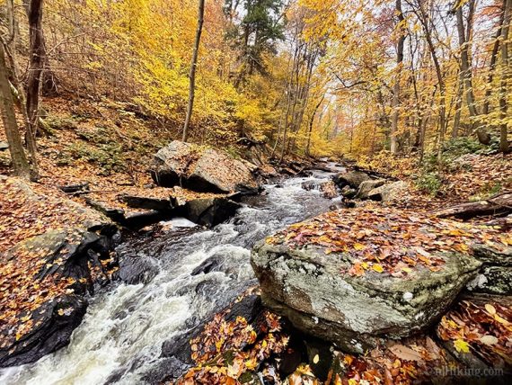
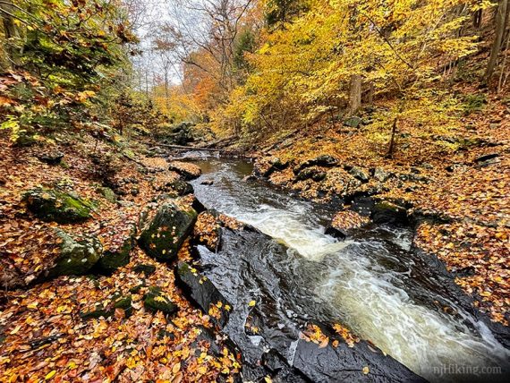
The gorge is very pretty with rushing water and cascades over rocks.
2.3 – GREEN DOT angles up a very short hill and ends at GREEN. The trail sort of merges into GREEN and you might not notice that GREEN DOT ended. Just after this point a side trail veers to the right to the edge of the water, ignore this.
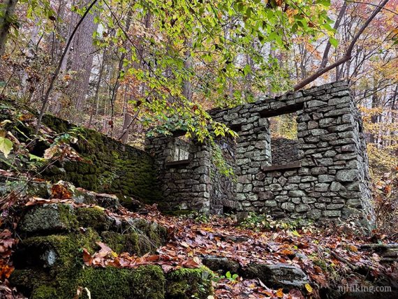
2.4 – Watch for the casual side trail off of GREEN that heads downhill on the right towards the river. You’ll hear the waterfall at Kay’s and stone steps/foundation comes into view.
Follow this down to arrive on the opposite side the river from Kay’s Cottage.
A pond was created in front of the cottage by damming the Black River.
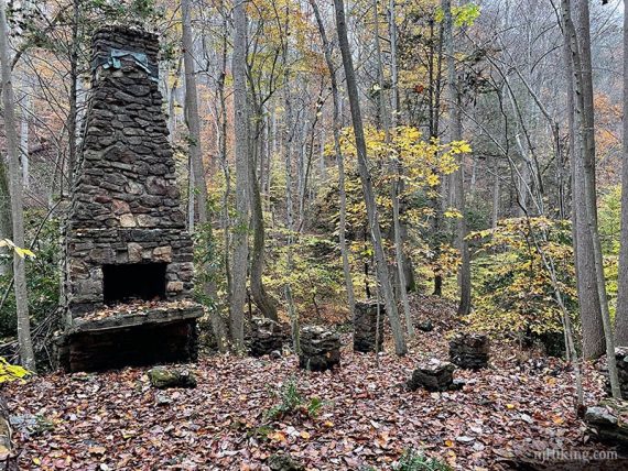
2.5 – Continue following GREEN as it veers to the RIGHT. (Greyed out markers are off on the left.) Pass the remains of a chimney.
2.7 – Turn RIGHT to now follow RED. [RED also goes straight. GREEN ends.]
// Shorter: Keep straight on RED to turn back to the main network of trails. There are multiple trails to get back to BLUE which leads to the parking lot. //
RED follows the Black River in a very pretty gorge.
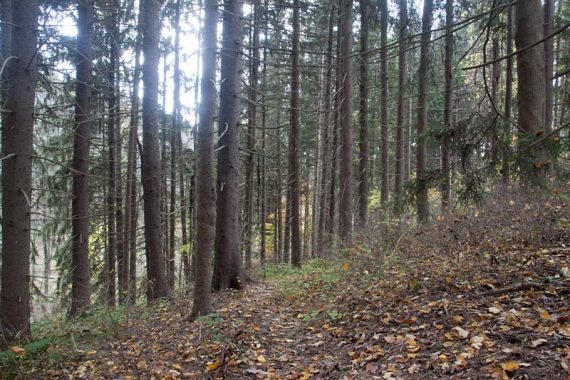
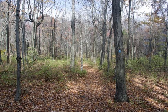
Eventually RED veers away from the river and heads uphill. Continue through a section of pine forest and cross a small stream.
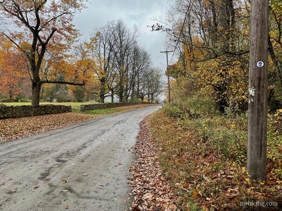
3.7 – Cross Pottersville Road.
4.0 – Large directional signs. Turn LEFT to start following BLUE.
[RED ends. BLUE also goes to the right, which leads to Bamboo Brook Educational Center]
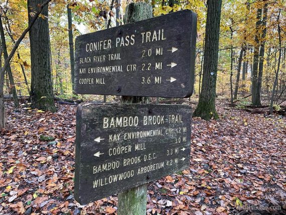
4.7 – Back at Pottersville Road. Turn RIGHT and walk along the shoulder of the road until the driveway for Kay’s Environmental Center.
4.9 – Turn LEFT onto the driveway for Kay’s Environmental Center.
Walk down the paved park road.
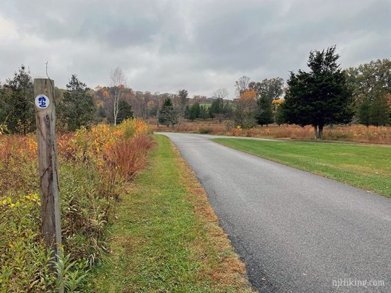
5.1 – Veer LEFT off of the pavement onto the grass. This is marked BLUE but was hard to spot.
Continue on BLUE by turning quick RIGHT at a post with ORANGE. Follow the wide straight path, past a marker with a #3.
Follow BLUE around the front of Kay’s Environmental Center and through the parking lot.
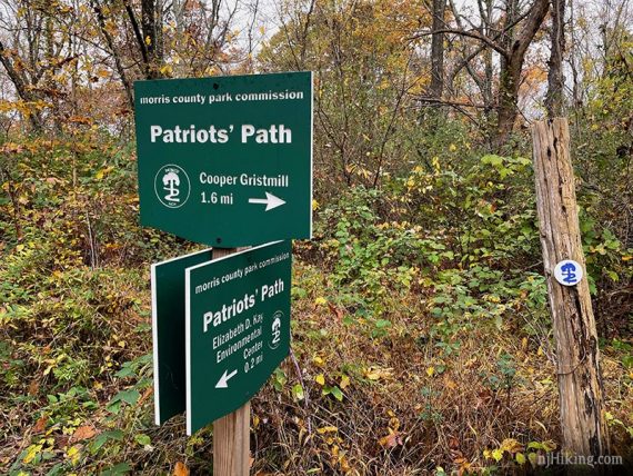
5.4 – Cross the parking lot, heading LEFT towards the “Black River Trail” sign and the “Patriot’s Path” post.
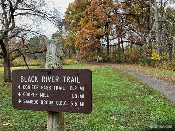
Shortly, follow BLUE as it turns RIGHT. [Pass WHITE, might not notice it].
5.6 – Patriot’s Path sign with “1.6 miles to Cooper Gristmill”. Turn RIGHT to continue on BLUE. [YELLOW goes left].
6.0 – Turn RIGHT to continue on BLUE.
Shortly, pass GREEN on the left, retracing the route from earlier on BLUE back to the parking lot.
—-
Hiked 9/27/25. only the Kay’s Cottage Ruins loop.
Hiked 10/15/23. only the Kay’s Cottage Ruins loop.
Hiked 10/24/20.
Hiked 11/4/18. Just to the spillway and back, 1.6 m RT.
Hiked 7/6/14. Trail Blog: “Black River County Park – Kay’s Cottage, Conifer Pass, Bamboo Brook – from Chubb Park“
Hiked: 4/28/12. Trail Blog: “Black River Park – Cooper Mill to Lamerson Road“
Hiked: 10/31/10. Trail Blog: “Black River and Cooper Mill on Halloween“
Hiked: 10/18/08. Trail Blog: “Black River in October” w/ B&T.
Hiked: 9/7/08. Trail Blog: “Black River from Cooper Mill to Willowbrook“; 14.8 miles
Hiked: 2/26/06. Trail Blog: “Black River and Cooper Mill in Winter“
Updated: 11/2023 – Minor edits, adjusted description for blaze change at the bridge (to GREEN DOT from GREEN/ORG); re-hiked Kay’s Cottage section only. 11/2020 – Re-hiked. Major route and description revision since formerly unmarked trails have been blazed. Interactive map updated. Photos added. 10/2020 – Page refreshed, not re-hiked. 11/2018 – Re-hiked the first section to the spillway only. Added fall photos. 11/3/17 – Updated map/park link. 7/11/14 – Re-hiked, route adjusted, GPX added.