View the Delaware River from atop a bluff, through scenic Van Campens Glen, and the historic buildings of Millbrook Village.
!!! We do not recommend hiking thiS ROUTE – SEE NOTES BELOW !!!
Trail surface: Moderate. Lots of woods roads on the first part; trail is very rocky and right at water’s edge through Van Campens Glen and could be slippery in wet or icy conditions.
| 6.8 miles | This hike guide: Detailed instructions and photos follow below. |
| Shorter | 1.6 – Hike through Van Campens Glen only (from different parking) 4.4 – (roughly). Out-and-back along Orchard, Hamilton & Pioneer to where the river is visible through the trees. 1.5 – (roughly). Coventry Pond trailhead is located at a smaller parking area just south of here. (We have not hiked this) |
| Nearby Hikes | Laurel Falls; Sunfish Pond to Raccoon Ridge; Catfish Fire Tower; Sunfish Pond – Douglas Loop; Coppermines – Rattlesnake Swamp; Rattlesnake Swamp – Catfish Fire Tower Loop; Buttermilk Falls, Crater Lake, Hemlock Pond; Buttermilk Falls (falls only); Silver Spray Falls; Tillman Ravine; Blue Mountain Lake Loop; Crater Lake and Hemlock Pond Loop; Crater Lake to Blue Mountain. |
Our two cents:
Updated: 4/2024 – Oddly, this hike still appears in two recently updated guidebooks: Best Day Hikes in New Jersey and Hiking New Jersey (2023). There continues to be a road walk (bleh) around the closure at Watergate. We still don’t recommend this route – but you do you.
5/2023 This hike has had various issues for a long time (see notes here) but we got a recent hike report that:
The Pioneer Trail, Hamilton Ridge, and cemetery are very overgrown, Orchard Trail is barely blazed, and the Watergate closure creates a lengthy road walk back… so just don’t do this hike. Thanks to Greg J. for the update.
However, Van Campens Glen on it’s own is really nice – we recommend doing that short hike then driving nearby for more.
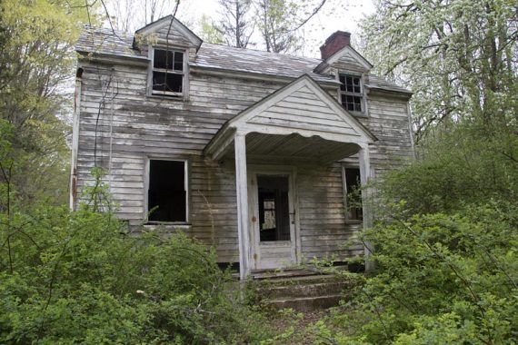
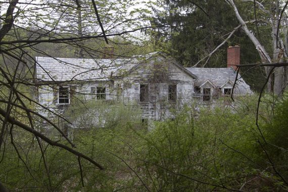
NOTE: We have not hiked this since 2011 and there have been changes that make this hike guide very out of date, especially past Van Campens. Note that the buildings in the photos have been demolished for years except for the ones at the end in Millbrook Village.
4/2021 – Page refreshed but not rewritten or re-hiked. 1/29/18 – Minor route updates at 3.7 and 5.6, thanks to Shelby M. for the info. 1/14/16 – minor updates to the description, park links, only Van Campens area re-hiked.
1/4/13 – The Pioneer trail was affected by construction, and the old houses shown in the photos and video along that trail been demolished. We’ve left the mile marker in the description, but it might not be obvious they were even there.
Map:
Get the Kittatinny Trails. There is also a not-so-hot map at the link above. The GPX and Interactive Map don’t reflect the change at 5.6 miles below.
Books:
This hike and a trail map appear in Hiking New Jersey (2023). Trail descriptions appear in the Kittatinny Trails and the The New Jersey Walk Book.
Parking: N41 04.449 W74 57.805
From Interstate 80 westbound take NJ Exit 1 and bear right to a 3-minute light which controls one-way alternating traffic. From this point, Millbrook Village is 12 miles north on a scenic route with views of the river.
Restrooms:
Building located in the parking lot; also have seen porta-johns sometimes. The parking area for Van Campens Glen had a composting toilet as well.
Hike Directions:
Overview: Orchard (Orange) – Hamilton Ridge (Blue) – Pioneer (Orange) – Hamilton (Blue) – side trail to DePue Cemetery and return – YELLOW through Van Campens Glen – Unmarked trails
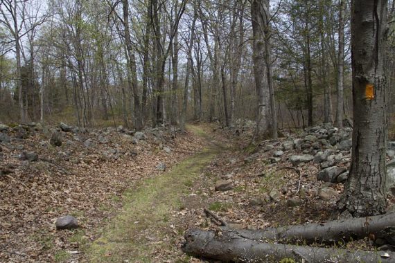
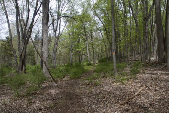
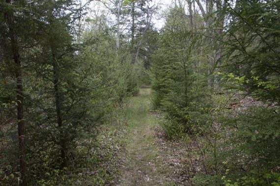
0.0 – The Orchard (ORANGE) trailhead is across the road from the driveway to the parking lot and is a little hard to spot. The trail heads uphill a bit, going through some fields being taken over by forest.
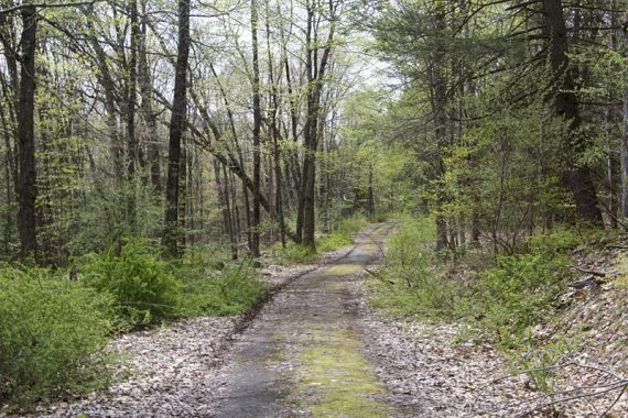
0.5 – Turn LEFT onto Hamilton Ridge (BLUE), now following BLUE. [Orchard (ORANGE) ends here] BLUE is a woods road with remnants of pavement.
1.3 – Turn RIGHT and now follow Pioneer (ORANGE). [Hamilton Ridge (BLUE) continues straight]
1.4 – Pass the remnants of a lime kiln on the right.
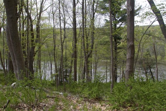
2.1 – The Delaware River is below, visible through the trees (with leaf cover… maybe not so much). Keep following Pioneer (ORANGE) as it turns left, following the river.
2.7 – Keep following Pioneer (ORANGE), a woods road.
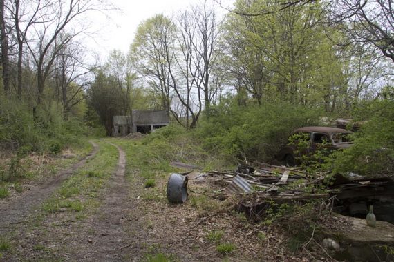
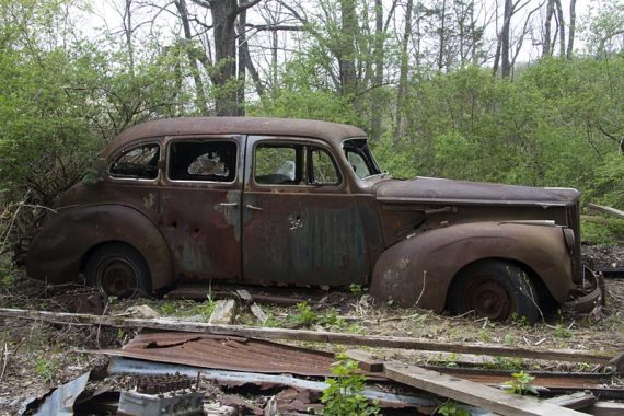
This is where the abandoned buildings and vehicles used to be. I’ve left the photos in to keep a record… and because they were cool.
3.5 – Continue straight but it is now blazed BLUE: The Hamilton Ridge (BLUE) comes in from the LEFT while Pioneer (ORANGE) ends here.
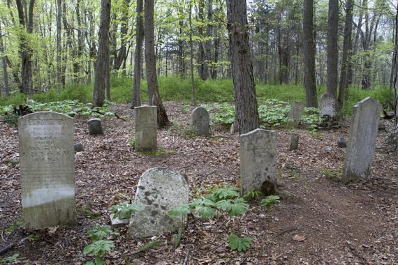
3.7 – Optional: Turn RIGHT for an easy-to-miss short spur trail to the tiny DePue Cemetery. Watch on the right for it where the gravel road bends left. The spur trail is at the start of a row of cement columns.
[Update 1/2018: The cement columns replace a guardrail that is now gone. The turn is before the guard rail and had a rock by it but is still easy to miss.]
4.0 – The Hamilton Ridge (BLUE) ends at Old Mine Road. Cross the road, turn LEFT and walk down the shoulder until you arrive at the Van Campens Glen parking area on the RIGHT.
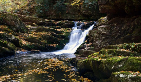
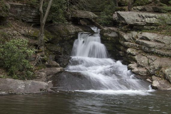
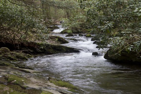
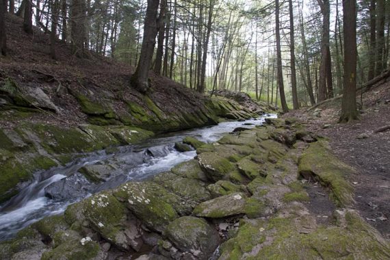
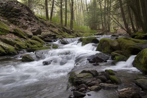
4.1 – Find the Van Campens Glen (YELLOW) trailhead at the end of the small parking lot by the trail kiosk and start following it as it hugs the side of the water.
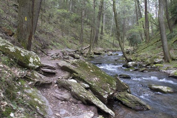
Pass pools of water and falls, climbing wooden stairs a few times. Very cool and shady.
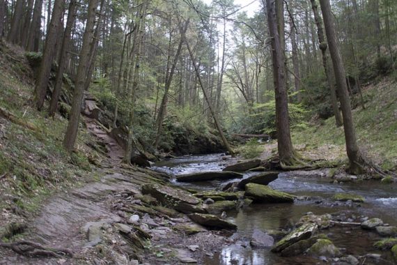
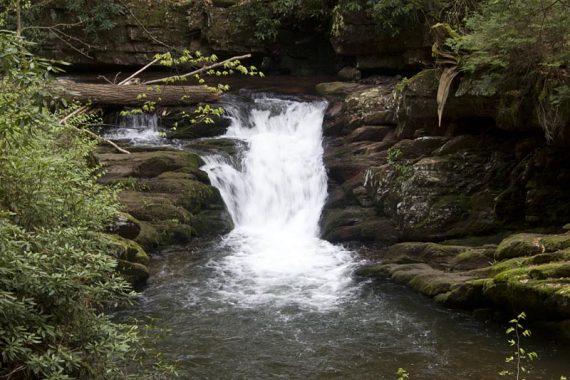
The trail runs along the top of the gorge, with drops to the water below. Watch your step.
At the end of the gorge, watch for YELLOW blazes that veer to the RIGHT, as the trail heads uphill and away from the water.
5.2 – Arrive at a “T” with a woods road. Turn LEFT. There were no markings when we hiked it. [the road is marked “Cut Off Road” on most maps]
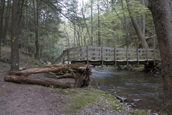
Walk down the woods road until just before a bridge where you make a sharp RIGHT back onto the trail. Keep following the unblazed trail.
5.6 – Turn left and heads toward Old Mine Road, turn right onto the road, then walk down the road to the Watergate picnic area.
[1/2018 – The trail is too overgrown to continue under the power line cut, so we’ve changed the directions but have not re-hiked this ourselves. Walk under a power line cut. There may be a closure reroute due to a washed out bridge; if so, you should be able to turn left and heads toward Old Mine Road, turn right onto the road, then walk down the road to Watergate. Go over a small bridge and head into the grassy area of the Watergate Picnic Area. Walk straight into the picnic area and pick up the gravel path. ]
In the Watergate picnic area, pick up the gravel path.
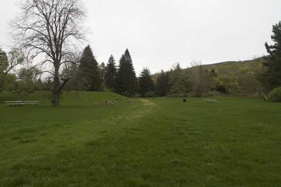
This will lead to the buildings of Millbrook Village.
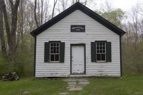
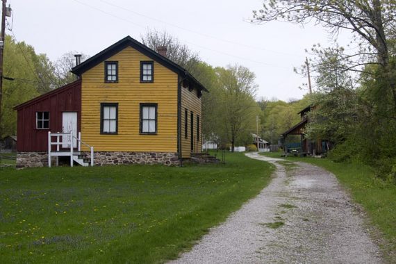
Continue following the path through the village and back to the parking lot.
—
Hiked: 10/31/21. Van Campens only.
Hiked: 10/18/15. Van Campens only.
Hiked: 5/1/11. Trail blog: “Millbrook and Van Campens Glen in Spring“