Hike a loop to Indian Rocks, Hemlock Pond, and Blue Mountain Lake in the Delaware Water Gap.
5.5 or 2.6 miles, total round trip. Mostly wide woods roads that aren’t that rocky, with minor elevation gain, but are quite grassy.
| 5.5 miles | This hike guide: Detailed instructions and photos follow below. |
| Shorter | 2.6 – Just to Blue Mountain Lake, skipping Hemlock Pond. Noted below. |
| Longer | 7.8 – Add a loop around Crater Lake. Noted below. |
| Nearby | Crater Lake and Hemlock Pond Loop; Crater Lake to Blue Mountain; Buttermilk Falls (falls only); Buttermilk Falls, Crater Lake, Hemlock Pond; Silver Spray Falls; Van Campens Glen; Millbrook Village and Van Campens Glen; Catfish Fire Tower; Tillman Ravine. |
Our two cents:
This is an enjoyable, not overly-taxing route on woods roads with a viewpoint, scenic pond, and a pretty lake all packed into a manageable length.
Abundant mountain laurel in the area. The trails should be suitable for snowshoeing or cross-country sking. While swimming is allowed at Blue Mountain Lake, there are no lifeguards – so be careful if you choose to do so.
The “Delaware Water Gap National Recreation Area” is located in New Jersey. “Blue Mountain Lake” is not to be confused with the “Blue Mountain Loop” in Stokes State Forest: Blue Mountain Loop – Upper or Blue Mountain Loop – Lower (but these are great hikes too!)
This is an alternate trailhead if you planned on hiking from Crater Lake and found that lot closed. In winter, the road is gated just after this parking lot.
Hike Info:
Map:
Kittatinny Trails. Follow along on your smartphone with our Interactive Map link above.
Parking: N41.09840° W74.93539°
“Blue Mountain Lakes Parking”, 34 Flatbrookville Stillwater Rd, Layton, NJ 07851. Large paved lot on the left side, with an entrance on either end.
If approaching via Rt 80 W, take exit 12 towards Rt. 521 and Blairstown (several quick turns here). Turn L on Rt 94, then soon turn R on Stillwater Rd, then very quick veer L on Bridge St, then sharp R on High St, veer L on Millbrook Rd. At Millbrook Village, turn R on Old Mine Rd, then R Flatbrookville Stillwater Rd, lot on the left.
Restrooms:
Composting toilet in the parking lot.
Refreshments:
Restaurants and Buck Hill Brewery are about 20 minutes away in Blairstown.
Hike Directions:
Overview: BLUE (Blue Mountain Lake – Outer) – GREEN (Hemlock Pond) – BLUE (Blue Mountain Lake Outer) – RED/BLUE Connector – RED (Blue Mountain Lake – Inner)
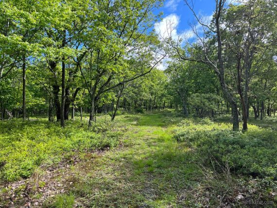
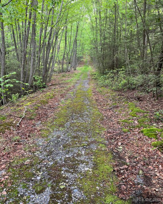
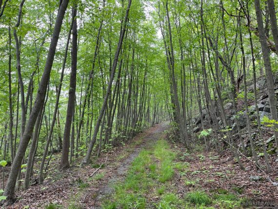
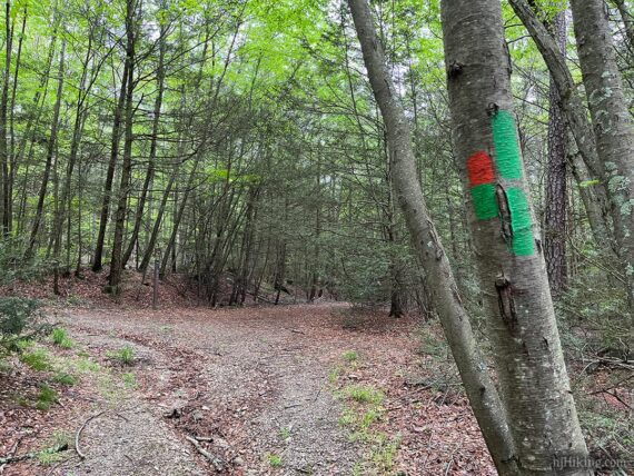
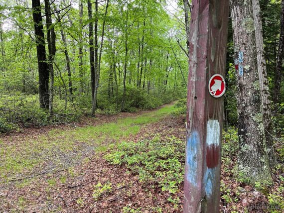
There is a network of wide woods roads all through this area, with multiple routes leading to the same place, but this route utilizes only the marked trails. The colored marks/blazes may not be that frequent but it’s usually obvious which direction to head.
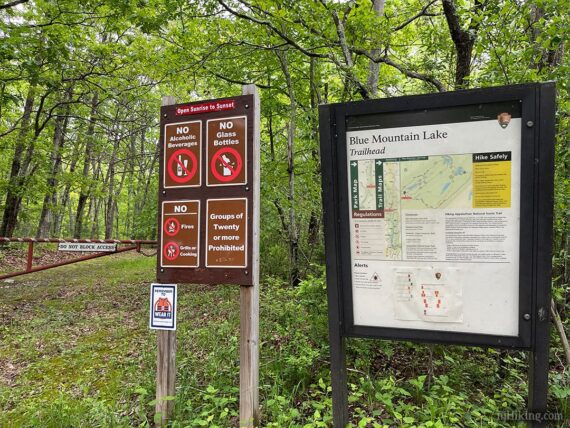
0.0 – The trailhead is at the opposite end of the parking lot from the toilet. There’s a trail kiosk with a map and info, and various warning signs.
Start following BLUE (Blue Mountain Lake – Outer) straight ahead by walking around the metal gate. The trail heads gradually uphill.
0.3 – Follow BLUE (Blue Mountain Lake – Outer) as it turns to the LEFT. Soon, it turns RIGHT. Continue along the wide flat woods road.
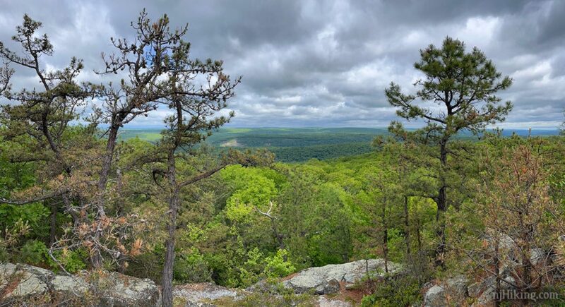
1.2 – Turn LEFT to follow a short unmarked side trail that meanders out to a viewpoint. There’s a obvious path at first and a few rock cairns then it’s less obvious where to continue over a rocky surface through pine trees.
MAP NOTE: Both the print and the Avenza version of Kittatinny Trails show this side trail and “Indian Rocks” viewpoint – but GAIA, AllTrails, and most other map sets do not indicate the location of the side trail or that there is a viewpoint at all.
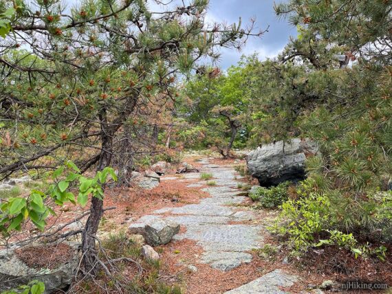
1.4 – Arrive at Indian Rocks viewpoint, looking towards the Delaware River and Pennsylvania beyond. There’s a nice sittin’ rock to take a break. Is it too early in the hike for a snack? Of course not.
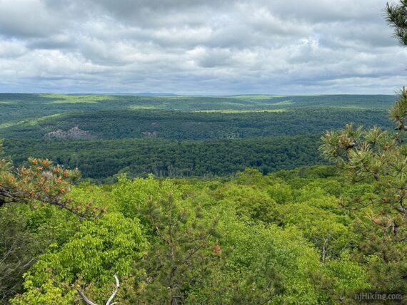
A zoom into the ridge line in Pennsylvania, on the other side of the Delaware River:
Retrace the side trail back and turn LEFT to continue on BLUE (Blue Mountain Lake – Outer). Soon, arrive at a junction with the RED/BLUE connector trail. Turn LEFT to continue on BLUE (Blue Mountain Lake – Outer).
// Shorter, 2.6 miles total round trip: Instead, turn RIGHT and follow RED-BLUE connector to an intersection with RED (Blue Mountain Lake – Inner). Continue left/ahead on RED (Blue Mountain Lake – Inner) (right leads back on RED too, but misses the lake view). Soon, RED turns RIGHT then passes another RED/BLUE connector. Scroll down to after 4.5 below to rejoin the description, following RED (Blue Mountain Lake – Inner) along the lake and back to the parking lot. //
Continue following BLUE (Blue Mountain Lake – Outer) on wide-n-straight woods roads.
Fun Fact: The grid of woods roads around Blue Mountain Lake are what remains from a vacation home development circa the 1950s and 60s, before the creation of the Delaware Water Gap National Recreation Area. [Source: The New Jersey Walk Book, and for more history see “Paradise Lost, and Found“].
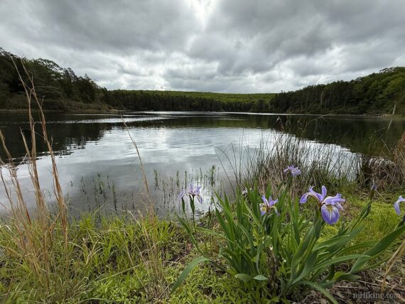
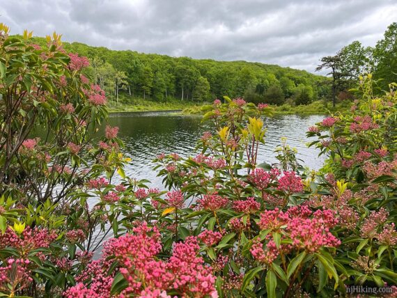
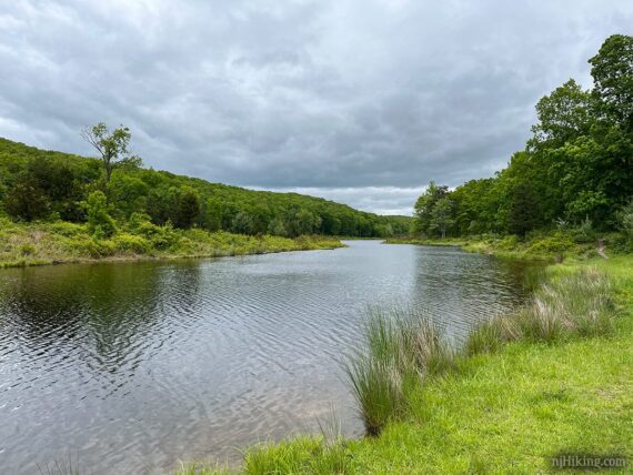
2.4 – Arrive at a Y-intersection and veer LEFT to now follow GREEN (Hemlock Pond). [BLUE (Blue Mountain Lake – Outer) / GREEN continues to the right]. Soon Hemlock Pond comes into view.
Head towards large rock outcrop jutting into the pond, then continue along the raised berm at the edge of the water. And yes, we had some very angry looking skies on our hike but it didn’t storm, it was just much cooler than usual for a Memorial Day Weekend.
At the end of the berm head down to the LEFT to follow GREEN (Hemlock Pond) back into the woods.
2.6 – Follow GREEN (Hemlock Pond) when it turns RIGHT. [YELLOW (Woods Road) continues ahead].
3.0 – Intersection with ORANGE-GREEN (Hemlock-Crater Connector).
First, turn RIGHT on ORANGE a short ways down to the edge of Hemlock Pond to see it from the other end, then return to this spot and continue following GREEN (Hemlock Pond).
// Optional add-on to Crater Lake +2.3 miles, for 7.8 total miles round trip – *note this is on rugged trail and harder than the woods roads you’ve been on until now: Instead, start following ORANGE-GREEN (Hemlock-Crater Connector). This heads uphill towards Crater Lake where you can loop around then return here, turning LEFT to continue on GREEN. See Crater Lake and Hemlock Pond Loop for details, being mindful that those hike directions start from Crater Lake. //
3.2 – Turn LEFT to again follow BLUE (Blue Mountain Lake – Outer). [BLUE and GREEN continue ahead to loop back around to where you were before].
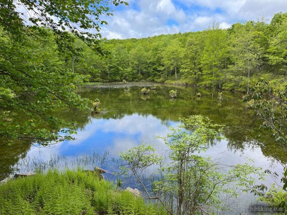
3.5 – A little unnamed pond appears down on the right. Continue following BLUE (Blue Mountain Lake – Outer).
4.3 – Turn RIGHT to now follow RED/BLUE connector trail. The wooden post also had a white mark… unsure what that is for, probably old. [BLUE (Blue Mountain Lake – Outer) continues ahead and also leads back to the parking lot – it just misses the lake].
4.5 – Turn LEFT to now follow RED (Blue Mountain Lake – Inner). [RED also goes to the right – and if you’ve cut Hemlock Pond out of the route this is where you meet up to the description.]
4.9 – Follow RED (Blue Mountain Lake – Inner) as it turns to the RIGHT. [Unmarked path continues ahead and meets up with this route in a bit).
When we hiked, there was a very muddy area just as the trail approached the lake but it was brief and the trial was fine after.
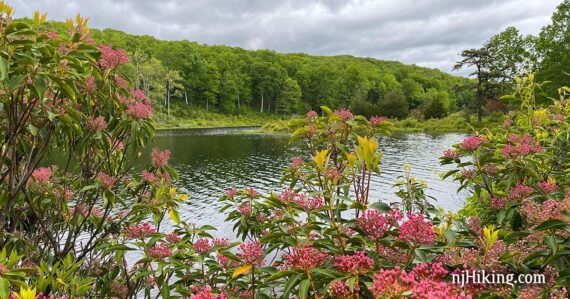
In late May the mountain laurel blooms were a little further along at the lake but on the rest of the hike the flowers were just budding.
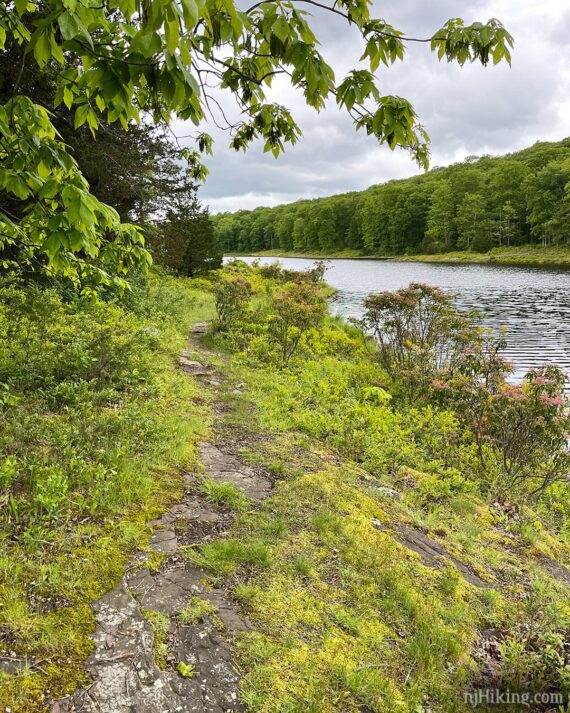
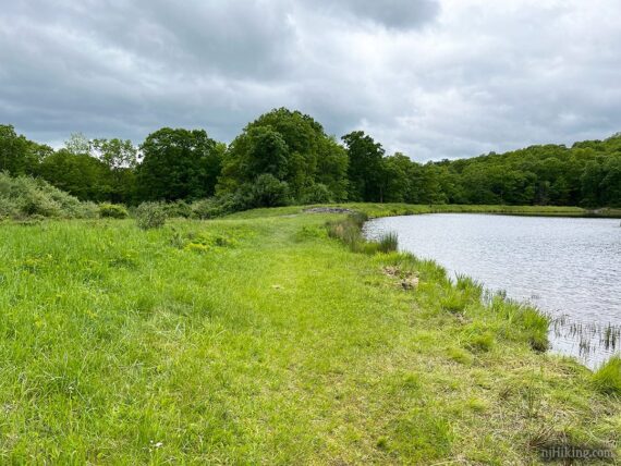
Continue following RED (Blue Mountain Lake – Inner) as it hugs the edge of Blue Mountain Lake.
We had a family of geese joining us along our journey.
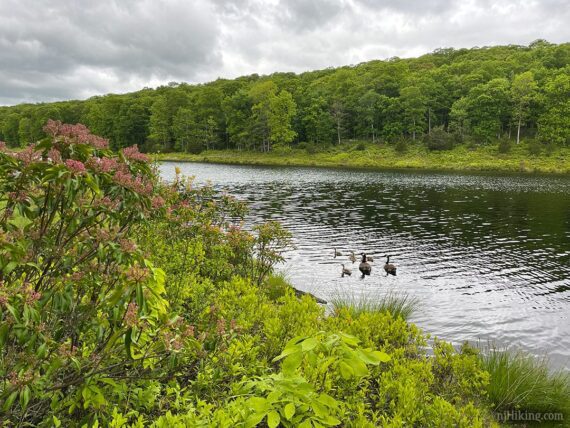
A small island in the middle of the lake comes into view, towards the far end of the lake.
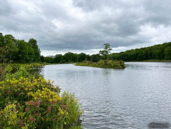
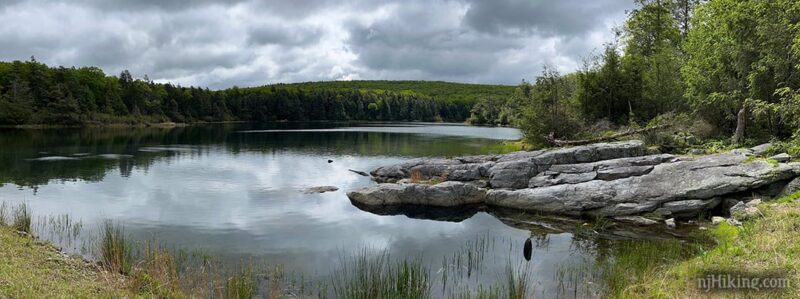
5.2 – Arrive at an large, open grassy area directly across from the small island. At the very end of the lake is a dam.
From the grassy area, looking back down Blue Mountain Lake, with the island on the left:
When ready, continue following RED (Blue Mountain Lake – Inner) back to the parking lot.
—
Hiked: 5/24/25.