
Hike a loop from the highest point in New Jersey for expansive views over the tri-state area.
3.5 miles, total round trip. Varies between very rocky and smoother trail; last bit is an uphill climb back up to the monument parking lot.
| 3.5 miles | This hike guide: Detailed instructions, photos, and video follow below. |
| Longer, variation | 7.7 – Monument Trail and Cedar Swamp via Appalachian Trail. |
| Same park | Monument Loop via Steeny Kill Lake; Appalachian Trail and Iris Loop. |
| Nearby | Wallkill River NWR; Culvers Gap to Blue Mountain; Culvers Gap to Culver Fire Tower. |
| Nearby, P.A. | Cliff Park, Milford Knob, Hackers Falls; Raymondskill Falls. |
Our two cents:
This solid loop starts with big panoramic views from the highest point in New Jersey over the entire area, with the option to climb the monument’s 291 stairs for even higher views (open seasonally).
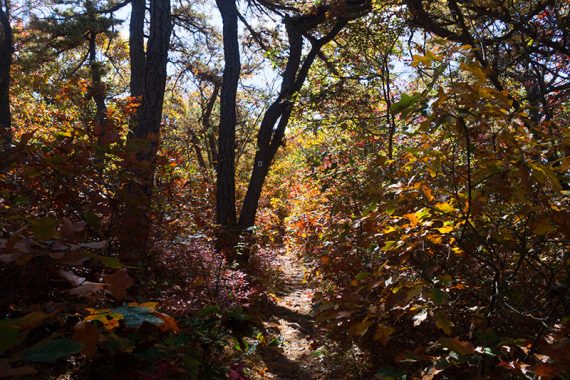
The hike continues through a beautiful forest with more viewpoints and crosses a cedar bog on a long boardwalk. This area is one of the best places to view fall foliage in New Jersey.
The High Point State Park Monument is a memorial to New Jersey veterans and also marks the highest elevation in the state at 1803’. Swimming is available at Lake Marcia in season.
Updated: 10/2025 – Minor edits, re-hiked.
Hike Info:
Map:
Pick up a trail map at the visitor center, print from the park site, or use the detailed Kittatinny Trails. Follow along on your smartphone with our Interactive Map link above.
Books:
This exact route isn’t in a book as far as we know but a similar loop is in Hike of the Week and our longer variation appears in Best Day Hikes in New Jersey. Other hikes in High Point State Park can be found in Hiking New Jersey (2023) and Best Day Hikes Near New York City.

Parking: N41.32319° W74.65973°
“High Point Lookout, Monument Rd, Wantage, NJ 07461”. Approaching 80W take Rt. 15 N to Rt 565 to Rt 23 N.
Or, a bit more scenic and a tad longer: Rt 287 N to Rt 206 N. When Rt 206 and 15 meet, Rt 206 turns into 565. Take 565 to 23. Turn left onto 23 and follow it into High Point.
This route starts at the large lot next to the monument. Fee charged from Memorial Day through Labor Day, see NJ State Park Pass.
Restrooms:
In the parking lot for the monument and also at the visitor center driven by on the way in. Times vary by season, check park site.
Hike Directions:
Overview: Monument (RED/GREEN) – Shawangunk Ridge (“SRT” – AQUA) – Monument (RED/GREEN)
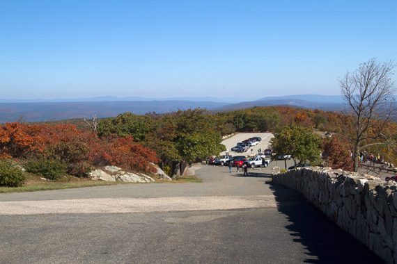
The trail starts at the far end of the parking lot – but check out the High Point State Park Monument first. There are fantastic 360° views from this point even if you don’t climb to the top.
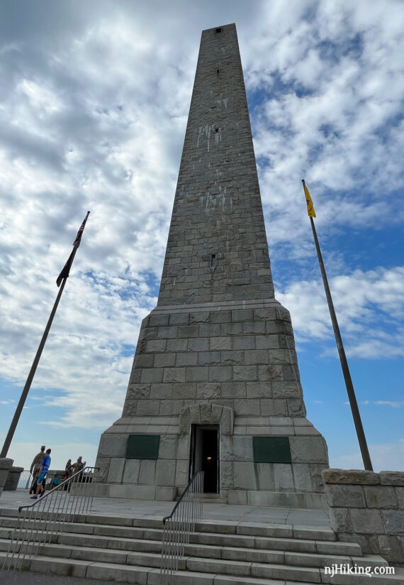
Fun Facts: Anthony and Susie Dryden Kuser gifted the monument and 16,000 acres of land to create High Point State Park in 1923. Construction was started in 1928 and completed in 1930. The monument is 220′ tall and there are 291 steps inside to climb to the top. [Source: Park website]
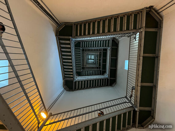
It’s worth the climb up the monument – but it is many flights of steps and it can be warm within the stairwell.
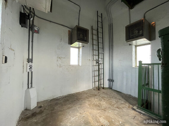
For those who aren’t keen on heights or climbing steps in towers and are trying to decide whether to go up, this is what you can expect:
The first short flight is a spiral stair with open grated steps that leads to a large landing; after that is a narrow staircase with closed steps. Looking up:
The top of the monument is a small enclosed room, with 3 smallish windows that are a bit high to see out of (may need to lift the kids). You were probably expecting something fancier.
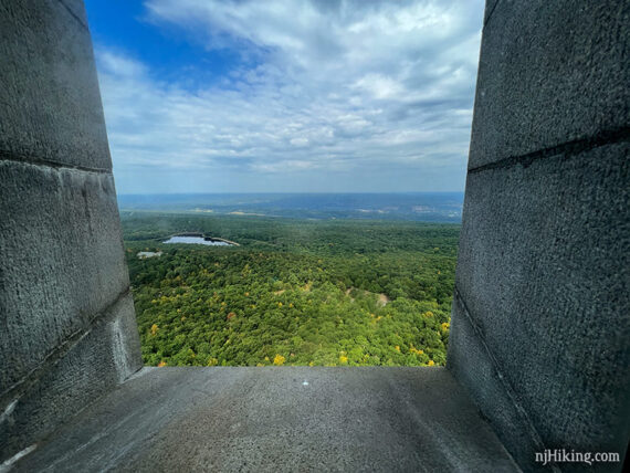
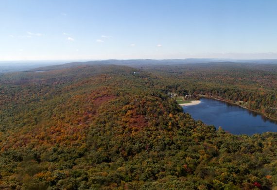
The thickness of the stone monument is obvious when looking out the windows. This is looking east over Lake Marcia within High Point State Park and into Pennsylvania.
Looking west over New Jersey and into Pennsylvania, with the end of Lake Marcia visible.

Zoom into Lake Marcia with the swimming beach at one end.
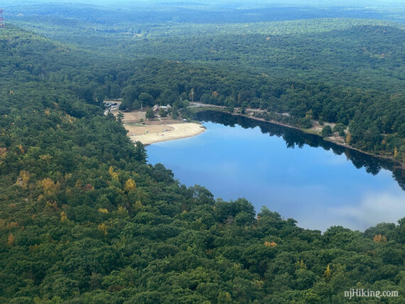
View looking south towards the Delaware Water Gap and over New Jersey with Lake Marcia within the park below. New Jersey’s prominent Kittatinny Ridge is visible and goes all the way to Mt. Tammany.
To start the hike, walk away from the monument to the opposite end of the parking lot.
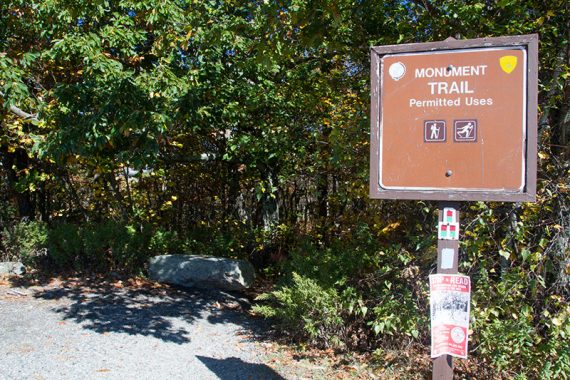
0.0 – Start following RED/GREEN Monument Trail at the trail sign at the far end of the parking lot.
Looking back at the monument from the trail sign:

Continue on Monument (RED/GREEN), which is co-joined with Shawangunk Ridge (AQUA).
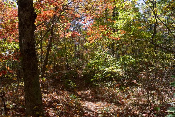
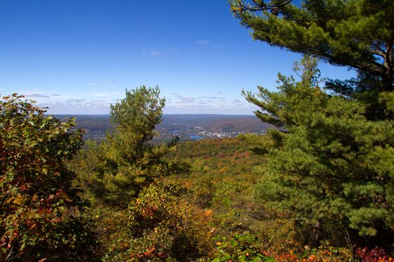
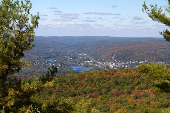
The trail is pleasant, easy and mostly level with some short paths to views on either side. The view from some of these side trails has become more limited over the years as vegetation and trees have grown.
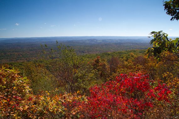
View from a side path on the right, looking over New Jersey (taken Oct 2014):
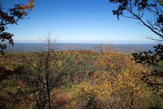
View from a side path on the left, looking into Pennsylvania (also Oct 2014):
1.0 – Don’t cross a small wooden bridge, and instead turn LEFT to now follow Shawangunk Ridge (“SRT” – AQUA).
Monument (RED/GREEN) continues ahead over the bridge, and if you miss this turn you’ll just skip the boardwalk section below. Ignore the unmarked trail on the right.
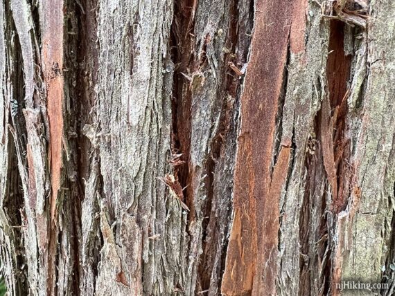
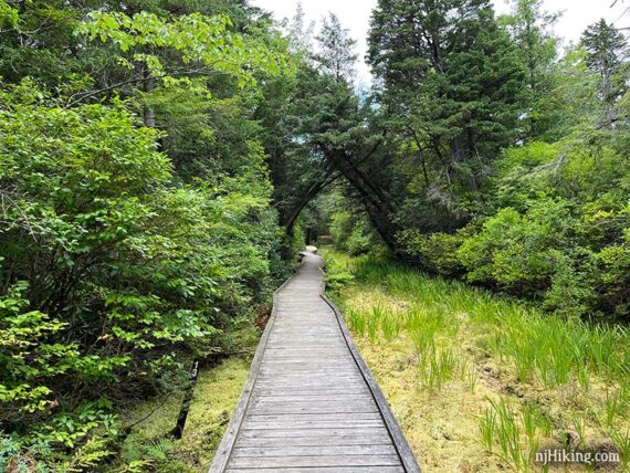
1.4 – Turn RIGHT and follow Shawangunk Ridge (“SRT” – AQUA) over a bog on a long boardwalk.
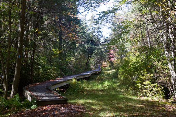
Fun Fact: This Atlantic white cedar swamp is at 1500’ and is the highest known swamp of this kind [Source: Park website]. The distinctive texture of the bark of a cedar tree:
We spotted multiple bobcats nearby, along the Cedar Swamp Trail, in August of 2022. These are seldom seen and it was just one of those “right place at the right time” moments. Be sure to pop over to the post and watch the video!
1.6 – Turn RIGHT at the bench and in a few steps meet back up with Monument (RED/GREEN).
Turn LEFT to start following Monument (RED/GREEN) again. Head uphill and along a ridge, with views on the right of Port Jervis, NY and PA.
The trail is moderately rocky with minor elevation changes and lined with scrub oak (short little oak tree bushes).
1.7 – Continue on Monument (RED/GREEN). [Shawangunk Ridge (“SRT” – AQUA leaves to the right].
The trail heads downhill a bit as it leaves the ridge before curving to the right and going over a small bridge.
2.5 – Continue on Monument (RED/GREEN). [Pass Steeny Kill (BLUE) on the right]. The trail starts to head back uphill.
2.7 – Arrive at the park road near the Interpretive Center. Turn LEFT to follow Monument (RED/GREEN) along the park road toward Lake Marcia.
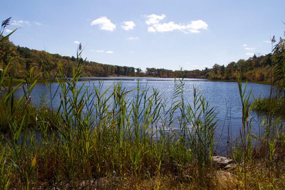
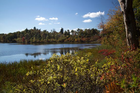
There is a bench at the end of the lake which makes a nice place to stop and enjoy the view. The monument can be seen from the Lake Marcia area, but you might want to walk along the shore a bit for better angles before continuing.
Follow an unmarked gravel trail as it skirts around the end of the lake to the other side. Views of the lake here too.
3.0 – Monument (RED/GREEN) markers appear again, turn LEFT and re-enter the woods, heading uphill. Cross the park road, continuing ahead on Monument (RED/GREEN).
3.1 – Turn LEFT to continue on Monument (RED/GREEN) at the junction with the Appalachian Trail (“AT” – WHITE). [AT – WHITE goes straight and to the right.]
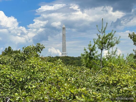
// Optional add-on, +0.3 miles total, out-and-back: At the junction with Appalachian Trail (“AT” – WHITE), instead turn RIGHT and follow the A.T. up a rocky hill and climb a viewing platform for another angle of the monument (shown below). Retrace to this intersection and continue ahead on Monument (RED/GREEN).
Continue following Monument (RED/GREEN). Cross over the park road and continue steeply up the path to arrive back to the monument and the parking lot.
—
Hiked: 10/17/25. Monument Loop only.
Hiked: 8/20/22. As part of the longer route.
Hiked: 10/5/14. As part of the longer route.
Hiked: 5/31/09. As part of the longer route.