Several nice viewpoints along a figure-8 loop using the Appalachian Trail and the Iris trail.
9.0 or 6.5 miles, total round trip. Very rocky start on the AT but moderate after that; a couple of minor steep areas, mostly rolling elevation changes. Swimming not allowed at Lake Rutherford, it’s a city water supply.
- Shorter: 6.5 miles. Return via the Iris trail when the AT first intersects it. Noted below.
- Longer: The Appalachian Trail goes north to Maine and south to Georgia so knock yourself out.
- Same lot: Hike Monument Trail via A.T. from here too.
- Same park: Monument Loop via Steeny Kill Lake.
- Nearby, 20 min: Wallkill River NWR; Culvers Gap to Blue Mountain; Culvers Gap to Culver Fire Tower.
- Nearby, PA: Cliff Park, Milford Knob, Hackers Falls; Raymondskill Falls.
Hike Info:
Our two cents:
Mostly shady route with several nice viewpoints relatively early on, and ends with a good view of Lake Rutherford.
Doing just one loop (the 6.5 mile version) is a solid option that gets you all the views with fewer miles. This hike can be reversed, but then the harder sections would be at the end.
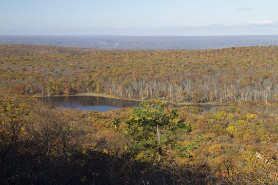
This area is one of the best places to view fall foliage in New Jersey.
Updated: 8/2023 – Page updated; re-hiked. Older change log at page bottom.
Map:
Use the Kittatinny Trails, pick up a trail map at the visitor center, or print the one from the park site. Follow along on your smartphone with our Interactive Map link above.
Parking: 41.302650, -74.667833
There are multiple parking lots at High Point. This route starts at the large “Appalachian Trail Hiker Parking” lot on Rt 23 once in the park, on the left, just after two stone pillars.
Just past the hiker lot on Rt 23 is the park office lot. This has a 2-hr parking limit so you can’t park there for hiking. Stop for info and restrooms and then return to the hiker lot.
Appalachian Trail Parking, Wantage, NJ 07461. Note: Google now shows multiple lots using this search term but this is the only street address available for the hiker lot.
Alternately, use the address for the park office which is a little PAST the turn off for the parking: 1480 NJ-23, Sussex, NJ 07461.
No fees at either of these lots; fees only if you continue into the park during the summer season.
Restrooms:
At the park office, just past the hiker parking area. Times vary by season, check park site.
Books:
Shorter non-figure-8 versions and map diagrams can be found in 50 Hikes in New Jersey and Hiking New Jersey (2023). A slightly longer variation and map diagram are in 60 Hikes Within 60 Miles: New York City.
Individual trail descriptions can be found in Kittatinny Trails and The New Jersey Walk Book.
Hike Directions:
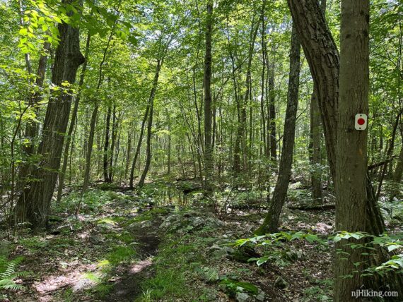
Overview: BLUE connector – Iris (RED DOT on WHITE) – Appalachian Trail (“AT” – WHITE) – Iris (RED DOT on WHITE) – BLUE connector
0.0 – From the parking lot, follow the trail near the trail sign.
0.2 – Turn RIGHT onto Iris (RED DOT on WHITE). It’s also marked BLUE connector.
0.3 – At the intersection, turn LEFT to now follow the Appalachian Trail (“AT” – WHITE) South. [AT (WHITE) also goes right and shortly arrives near the visitor center. YELLOW goes straight.]
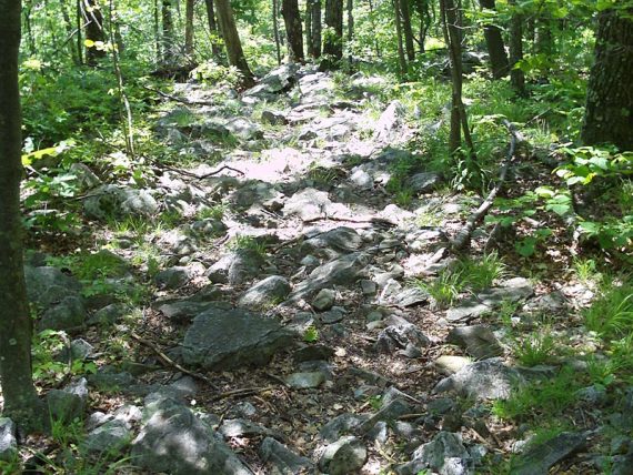
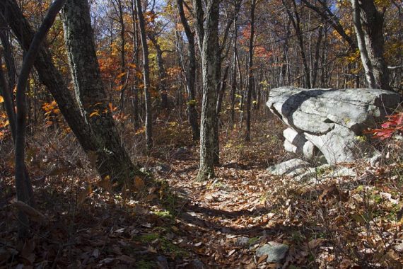
Soon after getting on the AT, pass a large sheer wall of rock rising above you. The trail surface of the AT throughout NJ is notoriously rocky – and the first couple miles of this route is even more so.
1.0 – Continue on AT (WHITE), passing the BLUE DOT trail on the right. [BLUE DOT leads to Sawmill Lake and campground].
1.1 – Limited viewpoint on the right. This looks over Sawmill Lake and into Pennsylvania but we couldn’t spot the lake in July 2023. It’s either a seasonal view now or tree branches obscure it all the time.
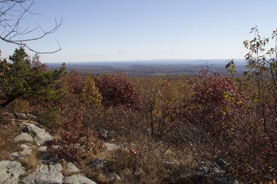
This is Sawmill Lake from this spot is from October of 2013:
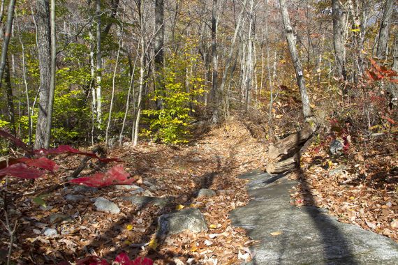
The trail descends a slightly steep section, then goes up a steep rocky section.
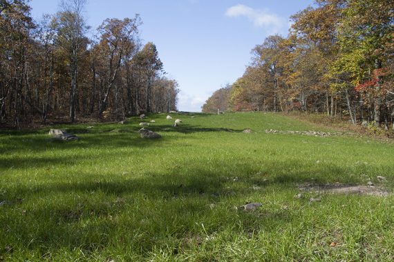
1.5 – Limited viewpoint east overlooking Sussex County. Lake Rutherford can be seen in the distance. There’s another limited view at 1.6 miles.
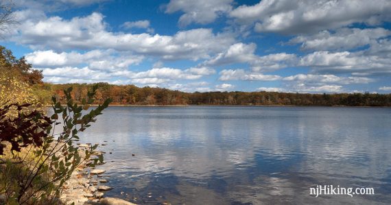
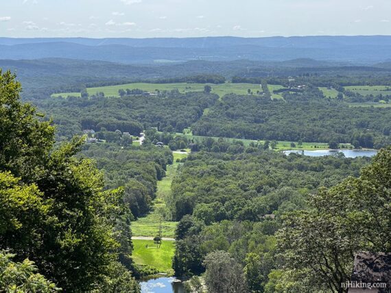
2.4 – Viewpoint from a large slanted slab of rock with Lake Rutherford in the distance. Nice place to take a break.
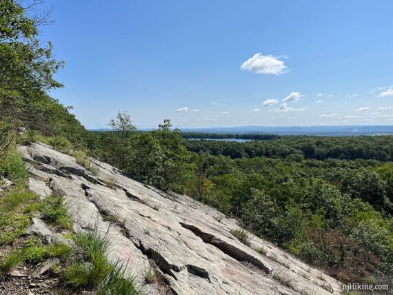
Close up of Lake Rutherford. There’s an opportunity to get down to the shoreline of this on the return trip.
2.6 – Another open rocky viewpoint, called Dutch Shoe Rock, that is similar to the last view but the lake isn’t visible. While many sources use this name, I could not locate the origin of it.
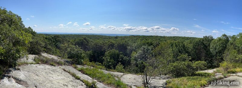
There is another view or two, but after so many, it had just gotten old hat and we neglected to mark them.
Pass a few interesting large rocks along the way.
2.9 – Continue on AT (WHITE), passing a BLUE spur trail on the left that leads to the Rutherford Shelter (camping spot on the Appalachian Trail). There is a sign for it.
3.3 – The AT (WHITE) intersects with Iris (RED DOT on WHITE). Bear RIGHT, still following AT (WHITE). AT (WHITE) and Iris (RED DOT on WHITE) are co-joined for a brief time, then split.
// Shorter option: Instead, return via the Iris trail now by turning LEFT. Follow Iris (RED DOT on WHITE) for a bit and then pick up the description below at 6.5. //
When the trails split, bear LEFT to continue following AT (WHITE) only, while Iris (RED DOT on WHITE) goes straight. There may not be obvious markings here.
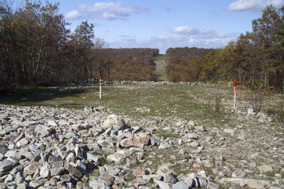
4.2 – The AT (WHITE) crosses a pipeline cut.
A short walk over to the left leads to a view over the valley below.
Just after crossing the cut, AT (WHITE) bears RIGHT. [A gated woods road continues straight ahead].
4.6 – At an intersection with a large rock, make a sharp RIGHT to begin following Iris (RED DOT on WHITE).
[Iris (RED DOT on WHITE) continues to the left and will go a little way to a parking lot on Deckertown Turnpike, while the AT (WHITE) continues ahead].
Head downhill, then back uphill.
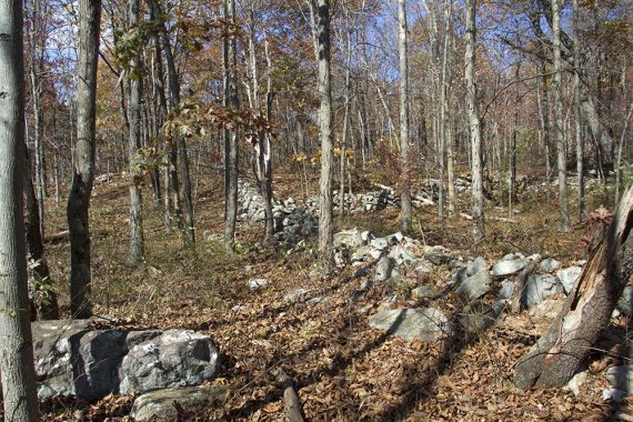
5.2 – Technically, pass an unmarked trail on the left for an optional side trip that leads to “Stone Wall Ruins” marked on the Trail Conference map.
The trail was no longer obvious (as of 7/2023) and even though we could see wall we didn’t bother to check it out again. The instructions/photos for this side trip are at the bottom of the hike directions, pop down there if interested in doing this.
5.5 – Pipeline cut, further down from the crossing earlier.
5.7 – Continue straight on Iris (RED DOT on WHITE) [AT (WHITE) is on the right, where you turned earlier in the day.] For this brief section, the two trails are co-joined.
Bear RIGHT when the trails split and continue following Iris (RED DOT on WHITE). [AT (WHITE) bears left]
6.5 – Continue following Iris (RED DOT on WHITE) as markers indicate a sharp LEFT. [The woods road continues straight but is marked private property].
Iris (RED DOT on WHITE) then quickly veers to the right. [An unmarked woods road continues straight, leading to the Rutherford shelter].
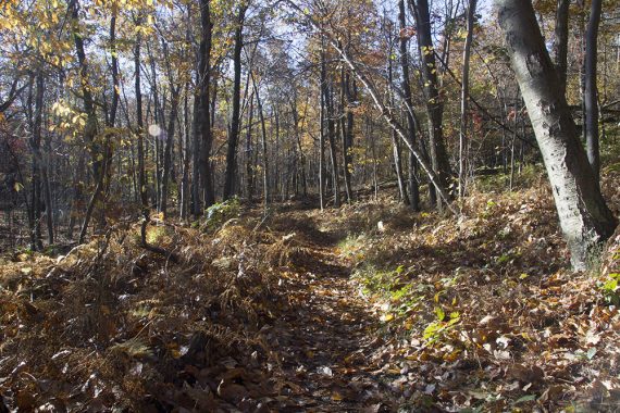
The trail is mostly level with moderate changes, grassy at times, with few rocks. There may be long areas of flooded sections to rock hop or walk along the sides.
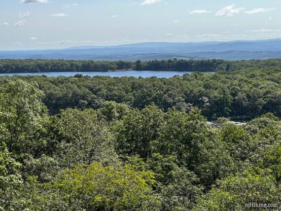
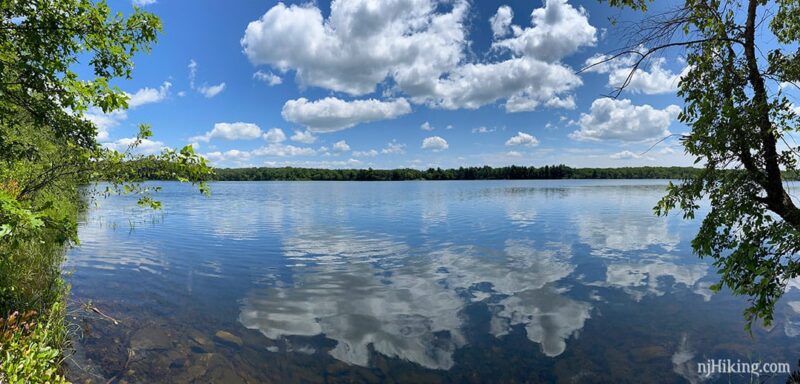
Lake Rutherford eventually comes into view, but the trail doesn’t run right along it.
7.0 – Cross a stream on a wooden footbridge. Shortly, is a limited view of Lake Rutherford through the trees. There is a rock to sit on for a break, but there’s another rest spot in a bit.
7.3 – Turn RIGHT on an unmarked spur trail (easy to miss – the Iris trail makes a left bend at this junction). Follow the unmarked spur trail somewhat steeply downhill to the edge of Lake Rutherford for a nice view and break spot.
Return to Iris (RED DOT on WHITE) and turn right on it to continue.
8.8 – Turn right onto BLUE connector and head back to the parking lot.
Optional add-on sidetrip from 5.2 miles above: Side trip to “Stone Wall Ruins”, out-and-back, only adds roughly .4 miles.
Not incredibly exciting, so most people will pass on this… but if you, like us, have a tendency to go wandering around the woods because you saw something marked “ruin” on a map AND you either have a GPS or a really good sense of direction…
Then pick up a faint, barely-a-trail that leads out to a large area of stone walls.
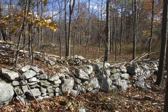
Near the walls, we spotted two old tin can bottoms nailed to a tree, red with a white center, but not any other markers leading out there.
The mileage from here on out assumes you DID NOT go on this little adventure, so add 0.4 to the rest of the mileages if you did. Hiked in 2013.
End of optional add-on //
—
Hiked: 7/22/23.
Hiked: 7/14/18. Trail Blog: “AT and Iris Trail in Summer“
Hiked: 10/20/13.
Hiked: 5/30/09. Trail Blog: “Hiking the AT and Iris Trail Loop“
Updated: 7/2018 – Re-hiked, description updated, changed map link to the one now on the park site instead of our older scanned PDF. 11/7/13 – Hike directions updated, new photos and GPS [Note: Older maps/books most likely will have the parking in the old area, and don’t show the BLUE connector trail.]