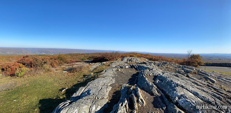
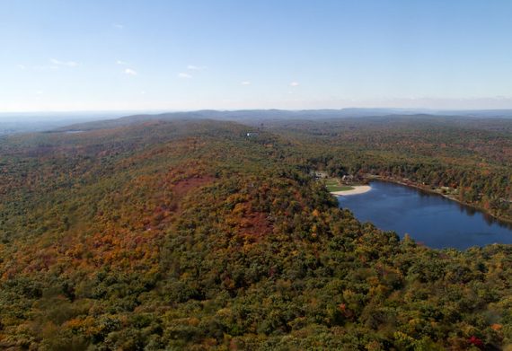
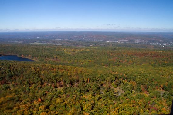
Varied views of High Point Monument and a panorama from the highest point in New Jersey.
6.0 or 5.0 miles, total round trip. Surface is rocky with some uphill sections.
| 6.0 or 5.0 miles | This hike guide: Detailed instructions, photos, and video follow below. 6.0 miles: Full route 5.0 miles: Skip the Cedar Swamp loop, noted below. |
| Longer | Add an extension on the Appalachian or SRT trails. |
| Nearby, same park | High Point Monument Loop; Monument Trail via A.T.; A.T. and Iris Loop |
| Nearby, 20 min | Wallkill River NWR; Culvers Gap to Blue Mountain; Culvers Gap to Culver Fire Tower |
| Nearby, PA | Cliff Park, Milford Knob, Hackers Falls; Raymondskill Falls |
Hike Info:
Our two cents:
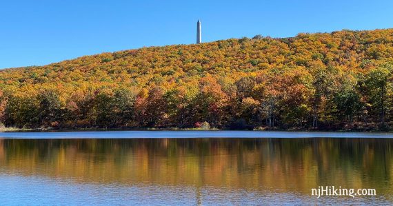
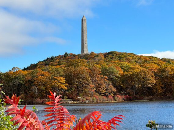
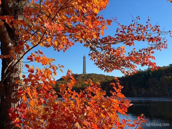
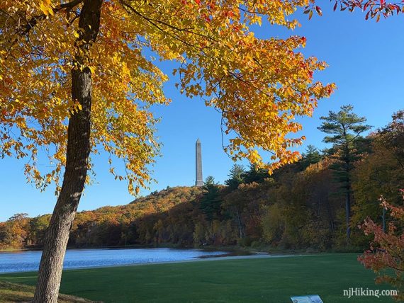
There’s plenty to treat your eyeballs on this hike in High Point State Park: two scenic lakes, the High Point monument seen from various distances, and vast views over NJ, PA, and NY.
Bonus: Climb the stairs inside the 220’ monument for an even higher view. Open between Memorial and Columbus Day but check the park site for current status, days/times.
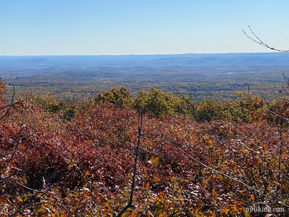
This park can be crowded, especially around the monument. This area is one of the best places to view fall foliage in New Jersey.
Updated: 10/2023 – Minor edits; re-hiked.
Map:
Kittatinny Trails or the park map. Follow along on your smartphone with our Interactive Map link above.
Books:
This route with the loop in the opposite direction is in Hiking New Jersey (2023). Other High Point routes are in 50 Hikes in New Jersey and Best Day Hikes in New Jersey.
Parking: N41.32137° W74.67727°
Steenykill Boat Launch – High Point State Park, 201 NJ-23, Sussex, NJ 07461. Rt 80 to Rt. 15 N to Rt 565 to Rt 23.
Pass the visitor center and main entrance. Parking entrance is further down Rt. 23 and on the right side. Continue down the driveway to a few spaces near the lake. The driveway was potholed but manageable in a normal car.
If this is full, the hike can be done starting from the monument lot (which is passed on this hike).
Fee: None from this lot. The main High Point lot at the monument does charge from Memorial to Labor day. Info on the NJ State Park Pass.
Winter note: This area requires a trail pass in season, Dec 1 – Mar 31, when snow is on the ground. For info: High Point Cross Country Ski Center.
Restrooms:
None at the trailhead. At the visitor center passed on the way to this lot. Mid-way through the hike in the monument parking lot.
Hike Directions:
Overview: Steeny Kill (BLUE DOT on WHITE) – Monument (RED/GREEN) – Steeny Kill (BLUE DOT on WHITE)
Fall Foliage in New Jersey was especially vibrant in 2020 and we managed to time this area at peak color… so there are a lot of photos :)
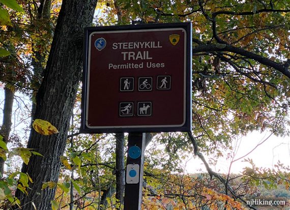
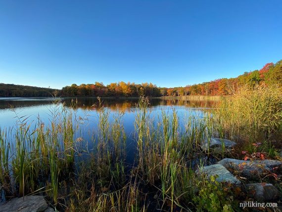
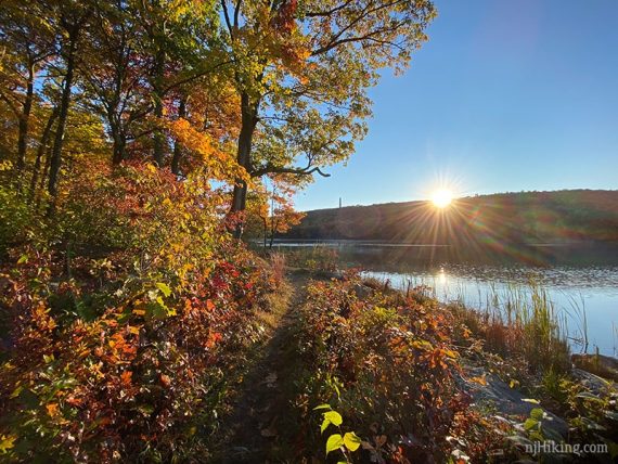
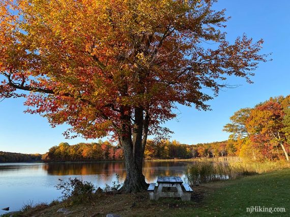
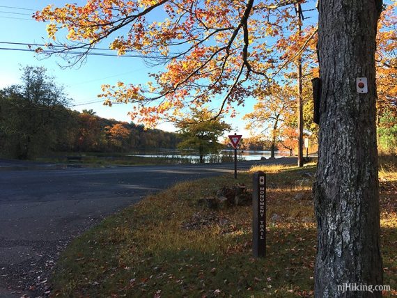
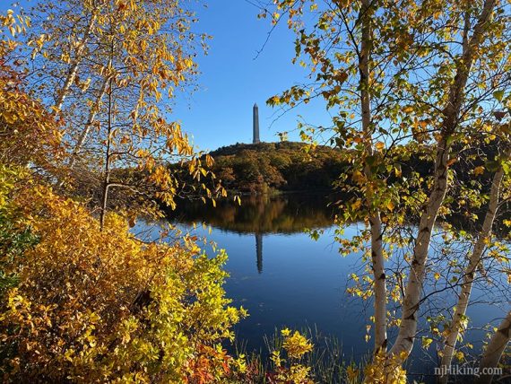
0.0 – Start following Steeny Kill (BLUE DOT on WHITE) at the edge of Steeny Kill lake.
The trail runs along the lake with the High Point Monument visible in the distance.
Pass a picnic table next to a large tree.
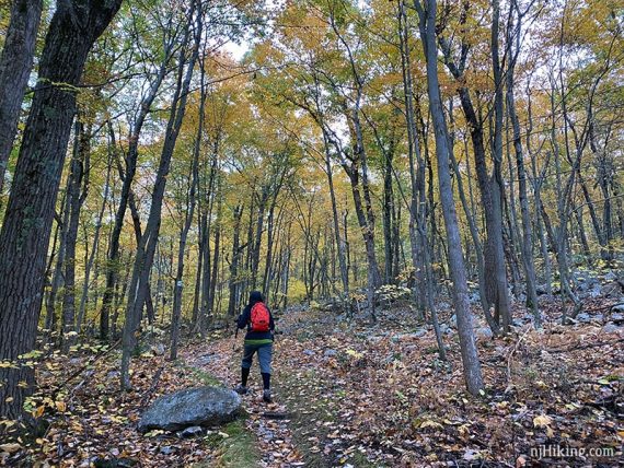
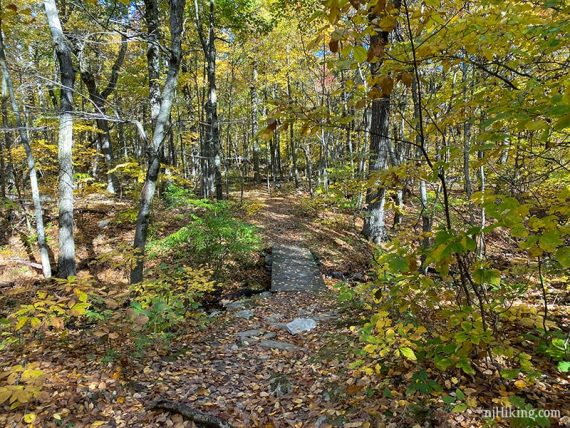
Continue following Steeny Kill (BLUE DOT on WHITE) as it crosses a stream on rocks, enters the woods, and heads uphill. There is a small section of stone steps.
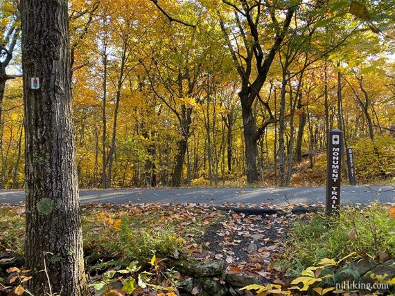
0.7 – Turn RIGHT to now follow Monument (RED/GREEN). [Monument (RED/GREEN) also goes to the left. Steeny Kill (BLUE DOT on WHITE) ends].
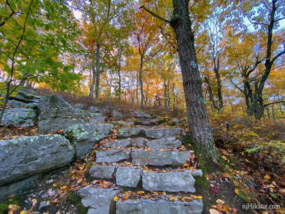
There are more stone steps as the trail continues uphill.
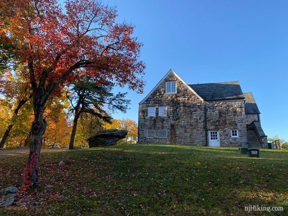
0.9 – Facing the park Interpretive Center building, turn LEFT and follow Monument (RED/GREEN) on the park road.
Head towards the corner of Lake Marcia.
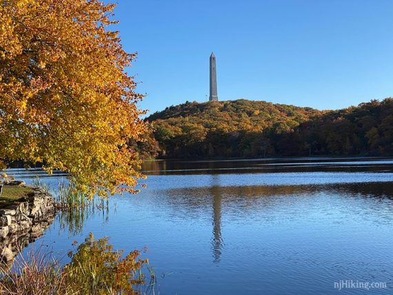
There is a view of all of Lake Marcia from the end of the lake (this photo is 2020). From the corner of the lake, there is an option to add a walk along Lake Marcia for views of the monument from different angles (for this reason, we recommend going at least a bit).

It’s set up as an add-on to the main hike because the distance people might want to go will vary. Do an out-and-back or loop around the whole lake (the other side is very rocky though).
If not doing the add-on, skip past both grey bars:
// Optional: Lake Marcia add-on, up to ~0.8 mile total //
For the Lake Marcia add-on… follow a casual path as it hugs the right side of the lake. The monument will be behind you.
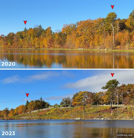
Update, 10/2023: Something seemed off to us as we started walking alongside the lake. Felt like there were less trees and we didn’t remember the hill between the path and the road being so open.
We’ve gotten really nice foliage shots from here and of the lake so later I checked my older photos and confirmed we weren’t crazy. This is from the other side looking at the path along the lake in Oct 2020 compared to Oct 2023. No idea if it was storm damage or they wanted to open the view from the road but it was kinda a bummer.
It’s still work walking down at least a bit to get shots of the monument with the lake in front but some of these next shots with trees in them aren’t possible anymore. I left them here as an archive… and because I like them.
On the path and looking back:
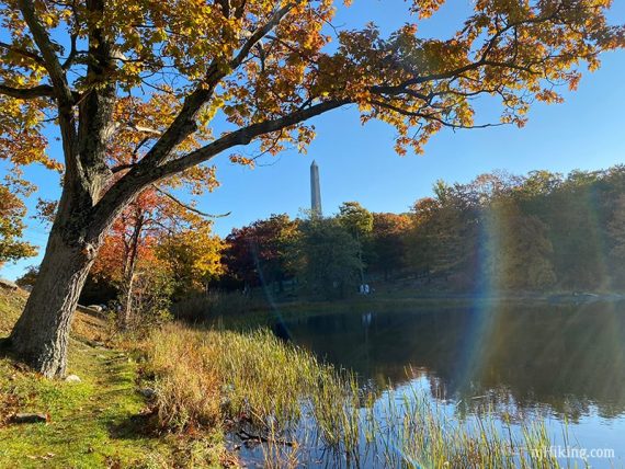
There are plenty spots for nice views of the monument, with places to frame the monument with trees…
…or with Lake Marcia in the foreground to reflect the monument.
There is a picnic table in an open grassy area.
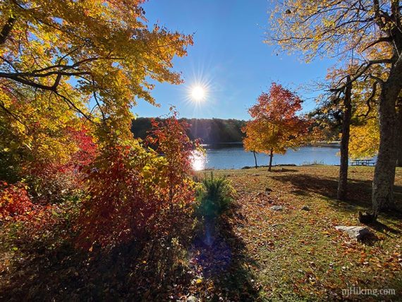
Continue as far as you’d like towards the beach area and then backtrack.
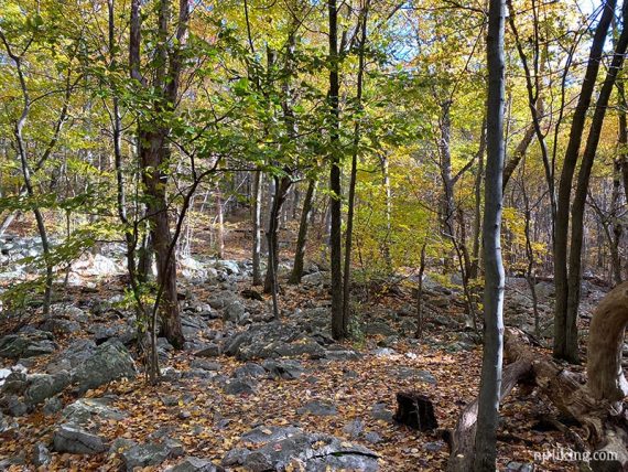
Or, to complete the loop, the trail continues back from the beach area on the other side of the lake and meets up with Monument (RED/GREEN) where it re-enters the woods. This section on the other side of the lake is quite rocky with a little minor scrambling.
Optional Lake Marcia add-on ends here. //
Continue following Monument (RED/GREEN) along the edge of the lake, with the monument to the left and the lake on the right.
1.2 – Soon after Monument (RED/GREEN) heads away from the lake, it re-enters the woods, and crosses the park road.
Not long after that is a 4-way intersection. Turn LEFT to continue on Monument (RED/GREEN). [Appalachian Trail (WHITE) comes in from the right and goes straight].
Monument (RED/GREEN) climbs up towards the Monument. Cross over the park road and continue steeply up the path. Soon you’ll approach the monument from below.
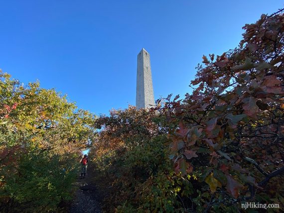
1.5 – Arrive at the High Point Monument. Fun facts: High Point State Park became a park in 1923. The monument honors all war veterans, was completed in 1930, and sits at the highest point in New Jersey at 1,803’.
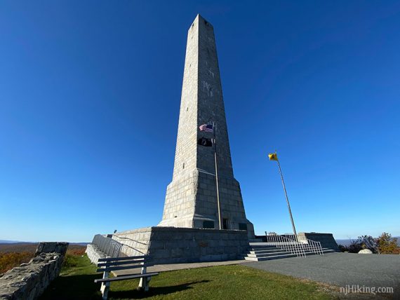
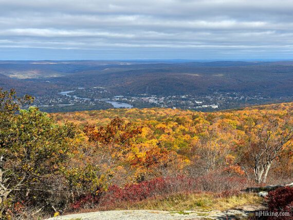
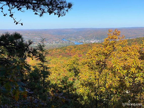
There are fantastic 360° views over New Jersey, and into Pennsylvania and New York from this point – even if you don’t climb to the top.
This is the view from the top of the monument… looking over Lake Marcia and towards the Delaware Water Gap…
…and over New Jersey into Pennsylvania…
Continue through the huge parking lot. On either side there are views…
Continue through the parking lot all the way to the end (passing restrooms on the left).
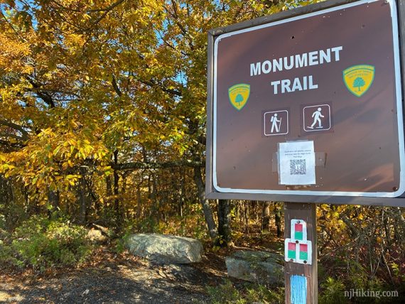
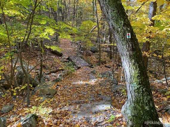
1.7 – Re-enter the forest at the RED/GREEN Monument Trail sign.
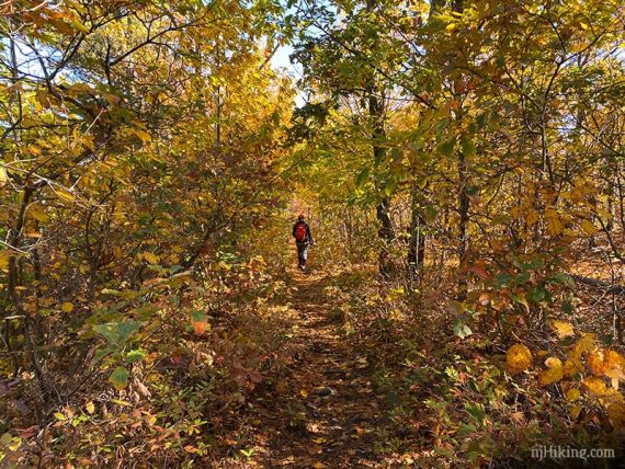
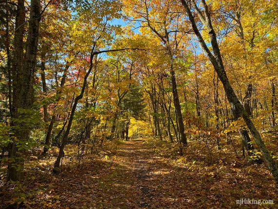
The trail is easy and mostly level with a few short paths to views on either side (some are better than others).
2.9 – Cross across a small wooden bridge to continue on Monument (RED/GREEN). [Left is SRT (Shawangunk Ridge (AQUA) and leads to Cedar Swamp also, and can be used to cut the hike shorter. Right is an unmarked trail.]
3.4 – Turn LEFT and now follow the Cedar Swamp (unblazed) loop (this junction was unmarked).
// Shorter option: To reduce the hike by 1.0 mile: don’t turn and continue straight on Monument (RED/GREEN). //
In a few steps the Cedar Swamp loop goes right and left (left is also the SRT). For this route, turn RIGHT and follow the woods road as skirts along the cedar bog.
4.0 – Follow the Cedar Swamp trail to the LEFT when a woods road comes in from the right.
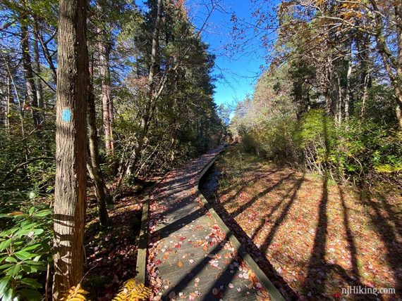
4.3 – Turn LEFT at the next junction [straight is SRT (BLUE) and leads back to an earlier junction]. Cross over the bog on a long boardwalk.
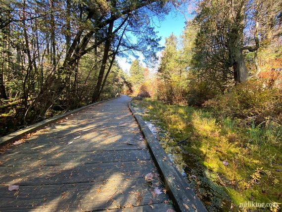
4.5 – Complete the loop and turn RIGHT, walking a few steps back out to Monument (RED/GREEN).
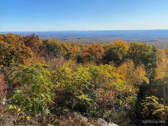
Turn LEFT to continue on Monument (RED/GREEN). Head uphill and along a ridge. There is a side trail or two on the right with limited views of Port Jervis, NY and PA.
4.6 – Continue on Monument (RED/GREEN). [SRT (BLUE) leaves to the right]. The trail heads downhill a bit as it leaves the ridge before curving to the right and going over a small bridge.
5.5 – Turn RIGHT and now follow Steeny Kill (BLUE DOT on WHITE). [Monument (RED/GREEN) continues straight].
Retrace Steeny Kill (BLUE DOT on WHITE) back to the lot.
—
Hiked: 10/23/23. Spotted a bobcat, very briefly.
Hiked: 10/17/20.