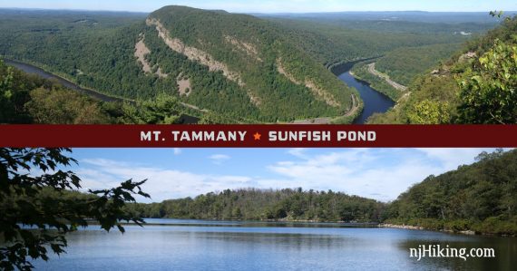
Challenging hike to the summit of Mt. Tammany and then to Sunfish Pond in the Delaware Water Gap.
Steeply climb to the summit of Mt. Tammany (1527′) for amazing views over the Delaware Water Gap, then follow the Kittatinny ridge along a fire road before heading over to beautiful Sunfish Pond. Return is via the scenic Dunnfield Creek Trail.
10.8 miles, total round trip; challenging. The hike up Mt. Tammany is short but steep (1250 feet in 1.3 miles), decent amount of distance, rock-hop stream crossings on the return.
| 10.8 miles | This hike guide. Detailed instructions, photos, and video follow below. |
| Longer, ~11.5 miles | At Sunfish Pond, continue on Buckwood (BLUE) to go around the pond, turn left onto the Appalachian Trail to the south end of the pond and pick up Dunnfield from there. |
| Option | Return via Appalachian Trail instead of Dunnfield Creek. The AT is slightly shorter and w/o the creek hops, but less scenic and rockier in our opinion (and busier). |
| Variation | Up Tammany via RED DOT, down BLUE, Dunnfield to Sunfish Pond, return via A.T. We have not done this combo and don’t have mileage. |
| Nearby, same lot | Sunfish Pond – version without Mt. Tammany and the fire road; or check out our challenging “Mind The Gap“ hike to summit Mt. Tammany and Mt. Minsi in one day. |
| Nearby Hikes | Appalachian Trail – Sunfish Pond to Raccoon Ridge; Sunfish Pond – Garvey Springs and Douglas Loop; Mt. Minsi; Jenny Jump – Ghost Lake; Jenny Jump Trail. |
Our two cents:
This is a long/challenging hike. Unless you are an avid hiker and up for it, stick to doing these destinations on their own, see Mt. Tammany or Sunfish Pond.
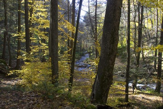
The Gap is one of the most beautiful areas to hike in NJ and is especially stunning in Fall. This hike can make for a long day; make sure you are up for it as once you are down the fire road a bit, there isn’t a shorter bailout.
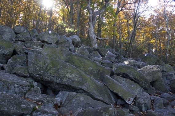
The trail surface is rocky up Tammany, and not as much along the ridge.
The fire road is not as popular/crowded as the areas around Mt. Tammany or Sunfish Pond and has a very remote feeling to it. However, because there are no views along the ridge and sometimes it’s a bit overgrown it can feel like a bit of a slog.
In late July to August, the wild blueberries along the fire road ripen. The return via Dunnfield requires multiple stream crossings which can be a tad tricky after a lot of rain.
Updated: 9/2023 – Edits and improvements, added photos; re-hiked 8/2023. Older change log at page bottom.
Related: Challenging Hikes in NJ
Map:
Get the Kittatinny Trails map set – when romping around the woods for 10+ miles, have a good map!! Follow along on your smartphone with our Interactive Map link above.
The trails are in Worthington State Forest (State of New Jersey) but some portions are in The Delaware Water Gap National Recreation Area (National Park Service) so resources can be found on both web sites.
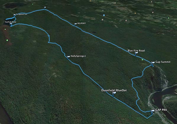
Below we’ve overlaid our GPS data on a 3D topographic map for a unique overview of the hike (not suitable to use as a trail map though!). Starting from the parking lot at the bottom right, the trail climbs steeply up Mt. Tammany which looms over the Delaware River.
Continue on the BLUE trail to the Mount Tammany Fire Road then take Buckwood over to Sunfish Pond. The return in on Dunnfield Creek Trail.
Books:
Similar route and map diagram can be found in Hiking New Jersey (2023). The trails in this area are described in Kittatinny Trails and the The New Jersey Walk Book.
Parking: N40.97213° W75.12592°
Dunnfield Creek Natural Area, I-80, Columbia, NJ 07832. Route 80 West to just before the last exit in New Jersey (exit 1). On the right is a brown sign for Dunnfield Creek Natural Area.
There’s the first parking lot, then a larger main lot. The exit road is one way so you can’t backtrack to a passed lot unless you get back onto Rt 80 and come around.
If both the first and main lots are full, try the parking area at the Kittatinny Point visitor center and walk back to the trailhead in the main lot (~about a 10 min walk).
Kittatinny Point Visitor Center: Head back out onto Rt. 80 from the Dunnfield lot and take the very next exit right, Exit 1 towards Millbrook/Flatbrookville. Then make a sharp left like you are going to go around to 80 E, but instead of merging onto 80, immediately head to the right into the visitor center on River Road.
Overview of the parking lots as it’s just easier to show it than explain it:
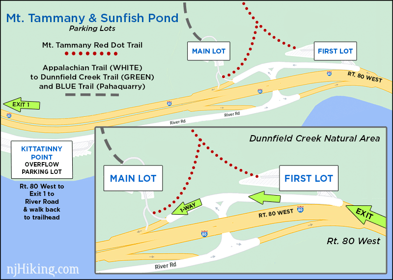
Parking may fill EARLY on nice weekends. If those three lots are full you may be able to wait a moment for a spot to open up, use the Hiker Shuttle if running, or switch to a nearby hike listed above. Do not park on roadsides, including Rt. 80.
Seasonal Hiker Shuttle (Free): Runs in season between Kittatinny Point Visitors Center and the DWG Park and Ride just over the bridge in Pennsylvania. Check www.gomcta.com for schedules and routes.
Restrooms:
Portable toilet in the far side of the main lot (there as of 10/2024). Toilets should be available at the Kittatinny Point Visitor Center (the center itself is closed). There is a rest area, Delaware Water Gap Travel Plaza, on Rt. 80 W. about 5 mins before the trailhead.
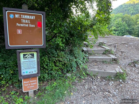
Locating the Mt. Tammany RED DOT Trail:
The RED DOT trail starts at the beginning of the main lot, near the road (when driving into the main lot, it is on your right).
Look for the big brown sign with a red blaze. If you parked in the first lot, there is a connector trail that leads to RED DOT but you won’t pass this sign.
NOTE: At the far end of the main lot is the start of the Appalachian Trail (WHITE) which leads to Dunnfield Creek (GREEN) and is the return route of this hike.
Hike Directions:
OVERVIEW: RED DOT to Mt. Tammany summit – BLUE DOT – MT. Tammany Fire Rd. – Buckwood (BLUE)/Sunfish Pond Fire Rd to Sunfish Pond – backtrack on Buckwood (BLUE) to Sunfish Pond Fire Rd – Dunnfield Creek (GREEN) from the southern end of Sunfish Pond – Appalachian Trail (WHITE)
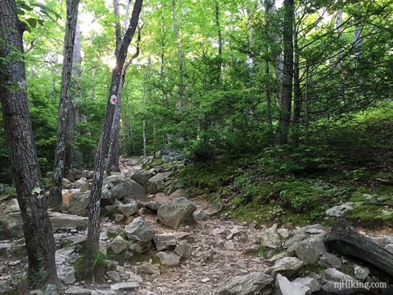
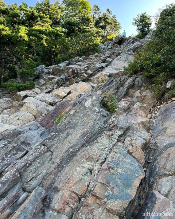
0.0 – Start heading uphill following RED DOT on a rocky trail.
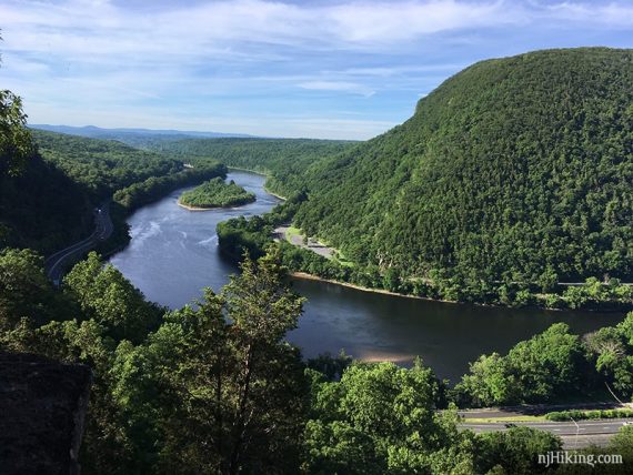
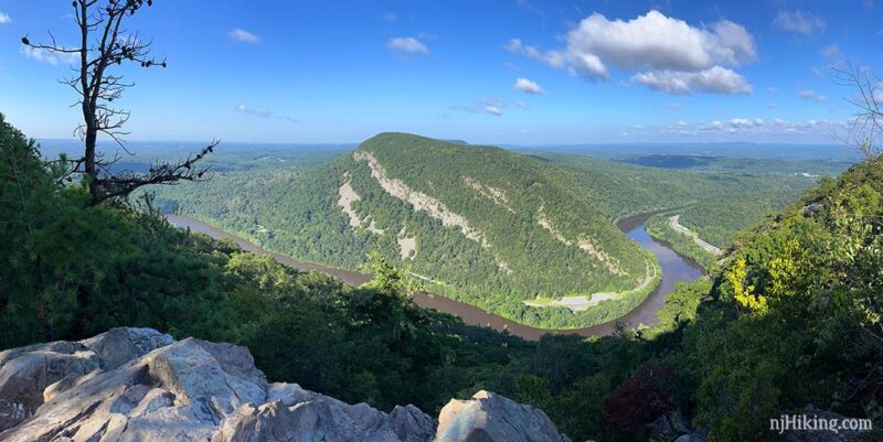
0.5 – Very nice view where Mt. Tammany can be seen on the left, Rt. 80 and the Delaware River going through “The Gap” in the center, and Mt Minsi on the right.
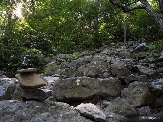
Continue following RED DOT as it levels off a bit before heading up a very rocky section.
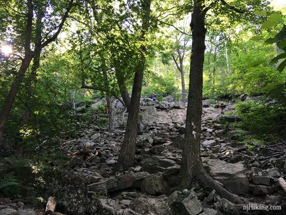
Pay attention on the rocky sections for markers to guide you through – they may be painted on the rocks as well.
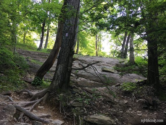
RED DOT trail continues making its way up.
1.2 – Optional side trip to alternate viewpoint: An unmarked and not entirely obvious side trail is on the right. Follow this downhill, with light scrambling, to an overlook for a slightly different angle to view Mt. Minsi.
The main viewpoint you’ll arrive at shortly is a bit more straight-on, but this one offers a flatter, wider area to sit. An out-and-back to this point only adds 0.1 mile roundtrip.
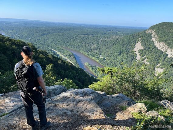
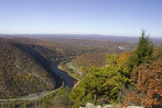
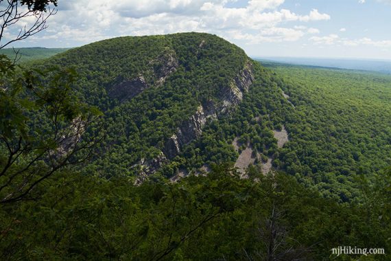
1.3 – At the rocky summit of Mount Tammany, there is a view of Mt. Minsi across the Delaware River and broad views of the entire Delaware Water Gap area as well as Rt. 80 below.
Fun Fact: Mt. Tammany is 1,527′ high… but while this point is what is referred to as the summit – it actually isn’t. That point is technically off of the BLUE trail somewhere amongst the trees so we’ve never bothered to go looking for it ’cause the view here is what you want.
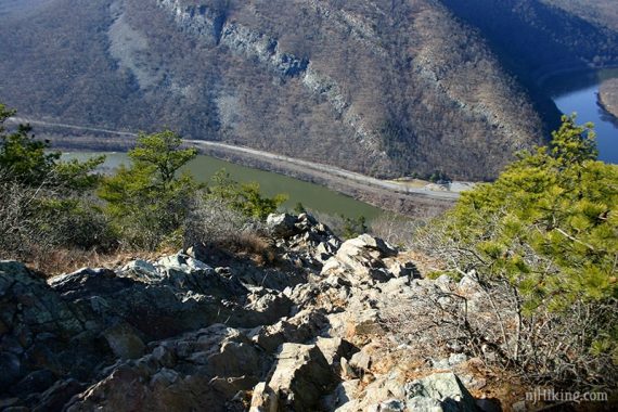
The Delaware River curving through the Gap, with Rt. 80 running alongside it.
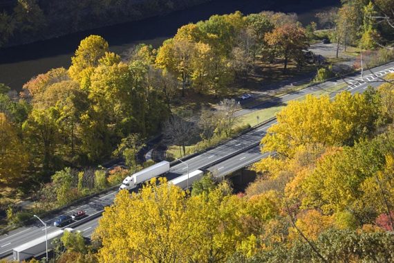
Zoom into Rt. 80 below the RED DOT trail:
Because the view from Mount Tammany is of it’s twin, Mt. Minsi, photographs of Minsi are usually used as the featured photo for hiking Tammany. Therefore hikers may not realize a photo like the one below is of Minsi and not Tammany. And vice versa for the Mt. Minsi hike.
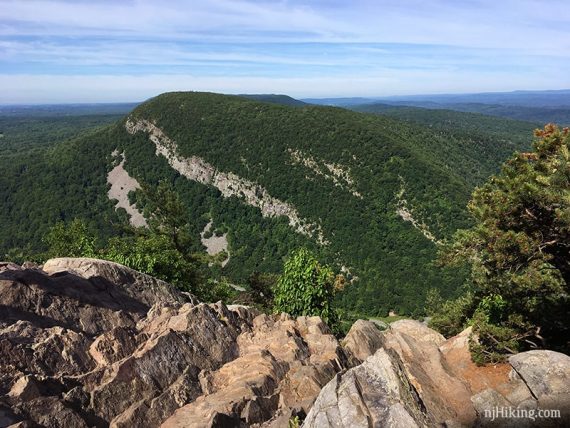
This is what Mount Tammany looks like, as seen from Mt. Minsi. They are a mirror image, and it’s easy to see how the Delaware River just cut through the same rock.
Fun Fact: Mt. Tammany is named after the Lenni Lenape chief Tamanend [Source: Wikipedia – Mount Tammany].
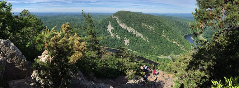
Scramble down the rocks for a unique break spot or stay at the top. The view from the top looking down the rock scramble:
This is a panorama from the end of the scramble down. It’s a good spot to watch hawks and turkey vultures ride the thermal air currents. And, of course, have a snack.
Looking up back up to the top after scrambling down (up is easier than down):
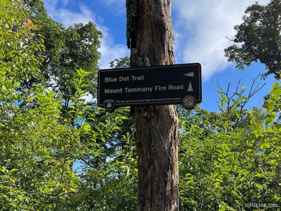
RED DOT ends at the summit. Look for the BLUE markers that start just past the viewpoint to now follow BLUE.
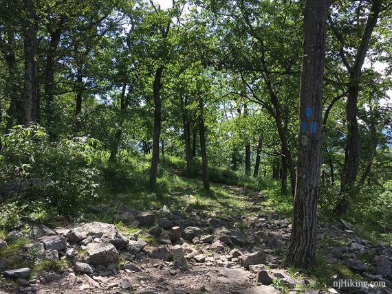
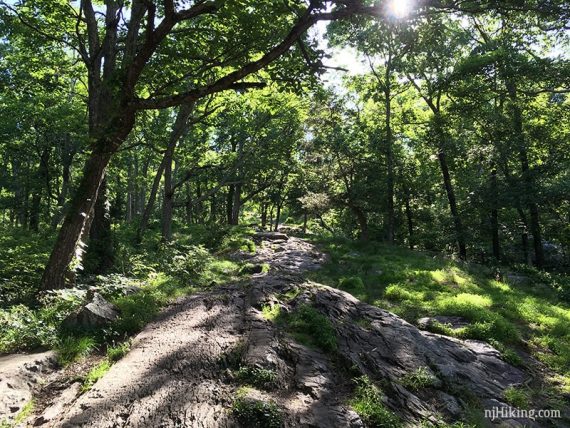
1.7 – Start following the unmarked Mt. Tammany Fire Road, straight. [BLUE leaves to the left].
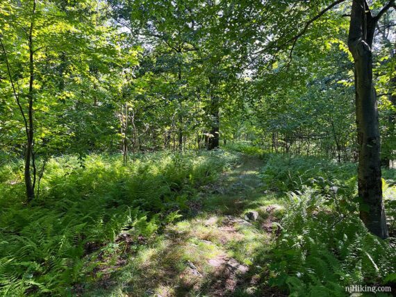
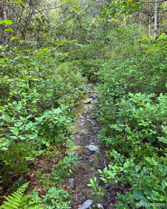
The Mount Tammany Fire Road is mostly level as it runs along a ridge without views along the way. It varies from a wide woods road to a more narrow and overgrown trail with rocks.
3.3 – Pass a HELISPOT sign on the left. This allows more access in case of a forest fire.
The fire road was created in 1976 after the 2000 acre Dunnfield Creek fire [Source: Wikipedia – “Mount Tammany Fire Road“].
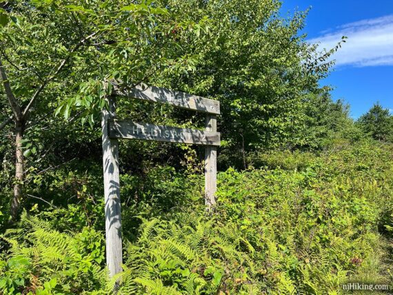
4.7 – Turn LEFT to start following Buckwood (BLUE). [Mt. Tammany Fire Road continues straight]. There’s a trail sign and a small cairn (little rock pile) on the ground.
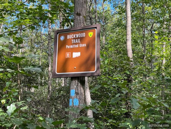
Buckwood (BLUE) used to be called TURQUOISE and there may be signage with either name (noticed a few TURQUOISE signs as of 8/2023).
Fun Fact: Worthington State Forest used to be called Buckwood Park, the private deer preserve of Charles Worthington (likely the reasoning behind the renaming). The state of New Jersey first leased it as a game preserve then purchased it from the Worthington estate in 1954. [Source: The New Jersey Walk Book]
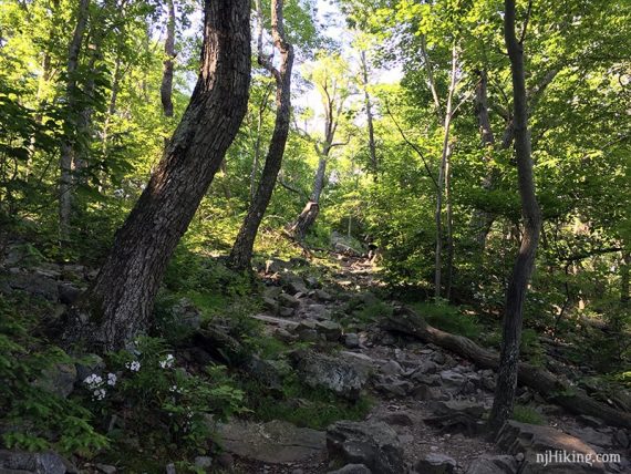
The trail is narrow and might be overgrown with vegetation – sometimes very much so, like it’s not well used.
Buckwood (BLUE) heads downhill to cross Dunnfield Creek, before going back uphill.
5.3 – Buckwood (BLUE) meets up with the Sunfish Fire Road. Turn LEFT and now follow the unmarked fire road. Sunfish Fire Road is briefly co-joined with Buckwood (BLUE).
5.6 – Turn RIGHT to now follow Buckwood (BLUE) as it leaves the Fire Road and heads toward Sunfish Pond.
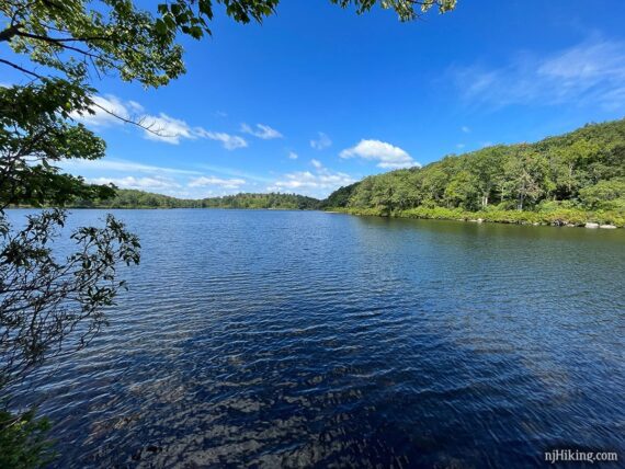
5.9 – Arrive at Sunfish Pond. There are rock slabs to sit on with a view of the Pond.
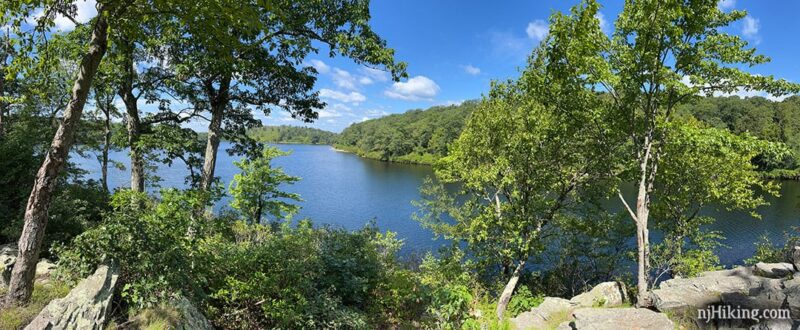
Follow faint paths through the brush to get down to the edge of the water; towards the left edge of the above photo.
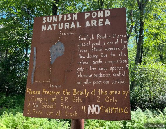
Fun Facts: The pond is 41 acres in size and was carved by glaciers during the last Ice Age. The composition of the pond is highly acidic and can only support a few species of fish such as pumpkinseed sunfish and yellow perch. [Sources: Worthington S.F. park site; Sunfish Pond Natural Area signage].
Backtrack on Buckwood (BLUE) to the Sunfish Fire Road when ready to leave.
// Longer Variation, 11.5 miles total: Instead, continue ahead on Buckwood (BLUE) around the end of the pond. Turn LEFT on the Appalachian Trail (WHITE) which follows the VERY rocky western shore. At the southern end of the pond, meet up with these directions at 6.7 below. //
6.1 – Back at the Sunfish Fire Road, turn RIGHT onto the fire road.
6.7 – The Sunfish Fire Road meets up with Dunnfield Creek (GREEN) near the southern end of Sunfish Pond. There are wooden trail signs for both.
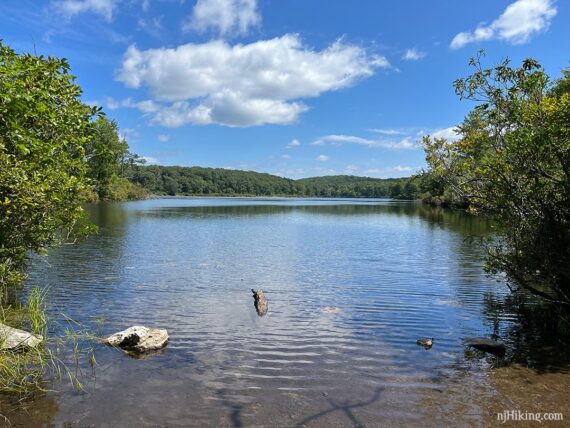
Before continuing on to Dunnfield Creek (GREEN), turn RIGHT and RIGHT again, passing a Sunfish Pond Natural Area sign, to get to the end of the pond.
There is a bench tucked in by the water to enjoy the view from this end of the pond.
Retrace the route back to the intersection of the fire road and Dunnfield Creek (GREEN) to start following Dunnfield Creek (GREEN).
// Variation: Walk back from the pond but don’t turn left towards Dunnfield Creek (GREEN), instead continue ahead to follow the Appalachian Trail (WHITE) all the way back to the lot. //
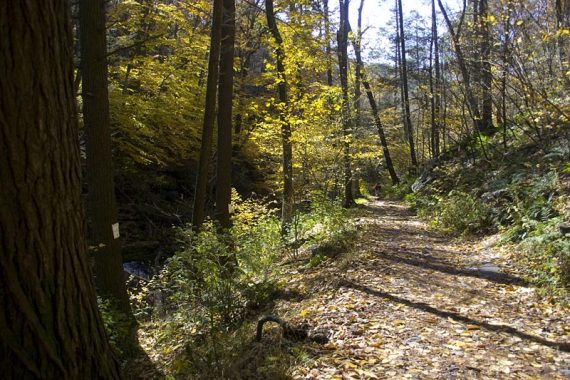
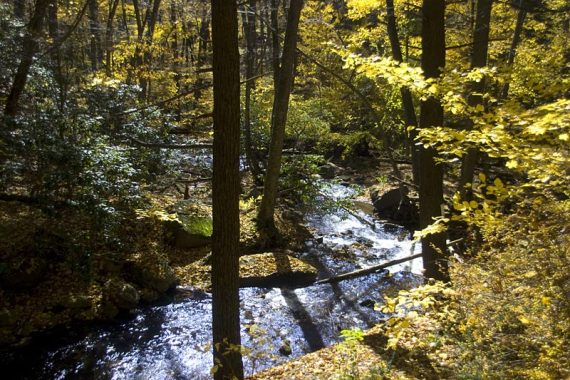
Dunnfield Creek (GREEN) heads uphill and then down a steep rocky section. After a low, seasonally wet section, the creek will eventually come into view, and the trail follows it the rest of the way back.
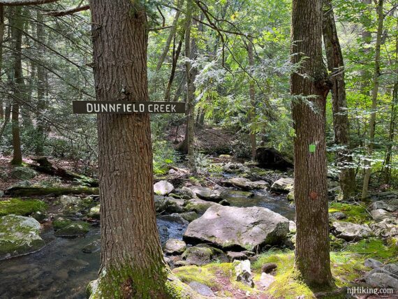
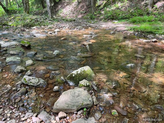
7.9 – Keep an eye out for the GREEN markers which can be sometimes hard to spot. They will also indicate to cross Dunnfield Creek several times on rocks.
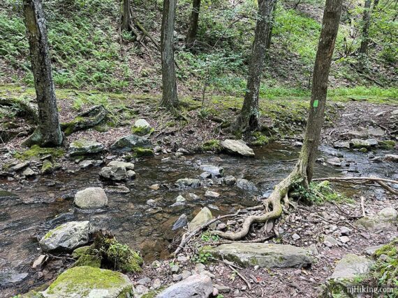
Some crossings are harder than others and it really depends on how much water is flowing and if there rocks or sturdy branches in good spots. Trekking poles or a stick can come in handy.
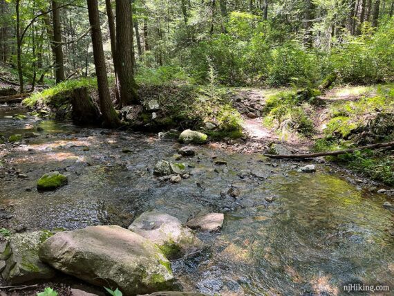
There is a sign for a “high water bypass” trail that goes above two of the stream crossings; consider using it if there’s been a lot of rain… or you just don’t want to deal with it.
9.0 – Pass RED (Holly Springs) on the right.
10.1 – Pass BLUE (Pahaquarry) on the LEFT.
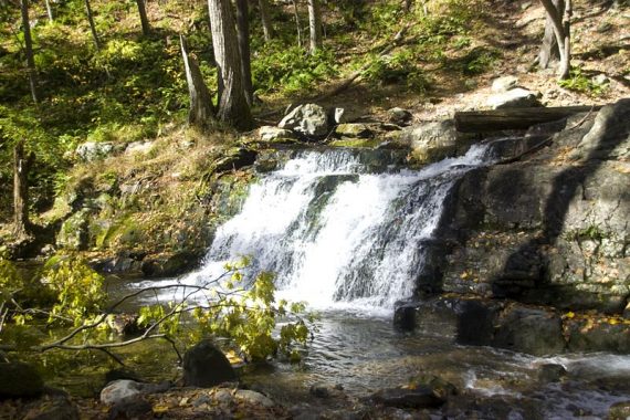
The creek, several cascades, and Dunnfield Falls comes into view. There is a wooden bench looking over the cascades.
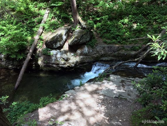
Looking down on the falls from the trail…. X marks the spot (that’s not one of us on the tree… I liked how he worked with the photo so I didn’t Photoshop ’em out).
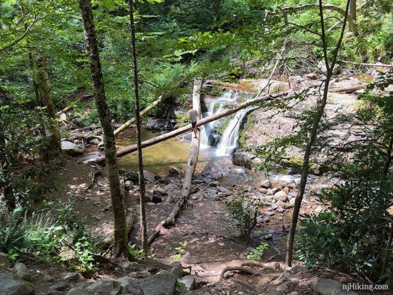
Dunnfield Creek (GREEN) heads down towards the bridge and past the falls. Below is an older photo of the falls (Oct. 2009) before trees fell over it. By our hike in Oct. 2010 the tree at the top left of the falls had fallen across it.
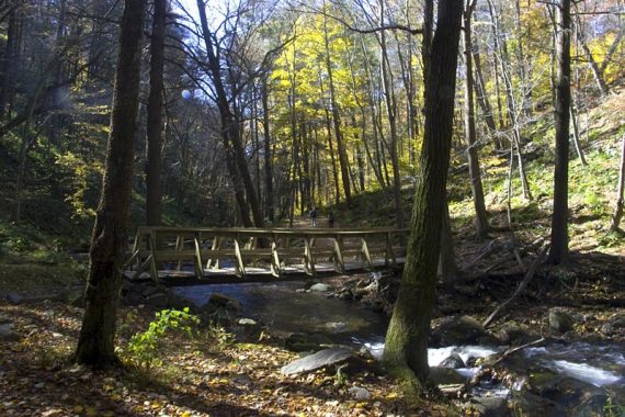
Continue following Dunnfield Creek (GREEN) over a bridge.
10.4 – Dunnfield Creek (GREEN) ends at the Appalachian Trail (WHITE). There is a large signpost.
Continue straight, now following the Appalachian Trail (WHITE) along pretty Dunnfield Creek and back to the parking lot.
—
Hiked 8/19/23. Spotted momma bear with 3 cubs along the fire road.
Hiked: 8/22/15. with M.
Hiked: 10/23/10. Trail Blog: “Mt. Tammany and Sunfish Pond in the Fall“
Hiked: 3/22/09. Trail Blog: “Water Gap: Mt. Tammany, Fire Road, Sunfish Pond, Dunnfield Creek“
Hiked: 8/03/08. Trail Blog: “Water Gap – Mt. Tammany to Fire Road to Sunfish to Green“
Hiked: 1/22/06.
Updated: 5/2021 – Description changed to reflect that TURQUOISE is now called Buckwood (BLUE); not re-hiked. 8/2020 – Page refreshed, not re-hiked. 9/2015: Revised description and GPX.