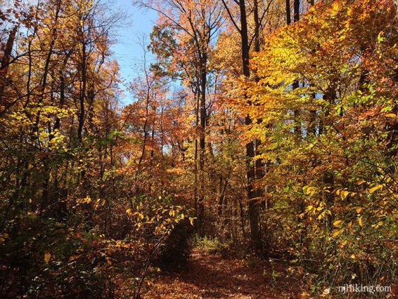
A small section of woods adjacent to Rutgers Gardens and Westons Mill Pond.
| 1.9 miles | Very easy, little elevation gain. Detailed instructions, photos, and video follow below. |
| Nearby | Rutgers Ecological Preserve; Six Mile Run; Negri-Nepote Native Grassland Preserve; Julian Capik Preserve; Forest Brook Trail; Ireland Brook, Farrington Lake Trail; Tamarack Hollow; Van Dyke Farm. |
Our two cents:
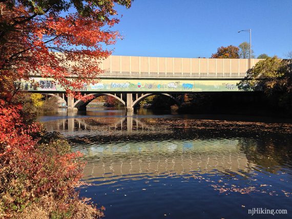
This nice area is sandwiched between some busy highways… high rises, highway overpass with graffiti, and even On The Border on Rt. 1 are sometimes visible, plus road noise.
Don’t drive far for this park but if in the area it makes for a nice, quick hike. Closed on Mondays.
Bonus: Wander around adjacent Rutgers Gardens and bamboo forest. Cook’s farmers market runs on Fridays (in season).
Updated: 9/2025 – Minor edits re-hiked 8/2025. Older change log at page bottom.
Hike Info:
Map/Book:
Print out the trail map from the park site. Follow along on your smartphone with our Interactive Map link above. Some of the trails are blazed, others not, but it’s not a large park.
A very brief description of the woods (no trail info) can be found in the The New Jersey Walk Book.
Parking: N40.47420° W74.42033°
“Rutgers Gardens Via Helyar Woods Trail”, 130 Log Cabin Rd, East Brunswick, NJ 08816. If approaching from Rt. 1 and take the Ryders Lane Exit.
Look for a sign for Rutgers Gardens, Helyar Woods is part of this. Drive through Rutgers Gardens, making a few turns to a small parking lot near the Log Cabin, with overflow parking on the dirt behind it.
Restrooms:
Small restroom building plus a portable toilet at a turn in the park road on the way to the parking lot. Also a portable toilet near the lot (as of 8/2025).
Hike Directions:
Overview: BLUE – RED – BLUE
Note: Trails may not have a lot of markings; trail colors have changed from older maps.
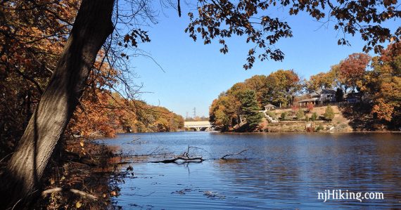
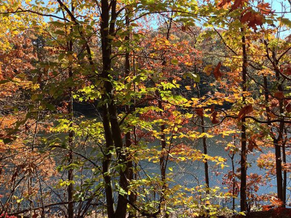
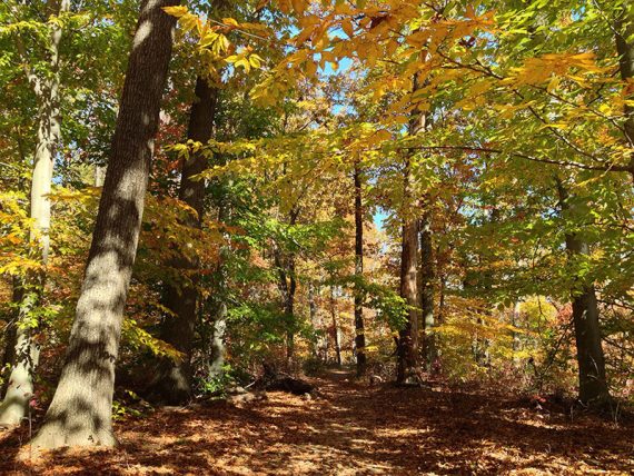
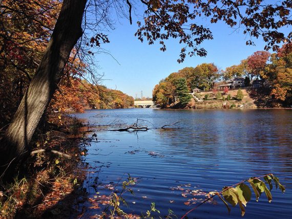
0.0 – From the end of the parking lot, start following BLUE. This runs along Westons Mill Pond, with the water visible through the trees and is co-joined with RED and YELLOW. [There is another trail access across the open field.]
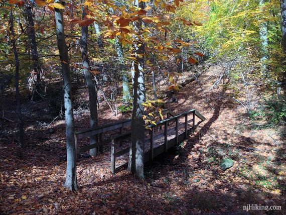
0.2 – BLUE/RED/YELLOW veers to the left to skirt a small ravine. (The old trail goes down into the ravine still, now unmarked and is a minor shortcut, meeting up with this route after the bridge… but we wouldn’t bother).
Soon BLUE/RED/YELLOW heads down to the right to cross Turtle Brook on a bridge. [RED leaves and is no longer co-joined].
Continue following BLUE / YELLOW as it runs parallel to the water.
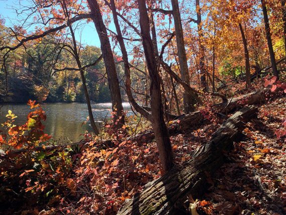
There are occasional unmarked side trails that get closer to the water. YELLOW leaves to the left eventually, leading to the pine grove.
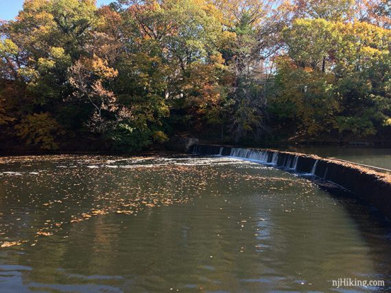
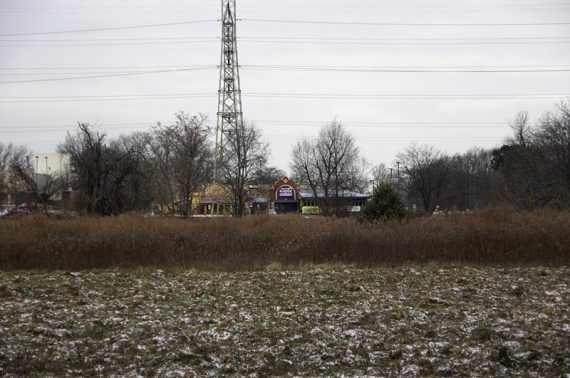
0.8 – The stopping point is a dam just before an Rt. 18 overpass covered with graffiti.
[While it isn’t worth checking out… the trail continues under the overpass, rock hops a dribble of water, and eventually peters out at a road.]
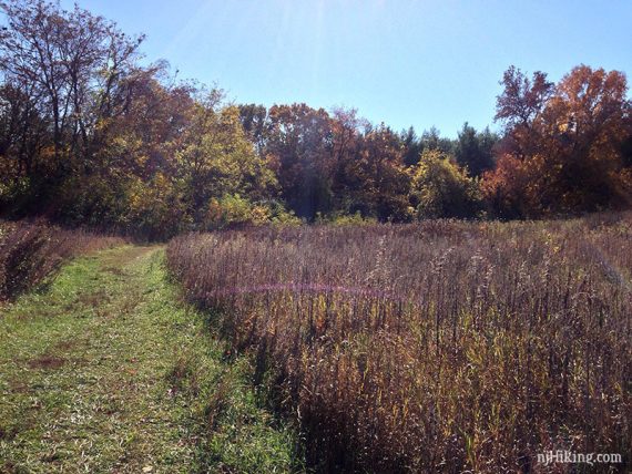
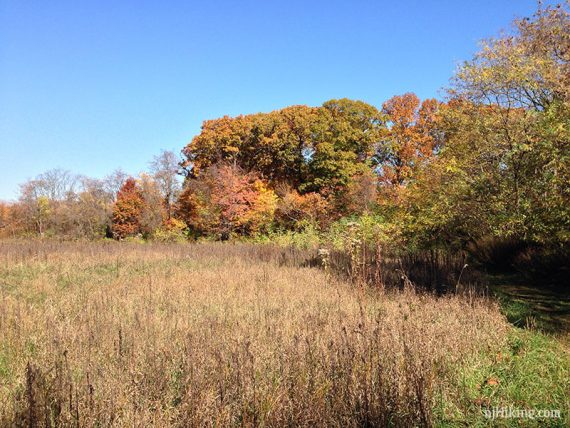
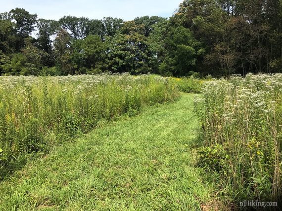
Turn back at the dam area, taking the other side of BLUE, heading a little uphill. BLUE follows the edge of large meadows. The trail map shows a PURPLE loop through the meadows which we didn’t notice.
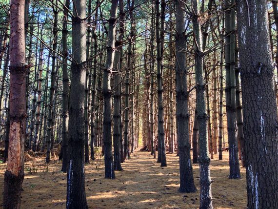
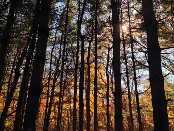
1.1 – Pass an old Christmas Tree farm on the left… the trees are all in rows and now very tall. This is marked “pine grove” on the trail map.
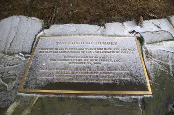
At the entrance to the pine grove used to be a “Field of Heroes” plaque dedicated to servicemen and women but it’s gone now.
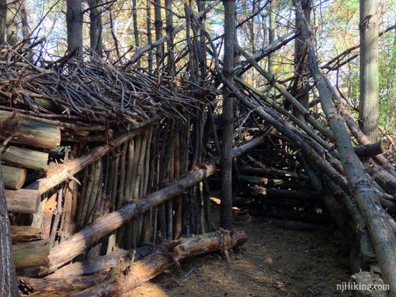
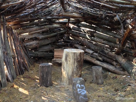
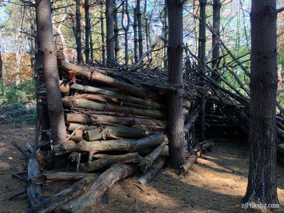
/// Optional: It’s cool to wander around the evenly planted rows of pine trees. In Nov. 2015 we saw these these structures made from branches and logs. Return back to the edge of the pine trees to continue.
Continue ahead, still following BLUE.
A bit further on, Rt 1 and On The Border may be visible in the distance on the right. Perhaps a post-hike sangria swirl margarita?
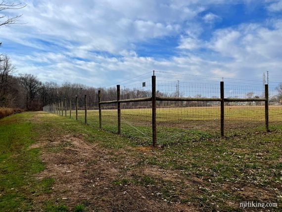
1.2 – Pass a fenced area for Rutgers Plant Research.
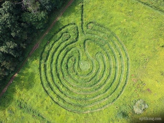
This once was a large labyrinth mowed into the field on the right, which could be walked around (and around…). It wasn’t obvious without a lot of growth:
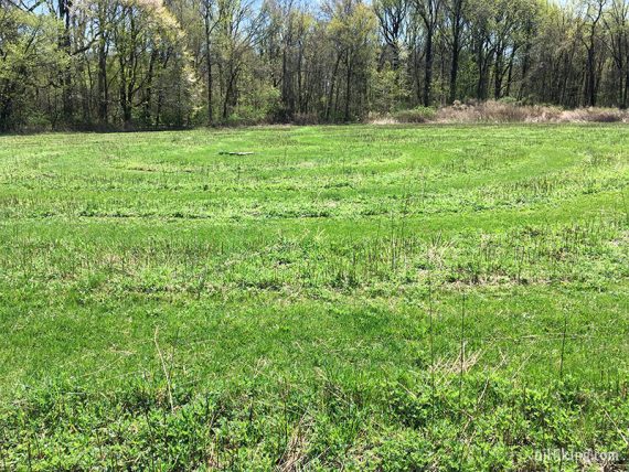
Walking the labyrinth after it was grown a bit:
The labyrinth seen from above, it was pretty cool:
After the fenced plant research area, BLUE enters the forest again.
1.3 – Turn RIGHT and now follow RED. //Shorter: Instead, continue ahead on BLUE and skip RED.
RED loops around, with a decent amount of road noise from Rt. 1. There are potentially wet areas and the trail is less traveled when we last did it. Shortly it meets back up with the main trails.
1.8 – Continue ahead, following BLUE/RED to the other trail access point at the edge of the field, back to the parking lot.
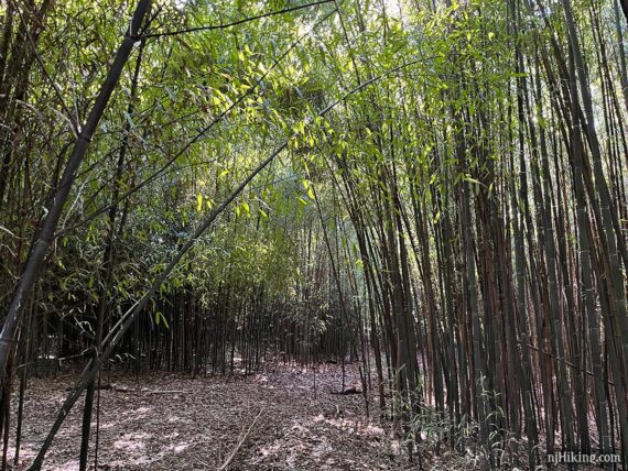
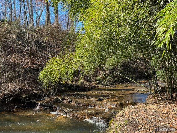
//Optional add-on: From here you can wander through the gardens. And at the far end of Rutgers Garden, past Holly House on Log Cabin Road, is a path through a small bamboo grove along a stream.
—
Hiked 8/19/25.
Hiked 2/2/24.
Hiked 12/20/20.
Hiked 8/27/17.
Hiked 4/18/17.
Hiked 2/25/17.
Hiked: 11/4/15.
Hiked: 2/23/14. Trail Blog: “Helyar Woods in the Snow“
Hiked: 12/3/12. Trail Blog: “Helyar Woods After Hurricane Sandy“
Hiked: 12/19/09. Trail Blog: “Helyar Woods in December“
Updated: 3/2024 – Updated description to reflect trail color changes/additions; re-hiked 2/2024. 5/2021: Adjusted page; labyrinth is gone. Re-hiked 12/2020. 5/2020: Page refreshed, not re-hiked. 4/2017 – Revised directions to reflect trail map, revised Interactive Map, added GPX. 3/2017 – Added link to new trail map. Added fall foliage photos and moved original winter photos to a blog post.