Rugged trail to Surprise Lake with plenty of views, mountain laurel, a rhododendron tunnel, and some scrambling.
6.3 or 5.7 miles, total round trip. While this trail is not long, it is challenging due to the initial steep ascent and some rock scramble sections throughout. The return is easier on a woods road.
| 6.3 miles | This hike guide: Detailed instructions, photos, and video follow below. |
| Shorter | 5.7 – Skip the expansive view over Greenwood Lake. Noted below. |
| Longer | 7.0 – Continue past West Pond by using the Ernest Walter, AT, and State line trails. Route described in 50 Hikes in New Jersey. |
| Very nearby | Terrace Pond North. |
| Nearby | Surprise Lake Loop via State Line Trail; Terrace Pond Loop; Terrace Pond Lollipop; Terrace Pond – West, Circular, North; Long Pond Ironworks; Wawayanda State Park – Old Coal Trail. |
| Nearby kayaking | Monksville Reservoir; Wawayanda Lake. |
Our two cents:
This route is consistently awesome. While even some of the nicest trails can have sections that are a little bit of drudge or are kinda ‘meh’ – there just isn’t a dull or sub-par section of this route.
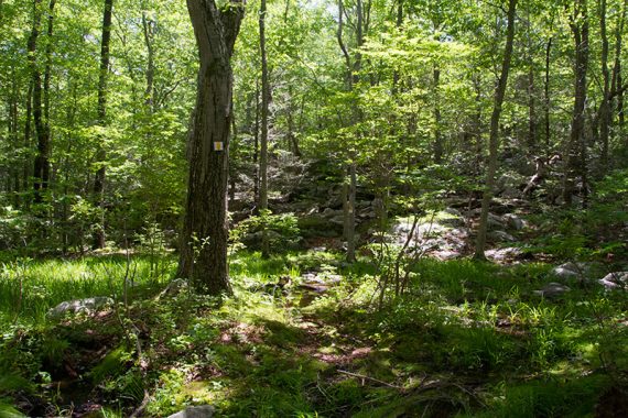
Beautiful hemlock forest, interesting trail, a bit of scrambling, views, and a pretty destination to work towards – all packed into less than 6 miles (if skipping the view over Greenwood Lake). The downside is the popularity of Surprise Lake.
Located in Abram S. Hewitt State Forest.
Updated: 9/2025 – Added peaks photo. 7/2025 – Minor edits; re-hiked a variation using much of this route. Older change log at bottom.
Hike Info:
Map/Books:
Northern New Jersey Highlands Trails Map is recommended to navigate the network of trails in this park. Follow along on your smartphone with our Interactive Map link above. Not all parking lot locations are shown on the State Park map.
This hike appears in Hiking New Jersey (2023), Hiking the Jersey Highlands and Hike of the Week. Longer variations can be found in 50 Hikes in New Jersey and 60 Hikes Within 60 Miles: New York City. Individual trail descriptions are found in The New Jersey Walk Book.
Parking: N41.15572° W74.36273° [1st pullout]
Near Warwick Turnpike & White Road, West Milford, NJ 07480. Note! There’s no street address for this small trailhead, this intersection is close but is beyond the 1st parking. Parking is all unmarked road side pullouts.
If approaching from Rt 287 N, take exit 55, follow 511 North through Wanaque. Bear left at the Y-intersection with Skyline Drive. Keep straight past the intersection with Lakeside Road, following Rt 513. Stay straight at the fork, becoming Warwick Turnpike.
Heading west on Warwick Turnpike… pass the large lot for “Highlands Preserve Parking Lot” on the right (technically, you could walk down the road or use a unmarked trail in the preserve to connect to this hike) and then a dirt pullout on the left at N41.15486° W74.36042° (might be used as parking, though it is not marked as such on the Trail Conference trail map).
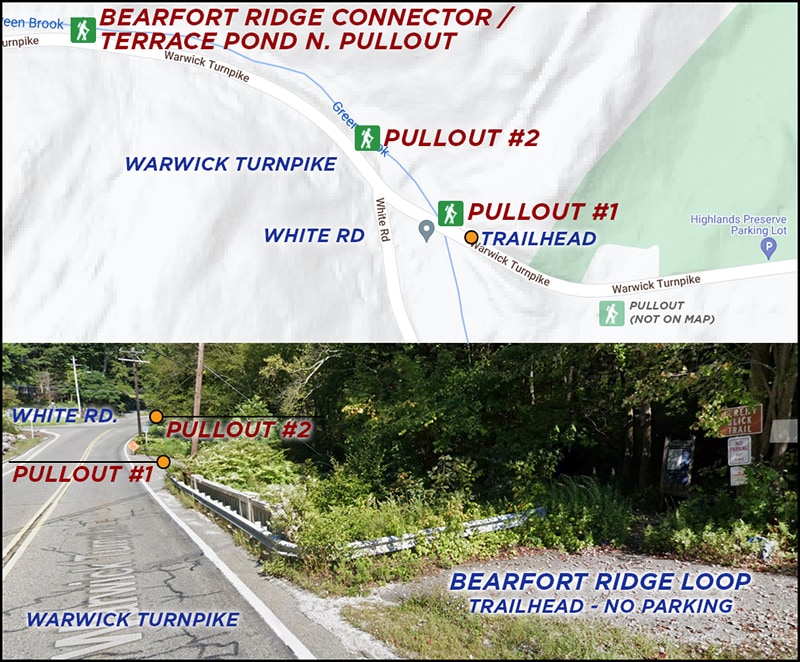
1st pullout – N41.15572° W74.36273° – On the right, just after the trailhead and a concrete bridge/guardrail – but before White Road. Space for 3-4 cars.
2nd Pullout – N41.15647° W74.36358° – Just up the road and past the intersection with White Road is another pullout on the right with a few spots.
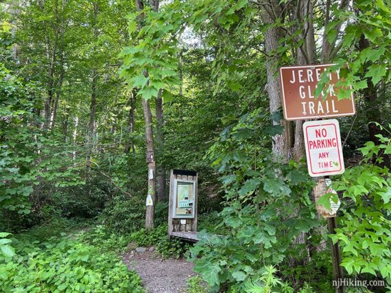
From either Pullout 1 or 2, walk back down the road along the guardrail/concrete bridge to the trailhead – be very careful as there isn’t much shoulder. Signs for the “Jeremy Glick Trail” and “no parking” and a trail kiosk just beyond.
Bearfort Ridge Connector / Terrace Pond North Pullout – N41.15757° W74.36742° – A larger pullout is further ahead, on the right, that is also used for the Terrace Pond North Trail on the opposite side of the road. From the end of this pullout, take the Bearfort Ridge Connector (BLUE/GREEN) which will meet up with this description as noted below. [Note: Google Maps shows this incorrectly labeled as “Quail Trailhead”].
Restrooms:
None. Best bet are stores/gas stations along 511, there is one nearest the trailhead at the intersection of Lakeside Rd.
Also: Possible portable toilet at the Monksville Reservoir North Launch on Rt 511. Look for the “Long Pond Ironworks” park sign on the left and follow the driveway down. Restrooms are at the visitor center for Long Pond Ironworks but open very limited hours (Usually 1-4 weekends).
Hike Directions:
Overview: Bearfort Ridge Spur (BLACK on GREEN) – GREEN (Bearfort Ridge Loop) – Bearfort Ridge Spur (BLACK on GREEN)
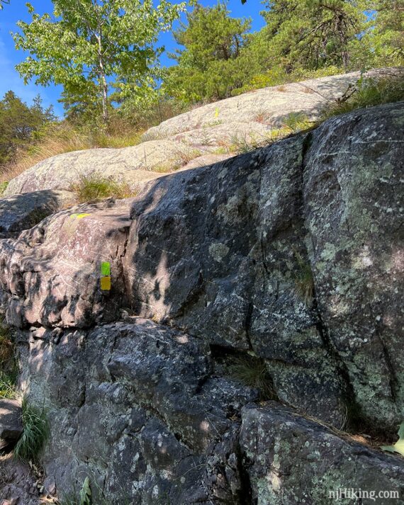
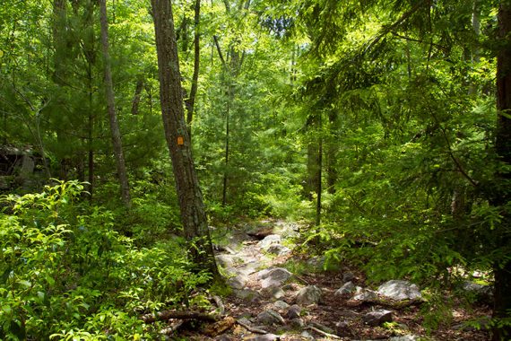
Note: Some photos show the old trail blazes of WHITE and ORANGE.
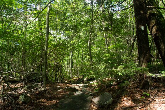
0.0 – Start following Bearfort Ridge Spur (BLACK on GREEN). The trail is immediately very pretty, but there is some road noise for a bit (the downside of being in Jersey – never that far from a road).
0.1 – Soon, arrive at the GREEN (Bearfort Ridge Loop). Turn LEFT to now follow GREEN (Bearfort Ridge Loop). [GREEN (Bearfort Ridge Loop) also continues ahead. Bearfort Ridge Spur (BLACK on GREEN) ends]
The trail begins to climb up to the ridge. This route gets the steep push over in the beginning and eases off after the first mile.
0.7 – Pass Bearfort Ridge Connector (BLUE/GREEN) on the left, continuing on GREEN (Bearfort Ridge Loop) steadily uphill.
If you’ve started from the Bearfort Ridge Connector / Terrace Pond N. pullout, join this route here: turn LEFT to start following GREEN (Bearfort Ridge Loop).
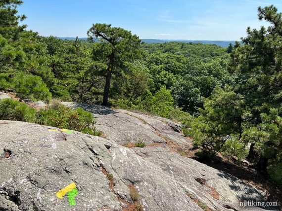
0.9 – Climb a large rock on the left for a view over the hills to the west and south.
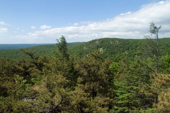
Clamber back down and continue on GREEN (Bearfort Ridge Loop). The trail turns to the right at this viewpoint rock. The trail levels off as it continues on long rock slabs across the ridge.
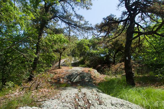
There are some rocky scrambles along the way. Just after this scramble is a limited view of the New York City skyline in the far distance (on a clear day).
1.4 – Continue following GREEN (Bearfort Ridge Loop) past West Ridge Trail (PINK). [This can be used to make hike variations.]
1.7 – Follow GREEN (Bearfort Ridge Loop) as it makes a sharp right downhill.
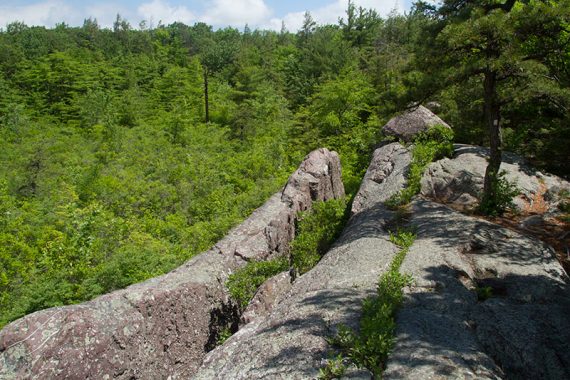
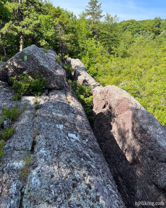
2.0 – Arrive at a huge rock cleft – a large slab of rock that has vertically sheered away from the larger rock face. It overlooks an overgrown swampy area.
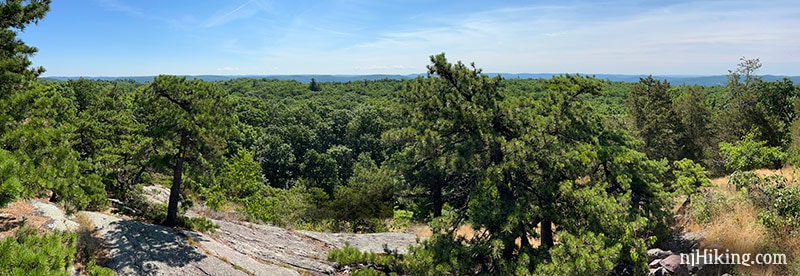
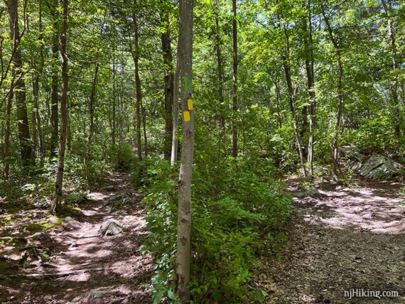
2.8 – Wide viewpoint at the intersection of GREEN (Bearfort Ridge Loop) and YELLOW (Ernest Walker). The NYC skyline might be visible, off on the right if it’s clear enough.
Turn RIGHT to continue following GREEN (Bearfort Ridge Loop) which is now co-joined with YELLOW (Ernest Walker). [YELLOW (Ernest Walker) also goes left and can be used to make a longer hike.]
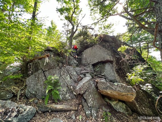
GREEN (Bearfort Ridge Loop) heads down a rock slab and steeply drops down a rock ledge. Looking back up at this section:
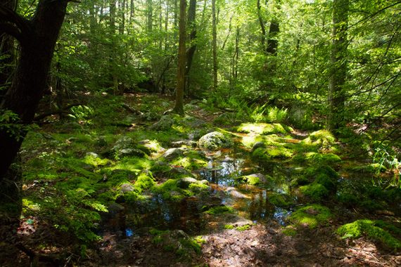
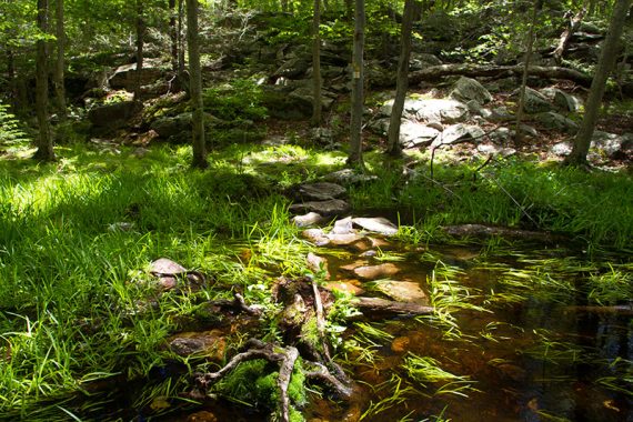
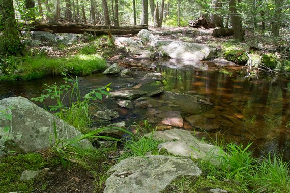
The trail goes through an area that if wet might need to be crossed by rock-hopping, but the rocks are large.
Our last hike through here (2025) was after a very heavy rain and this crossing was not a problem. There are large rocks set in place so it’s possibly not issue anymore, unlike how it was in the past:
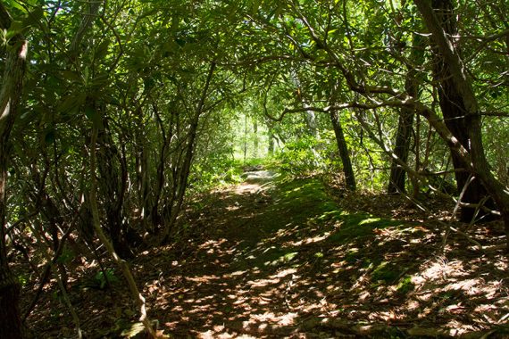
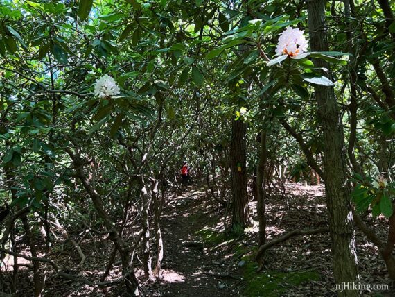
On the approach to Surprise Lake, the trail meanders through a very long “tunnel” of rhododendron thickets.
Throughout the Bearfort Ridge area, rhododendron usually bloom sometime between the end of June or early July and run through the month. Time it jussssst right and enjoy flowers along your hike.
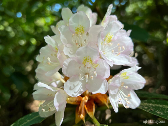
This rhododendron tunnel just keeps going and going and is our favorite in all of New Jersey. (Yes, we have a favorite rhododendron tunnel.)
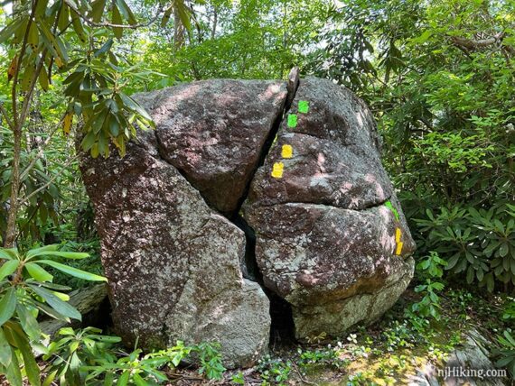
GREEN (Bearfort Ridge Loop) passes an interesting split rock and then climbs a bit.
3.2 – Almost to the lake, GREEN (Bearfort Ridge Loop) meets up with the return leg of the loop. Now start following just YELLOW (Ernest Walker) to the left and arrive at…
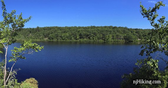
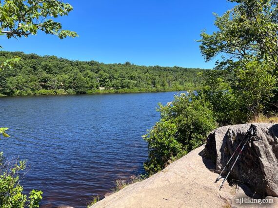
3.3 – Surprise Lake. There are some rocks to sit on in a few areas. This can be a popular spot, so there’s a good chance that people will be here.
With your back to the lake, walk ahead and turn LEFT to continue on YELLOW (Ernest Walker).
// Shorter option, 5.7 miles round trip: Skip the next section and instead retrace YELLOW (Ernest Walker) to the RIGHT and back to GREEN (Bearfort Ridge Loop), and pick up the description at 3.9 below. You’ll skip a very worthwhile viewpoint over Greenwood Lake but if you’ve already had it you might want to bail here and reduce the hike by 0.6 miles. //
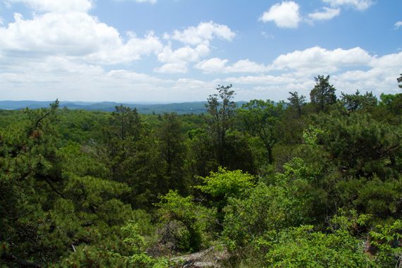
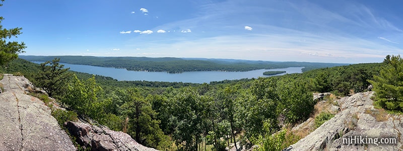
Soon, arrive at a rocky outcrop with a view… but wait! Keep going – it gets better… keep following YELLOW (Ernest Walker) as it turns left along the ridge with an expansive view over Greenwood Lake, New Jersey, and into New York.
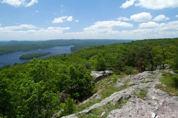
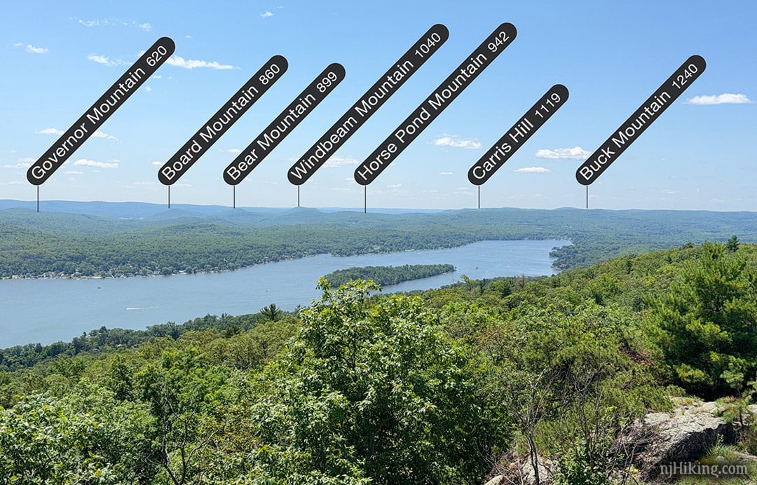
The mountains seen in the distance have lots of trails to explore.
Hike Governor Mountain for a stunning view over the Wanaque Reservoir. Board, Bear, and Windbeam Mountains are part of the challenging Stonetown Circular. And Norvin Green State Forest contains Carris Hill and Buck Mountain.
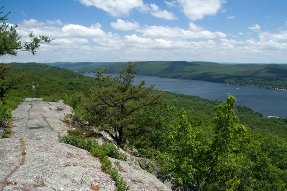
3.6 – Continue following YELLOW (Ernest Walker) along a long rock outcrop until it reaches a prominent bump. The trail continues further but this is the highest viewpoint on the ridge. Just on the other side of this bump are partially shaded rocks to take a break.
When ready retrace YELLOW (Ernest Walker) back to Surprise Lake.
3.9 – From Surprise Lake, retrace YELLOW (Ernest Walker) back to the intersection with GREEN (Bearfort Ridge Loop). GREEN arrows and yellow blazes are on a tree, with a trail on either side.
Continue ahead to now follow GREEN (Bearfort Ridge Loop). [YELLOW (Ernest Walker) and GREEN (Bearfort Ridge Loop) veer right, and is the way you came in].
// Variation, longer, more challenging: Instead, turn right onto GREEN (Bearfort Ridge Loop) to return via the same route you came in on. However, there’s no good reason to do this. //
Much of the way back on GREEN (Bearfort Ridge Loop) is an eroded woods road. This is much easier than the beginning of the route but just as pretty – although it is lower so there aren’t any views.
The trail starts a gradual descent. If it’s wet it might be muddy or require some rock hopping.
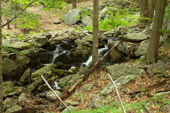
5.0 – Pass a seasonal small water cascade on the right.
5.6 – Back at where GREEN (Bearfort Ridge Loop) split at the very beginning of the hike, now follow Bearfort Ridge Spur (BLACK on GREEN) straight. [GREEN (Bearfort Ridge Loop) goes to the right].
If you’ve started from the Bearfort Ridge Connector / Terrace Pond N. pullout: Instead, turn RIGHT and stay on GREEN (Bearfort Ridge Loop) until turning LEFT onto Bearfort Ridge Connector (BLUE/GREEN).
Continue on Bearfort Ridge Spur (BLACK on GREEN) when it turns to the RIGHT. [An unmarked trail continues ahead and ends up at the road as well]. Head downhill to the trailhead, turn right on the road shoulder, and back to the car pullout.
—
Hiked: 7/4/25. Variation using West Ridge and starting at Bearfort Ridge Connector pkg.
Hiked: 7/9/22.
Hiked: 6/14/14. Trail Blog: “Bearfort Ridge to Surprise Lake – Hemlock Forest and Ridge Views”
Hiked: 6/28/09. Trail Blog: “Bearfort Ridge to Surprise Lake in Summer”
Hiked: 10/3/04.
Updated: 7/2022 – Re-hiked, minor edits, added photos/parking info, extended route to include the Greenwood Lake view that was an optional add-on before. 6/2022 – Minor edits. 2/2022 – Trail map info. 8/2020 – Description adjusted to reflect recent trail changes, but was not re-hiked. Thanks to Nicole T. for letting us know the directions remain the same, just the name/colors are changed. 7/2020 – Page refreshed, not re-hiked. 8/2017: Updated main photo; minor tweaks. 6/2014 – Re-hiked, description updated, new photos and GPX.