Hike through Jenny Jump State Forest for many views of the surrounding mountains and valleys before arriving at Ghost Lake.
5.5 miles round trip. Rocky trail, two somewhat steep descents and the route back is uphill most of the way.
| 5.5 miles | This hike guide: Detailed instructions, photos, and video follow below. |
| Shorter | Multiple options noted in description. |
| Longer | 6.3 miles. Continue to the “Fairy Cave”. Noted in description below. |
| Same park: | In another section: Jenny Jump Trail. |
| Nearby | Allamuchy Pond Trail; Allamuchy Mountain – Deer Park; Stephens State Park; White Lake; White Lake Kayak; Paulinskill Valley Trail – Cedar Ridge to Viaduct; Mt Tammany; Sunfish Pond; Mt. Tammany and Sunfish Pond. |
Our two cents:
A solid hike packed with tons of viewpoints with a nice pond as the destination. Add an optional extension to explore a small cave called “Fairy Cave”.
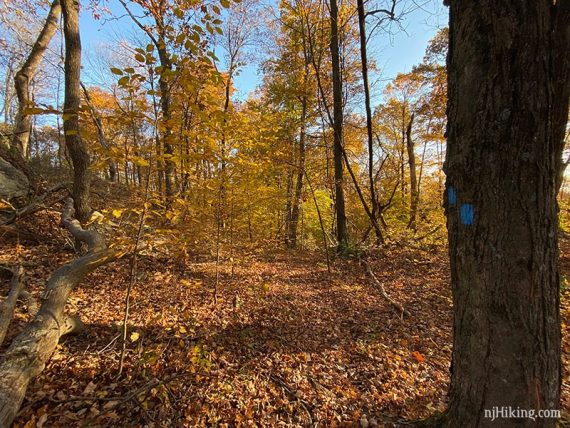
Very pretty during fall foliage season and is also a Halloween Hike.
Updates: 4/2024 – Re-hiked, minor text changes. Older change log at page bottom.
Hike Info:
Map/Books:
Print out the park map or check at the park office. Follow along on your smartphone with our Interactive Map link above, which includes a point for the “Fairy Cave”.
Variations appear in 50 Hikes in New Jersey, Hiking the Jersey Highlands and 60 Hikes Within 60 Miles: New York City plus there is a very short one in Hike of the Week. Trail descriptions can be found in The New Jersey Walk Book.
Parking: N40 54.714 W74 55.287
Jenny Jump State Forest, 330 State Park Rd, Hope, NJ 07844. If approaching from from Rt 80 W take exit 12 (Hope/Blairstown) for Rt 521 S. Turn L at the blinking light onto Rt 519. Turn R on Shiloh Road. Turn R onto State Park Road. There are several brown and white Jenny Jump State Forest signs marking the way.
Follow State Park Road, passing an alpaca ranch on the right. Turn L at the park sign then soon continue ahead when the park office is visible off to the left. Arrive at a small parking area near cabins and a comfort station.
Alternate: N40 55.327 W74 53.636
Park at the Ghost Lake boat launch area off of Shades of Death Road (have to love that road name) and do the route in reverse (the uphill will be at the beginning instead of the end). This lot is close to the Fairy Cave.
Related: Best Fall Foliage Hikes in New Jersey
Restrooms:
Comfort station in the parking lot. Portable toilet at the Ghost Lake parking lot (as of 4/2024).
Post-hike:
Nearby, town of Hope: A cafe/deli and antique and toy shops, and the Land of Make Believe amusement park. The alpaca sanctuary on State Park Road offers interactive experiences (booking required).
Enjoy craft beer? About 15 min. away in Hackettstown is Czig Meister and Man Skirt, and Jersey Girl is a bit further from that.
Jenny Jump is one of the few “dark sky” areas in the state. The United Astronomy Clubs of New Jersey has a observatory in the park, check the UACNJ’s website for free public programs that run on Saturdays from April through October.
Hike Directions:
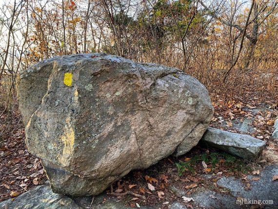
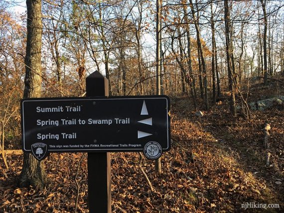
Overview: YELLOW (Summit) to BLUE (Ghost Lake) and back.
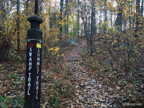
0.0 – From the lot, follow RED (Swamp)/YELLOW (Summit) up a woods road.
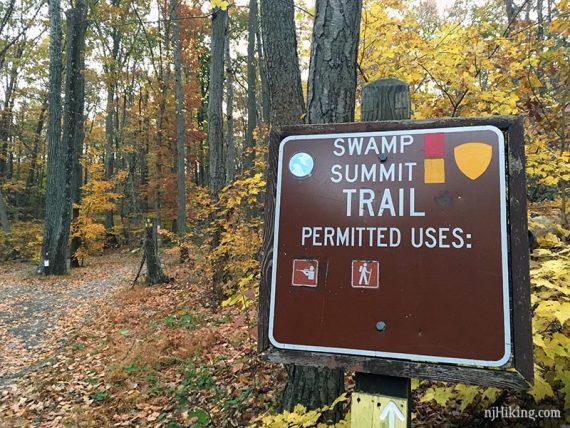
0.15 – The trail splits. Continue following YELLOW (Summit) to the RIGHT. [RED (Swamp) continues to the left.]
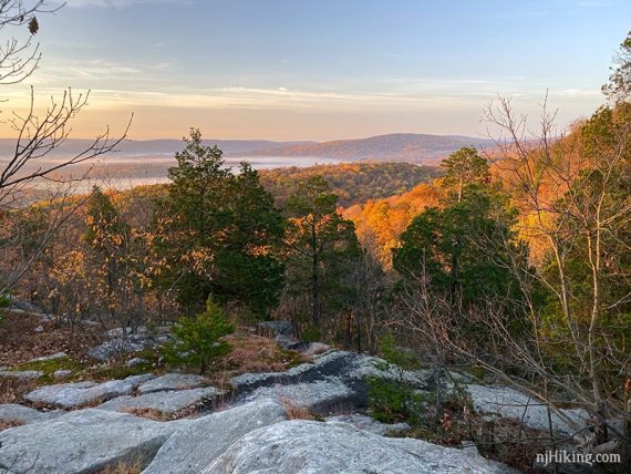
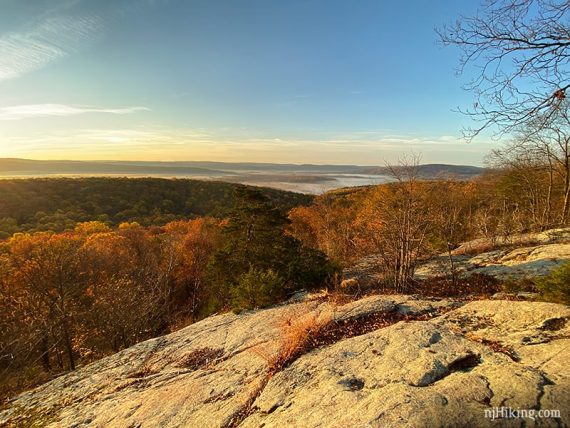
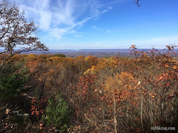
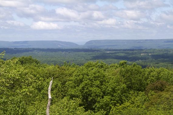
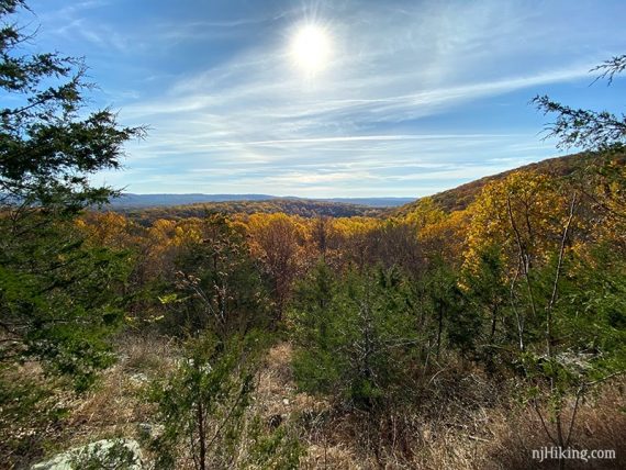
0.2 – Short side trail to an overlook on the right, and another shortly after. Watch for multiple side trails on the right leading to viewpoints.
Why is this park named “Jenny Jump”, and why is “Ghost Lake” on “Shades of Death Road”? The lore is that Jenny was a 9-year old girl who lived long ago in a small house under a high cliff.
While picking berries one day, a Native American surprised her. She called out to her father in terror and he yelled back, “Jump, Jenny Jump!”. Supposedly she jumped from the cliff and died.
Ghost Lake was created in the 1900’s by homeowners who damned a stream and named it for the morning fog that hung over the lake, and there are various stories surrounding the road. [See Wikipedia for a summary via Weird NJ and other publications].
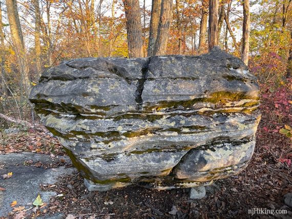
Pass two large glacial erratics, one of either side of the trail.
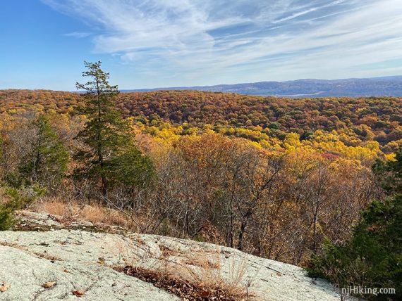
0.7 – Near a bench on the left is an overlook where the Delaware Water Gap can be seen in the distance. This is where the Delaware River has carved a gap through the Kittatinny Mountains.
On the right is Mt. Tammany in N.J. and on the left is Mt. Minsi in P.A. Seen in fall and in summer:
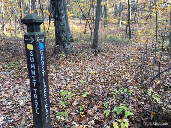
0.8 – Continue straight on YELLOW (Summit). [DARK BLUE (Spring) crosses the trail, left and right.]
// Shorter options at this junction: 1) Turn around and retrace on YELLOW (Summit); 2) Turn right and take DARK BLUE (Spring) back; 3) Turn left and take DARK BLUE (Spring) to RED (Swamp) and take that back to the lot. //
Long stretch of trail with no viewpoints.
1.5 – Turn RIGHT and start following BLUE (Ghost Lake). [BLUE (Ghost Lake) also continue to the left, YELLOW (Summit) ends].
// Shorter options at this junction: Turn left instead to follow BLUE (Ghost Lake) until it ends at a camping area – you won’t get to Ghost Lake but you also miss a downhill/uphill section. Follow the park road until it hits RED (Swamp) and take that back. This is also an option for an alternate on the way back from Ghost Lake. //
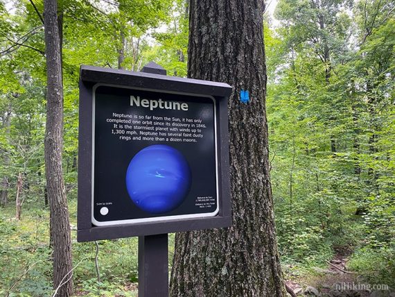
Pass a sign from the planet system walk (new, 2020).
This one mile scale model of the solar system starts with the Sun at the Orchard Trail parking area and ends with Neptune on the Ghost Lake trail.
The path is a rolling, rocky trail with two slightly steep rocky descents.
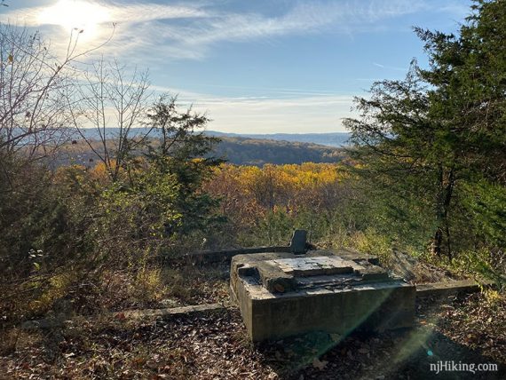
2.1 – On the right is a short path to the ruins of an old cabin, and a nice view of the surrounding area. The cement foundation works well as a bench for a break spot. (Fun Fact: The last time we saw the cabin standing was in 2000).
Shortly after, the trail turns into more of a woods road and Rt 80 can be seen (and heard) briefly.
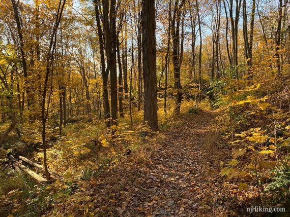
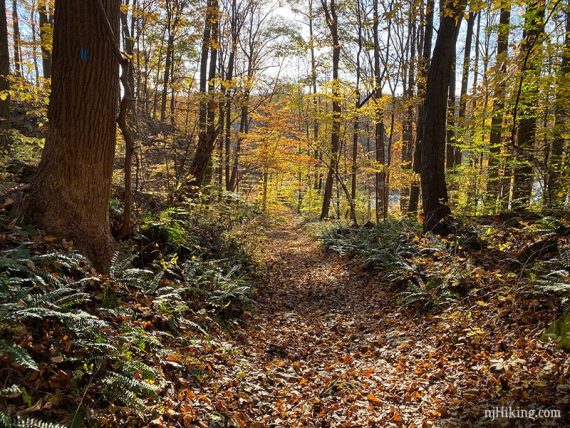
The trail becomes exceptional pretty with lots of ferns and some large rocks. A small gurgling stream leads into Ghost Lake.
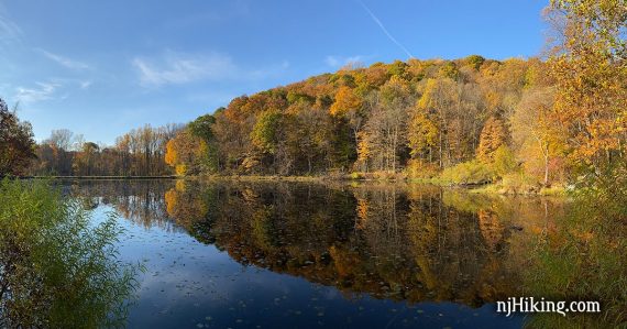
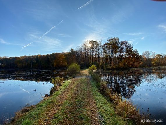
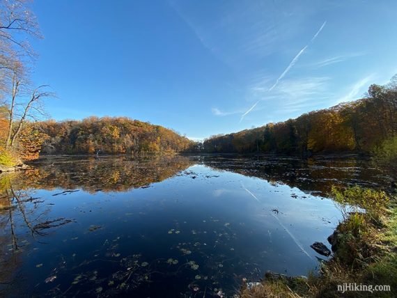
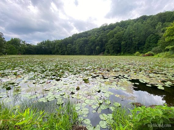
2.8 – Arrive at Ghost Lake. A walkable causeway splits the lake in two. This used to be grass, like it is show here, but is now covered in gravel.
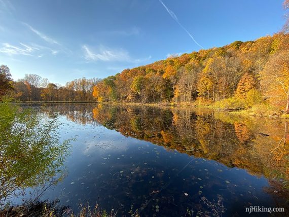
Fall color reflecting in Ghost Lake can be exceptional if timed correctly. Early morning often brings a low fog over the water.

We’ve seen Ghost Lake utterly clogged with lily pads in summer.
Our hike route ends here on the causeway – but you can continue around for different views of the lake (…and find a rock for a snack break) or walk to the boat launch area before heading back.
Extend this route with an optional little jaunt to find the Fairy Cave using the directions just below.
When ready, retrace the route back to the parking lot – BLUE (Ghost Lake) to YELLOW (Summit) and revisit all those views – or use the notes for Shorter Options to take different trails back.
Jenny Jump Fairy Cave Directions
Optional add-on: Add 0.8 miles total round trip to continue around the lake to the “Fairy Cave”, a small cave on the edge of Ghost Lake where some Native American artifacts were found long ago.
Continue across the causeway and follow BLUE (Ghost Lake), now a gravel path. Continue as it veers left (this is where the portable toilet is) with a parking area off on the right, near the road.
It ends at Shades of Death Road. Walk along the guardrail into a 2nd parking lot. Across the parking lot and near the edge of the water is tree (think it had a white park sign on it) where an unmarked path starts.
Follow this short (but root and rock filled) path that hugs the edge of Ghost Lake to the cave. From this 2nd lot it’s about 0.1 mile to the cave. It’s just uphill on the right. The cave is obvious and not hidden.
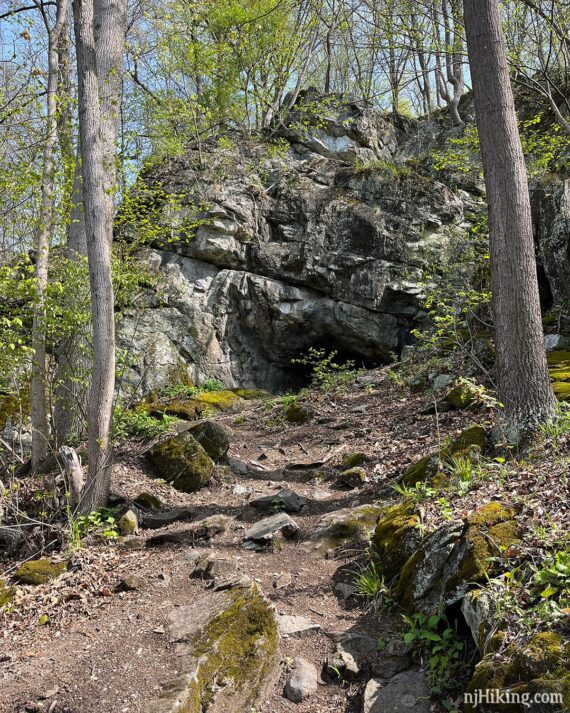
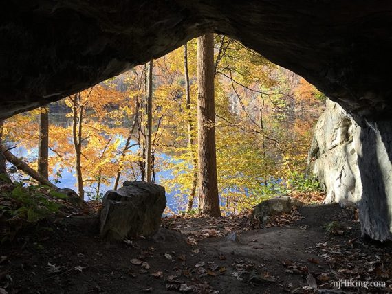
Fun Facts: Also called “Faery Hole”… so take your pick: Fairy or Faery, Cave or Hole. Either way, in 1936 Dr. Dorothy Cross excavated the cave and found 10,000 fragments, including a tooth from a extinct giant beaver. [Source: Caves of New Jersey, pg 34-5 (diagram) 1976.]
The Fairy Cave entrance is wide and can be entered for a short distance.
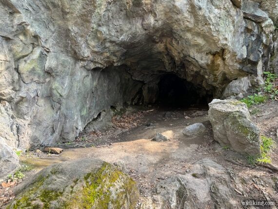
Looking out on to Ghost Lake from inside the fairy cave:
The very back of the cave gets lower and continues for a bit – it turns to the right beyond what is seen in the photo below.
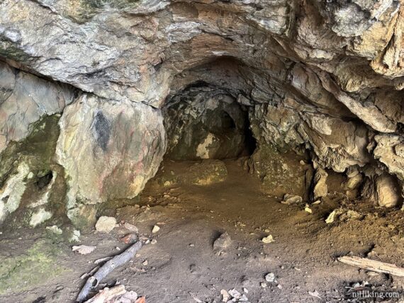
While we love romping around caves we have never felt it was worth crouching into the back section but knock yourself out if you like – or just shine a light in to take a peek.
Retrace the route from here. Alternately, park at one of the Ghost Lake lots and it’s a short walk from there.
—
Hiked: 4/28/24. plus Fairy Cave.
Hiked: 8/7/20. with B.
Hiked: 10/26/19. plus Fairy Cave.
Hiked: 12/13/15. Trail Blog: “Jenny Jump in December“
Hiked: 5/21/11. with B&T. Trail Blog: “Jenny Jump in Spring”
Hiked: 5/17/09. Trail Blog: “Jenny Jump in May”
Hiked: 3/5/06. Trail Blog: “Jenny Jump in March”
Hiked 8/2000. Old cabin still standing.
Updates: 8/2020 – Re-hiked, minor text changes, added pics. 10/2019 – Re-hiked, new photos, minor description changes, added the Fairy Cave. 12/13/15 – Minor description changes, inserted shorter hike options.