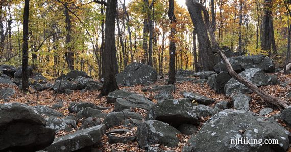
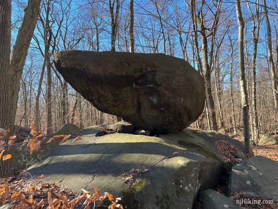
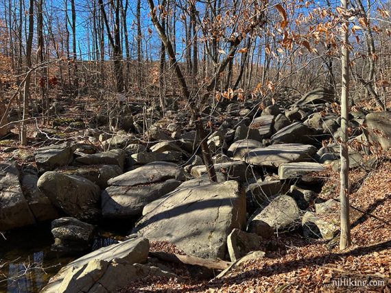
Hike over boardwalks and through the boulders of Devil’s Half Acre and Roaring Rocks.
5.7 miles. Very rocky with some minor elevation gain. Mountain biking, horseback riding, and bouldering are also allowed.
| 5.7 miles | This hike guide: Detailed instructions, photos, and video follow below. |
| Shorter | 1.4 miles – ORANGE (Maple Flats) only; or other loop combos. |
| Nearby | Duke Farms; Griggstown Grassland; Bunker Hill; Butler Road Natural Area; Negri-Nepote Native Grassland Preserve; Sourlands Ecosystem Preserve; Six Mile Run Reservoir – Red Trail; Six Mile Run – Canal Road. |
Our two cents:
A solid loop with plenty of interesting rock formations. Though the trail requires no scrambling, bouldering is allowed here so energetic hikers can clamber around the big rocks in Devil’s Half-Acre.
Even though there’s a “Ridge” trail, there are no views from any of the trails. From info located online, this appears to be a no-hunting park.
Bonus: Enjoy craft beer? There are four breweries within 15-20 minutes. If you can’t decide… try Flounders (closest to the park) or Readington Brewery. We’ve enjoyed everything we tasted at both and the locations are nice.
Updated: 8/2024 – Minor edits. 2/2023 – Re-hiked, minor edits. Older change log at page bottom.
Hike Info:
Map/Books:
Print out the map from the park site, and maps may be in the trail kiosk. Follow along on a smartphone with our Interactive Map link in the box above.
This route now appears in Best Day Hikes in New Jersey and Hike of the Week. Variations can be found in Best Day Hikes Near Philadelphia and 60 Hikes Within 60 Miles: New York City.
Parking: N40.47380° W74.69425°
Sourland Mountain Preserve, 421 East Mountain RoadHillsborough, NJ 08844. Large paved lot.
Restrooms:
Portable toilet in the parking lot (bring TP; it sees a lot of use).
Hike Directions:
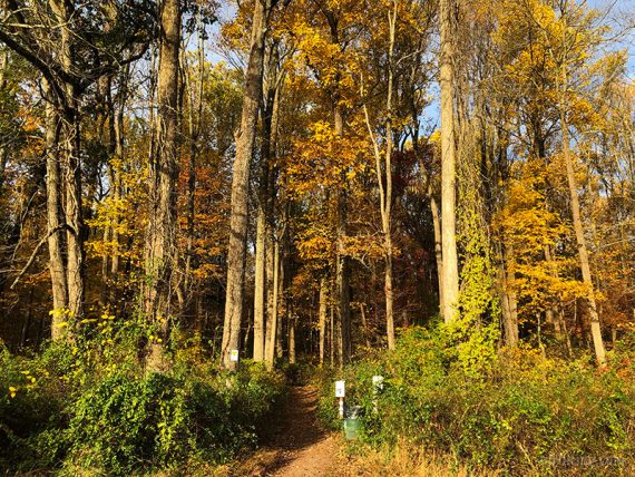
Overview: ORANGE (Maple Flats) – YELLOW (Devil’s Half-Acre) – WHITE (Tributary) – RED (Ridge) – BLUE (Roaring Rocks) – WHITE (Tributary) – ORANGE (Maple Flats)
0.0 – The trailhead for all trails starts at trail kiosk near the tree line. Start following ORANGE (Maple Flats).
0.2 – Start following YELLOW (Devil’s Half-Acre) straight, passing Marker #1 and a bridge on the left. [ORANGE (Maple Flats) goes left.]
0.4 – Continue following YELLOW (Devil’s Half-Acre), passing YELLOW DOT (Devils’s Half-Acre Connector) on the left (but did not notice this the last time we hiked).
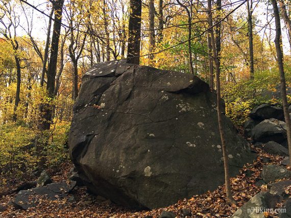
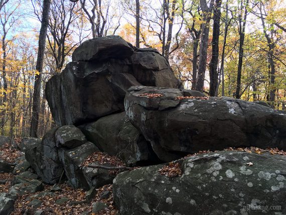
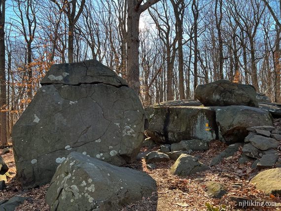
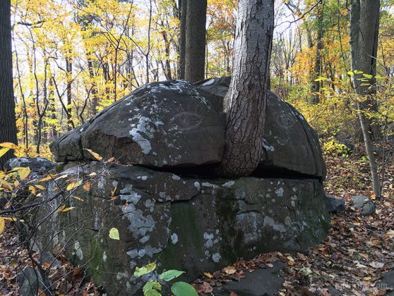
The trail heads uphill and loops around an area of large boulders.
0.8 – At a Marker #2 continue following YELLOW (Devil’s Half-Acre) where there is a yellow arrow painted on the rock. [PINK (Bouldering) starts ahead and meets up with YELLOW in a bit].
The trail winds over and around some very large boulders.
1.0 – Continue following YELLOW (Devil’s Half-Acre), passing the other end of YELLOW DOT (Devils’s Half-Acre Connector) on the left (did not notice this end either the last time we hiked).
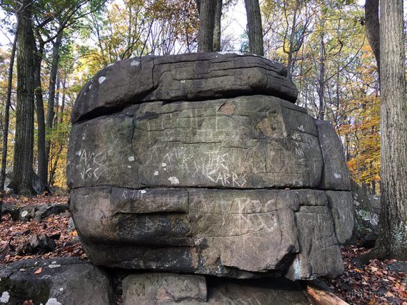
Continue past a tall tree growing out of a split boulder.
1.7 – Marker #3 – yellow and white blazes but the #3 isn’t visible in this direction. Start following WHITE (Tributary) to the RIGHT. [YELLOW (Devil’s Half-Acre) continues to the left and is a shorter way back to the lot].
Shortly, the trail splits in a “Y”. Veer RIGHT to start following RED (Ridge). [WHITE (Tributary) continues off to the left and is a variation of this route with about the same mileage].
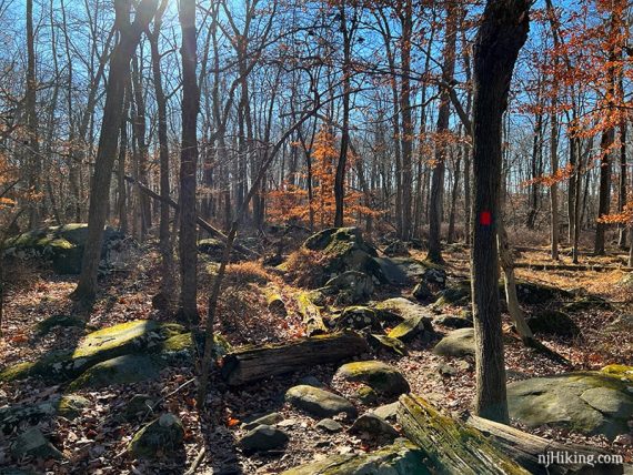
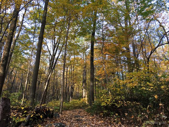
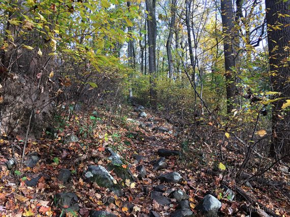
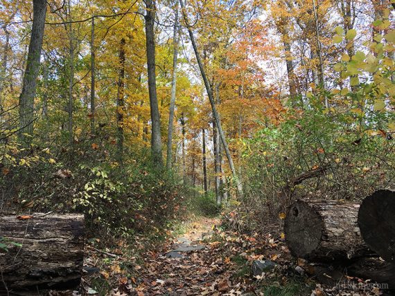
RED (Ridge) winds through a rock filled trail.
2.1 – Cross a pipeline cut.
2.5 – Continue following RED (Ridge) to the RIGHT. [RED DOT (Ridge Connector) starts to the left and is an alternate route through this area].
Additional blue marks appeared in this area (circles, arrows) which weren’t reflected on the trail map – just follow RED (Ridge).
2.9 – Pass a rock perched on a boulder that we call “Shark Head Rock” as an homage to Pyramid Mountain’s “Whale Head Rock”.
3.1 – Marker #4. Start following BLUE (Roaring Rocks) to the right. [RED (Ridge) ends. RED DOT (Ridge Connector) is on the left. BLUE (Roaring Rocks) also goes left.]
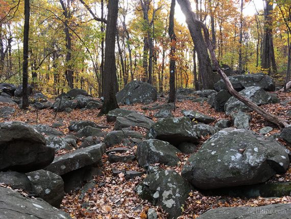
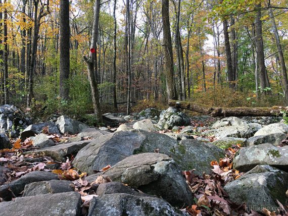
3.3 – Continue on BLUE (Roaring Rocks), passing BLUE DOT (Roaring Rocks Connector) on the left. Off on the right, the huge rocks that fill Roaring Brook come into view.
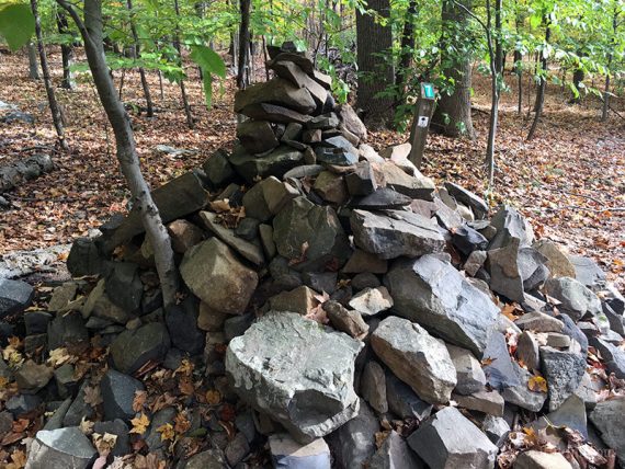
3.4 – Marker #5, near a very large cairn (hiker pile-o-rocks). Start following WHITE (Tributary) ahead. [BLUE (Roaring Rocks) and WHITE (Tributary) also go to the left, towards Marker #6].
Follow WHITE (Tributary) as it zig-zags down several gradual switchbacks before the trail levels out and arrives at an opening in a chain-link fence.
3.8 – Walk through the fence opening and continue straight on WHITE (Tributary). [WHITE DOT (Tributary Connector) goes left, also leading to Marker #7]
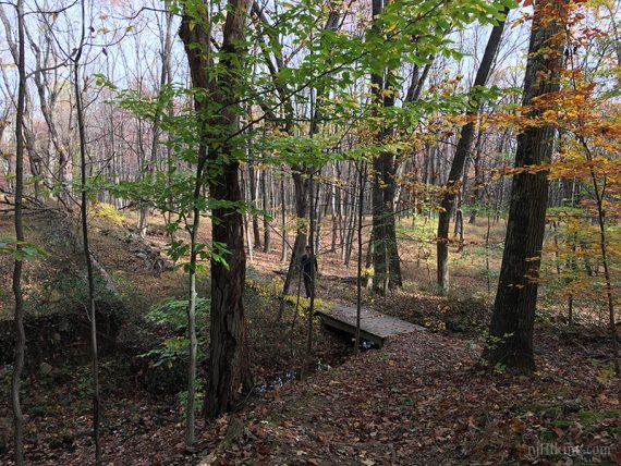
4.3 – Pass a long low stone wall, remnants of a structure, off on the left (may not notice it if there are leaves on the trees). Dip down and cross a wooden footbridge.
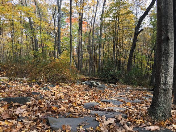
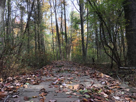
Marker #7. Continue straight on WHITE (Tributary). [WHITE DOT(Tributary Connector) goes left]. There are several boardwalks and stone pathways in wet areas.
4.9 – Marker #8. Turn RIGHT, to now follow ORANGE (Maple Flats). [ORANGE (Maple Flats) also continues to the left. WHITE (Tributary) ends].
Cross the pipeline cut again and ORANGE (Maple Flats) continues on the other side.
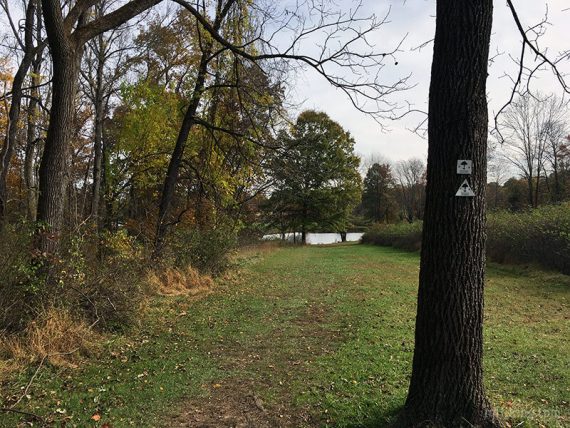
5.5 – At a wooden marker post, continue on ORANGE (Maple Flats) as it turns RIGHT. [ORANGE DOT (Maple Flats Connector) goes to the left].
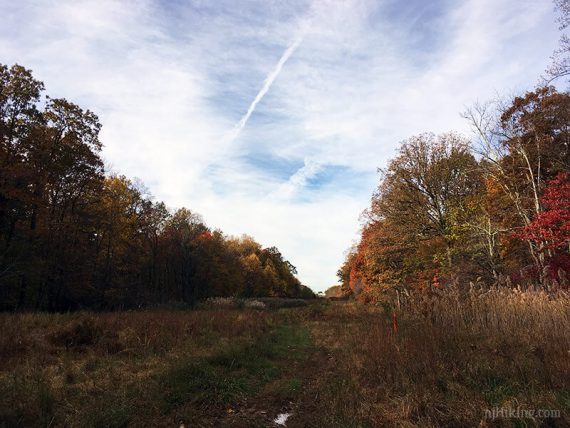
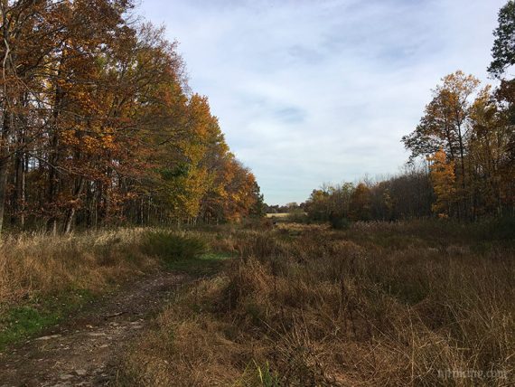
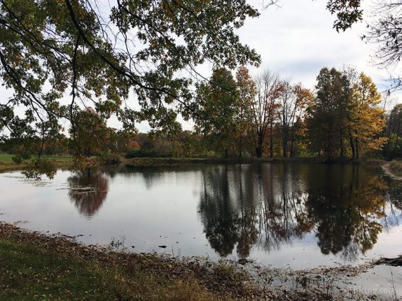
Head towards a pond on a grassy area in a field (photo has the old style of trail markers).
At the pond, the parking lot will be visible off to the left.
—
Hiked: 2/20/23.
Hiked: 12/13/21.
Hiked: 1/1/20. Variation; using Blue. Same mileage.
Hiked: 11/4/17.
Hiked: 11/14/14. Variation; skipped Roaring, stayed on Ridge. 5.3 miles.
Hiked: 1/19/13. Trail Blog: “Sourland Mountain Preserve in Winter“
Hiked: 8/8/09. Trail Blog: “Sourland Mountain Preserve in Summer“
Updates – 12/2021: Re-hiked; minor edits to text and map, mileage to 5.7 from 5.4. 5/2021: Description and Interactive Map updated to reflect major trail system changes; but not re-hiked.
1/2021 – While trail locations are unchanged the park has completely changed the trail markings: circle and squares are now painted blazes, “C” connector trails are now blazes with dots, position of numbered signs has changed, and some trail names have been changed.
1/2020: Re-hiked, minor description changes. 11/9/17: Re-hiked, minor tweaks, updated GPX, added new fall photos, moved winter/summer photos to the blog posts.
11/15/14: The unmarked trail that bypasses some switchbacks at marker 7 has been blocked, so that option been removed from the description.
1/24/13: Since this hike was posted in 2009, the “Roaring Brook Trail” (RED, 2.1 miles) has been added to the park, and the location of Marker 7 moved. The description and GPS file have been updated to reflect the addition, and the route is now longer.