Hike the Appalachian Trail past Catfish Fire Tower for tons of views over New Jersey.
4.4 or 2.0 miles, total out-and-back. Very rocky. Uphill at beginning / downhill at end, level the rest of the way.
| 4.4 or 2.0 miles | This hike guide: Detailed instructions and photos follow below. 4.4 miles – Past Catfish Fire Tower for plenty of ridge views. 2.0 miles – Just Catfish Fire Tower and back; noted below |
| Longer versions; nearby | Rattlesnake Swamp – Catfish Fire Tower Loop Coppermines – Catfish Tower – Rattlesnake Swamp |
| Nearby Hikes | Van Campens Glen; Millbrook Village and Van Campens Glen; Blue Mountain Lake Loop; Crater Lake to Blue Mountain; Crater Lake and Hemlock Pond Loop; White Lake Natural Area; Swartswood S.P. – Spring Lake / Swartswood Grist Mill |
| Nearby Kayak | Catfish Pond; White Lake Kayak |
Our two cents:
Manageable length hike packs a fire tower and lots of ridge views in a straightforward out-and-back hike on the Appalachian Trail.
Make it short-n-sweet to the fire tower and back for 2.0 miles total. Extend the hike a bit by making a loop with Rattlesnake Swamp trail or by continuing further on the Appalachian Trail.
Updated: 10/2024 – Minor edits; re-hiked. 10/2023 – Minor edits; re-hiked. 3/2022 – Minor additions.
Related: Best Fall Foliage Hikes in New Jersey
Hike Info:
Map:
Kittatinny Trails is best. Follow along on your smartphone with our Interactive Map link above.
Note: Underlying Google Maps data has an incorrect “Rattlesnake Trail” hiker icon along the Appalachian Trail, nowhere near the actual intersection of the A.T. and Rattlesnake Swamp Trail.
Also, it shows a curved section of unmarked woods road incorrectly as the Appalachian Trail in the beginning of the hike (as of 10/2023). Our Interactive Map has the correct track and waypoints in the correct locations.
Books:
A good loop with the Rattlesnake Swamp trail is in 50 Hikes in New Jersey.
Parking: N41.05819° W74.96430°
233-225 Millbrook Rd, Hardwick Township, NJ 07825. Or try entering “AT Trailhead – Millbrook – Blairstown Rd.” for the pullout just BEYOND this one.
Rt 80 West to Exit 12 for Rt 521 Blairstown. Rt 521 to L on Rt 94 then multiple turns through Blairstown (best to use a GPS) to Millbrook Road/Rt 602.
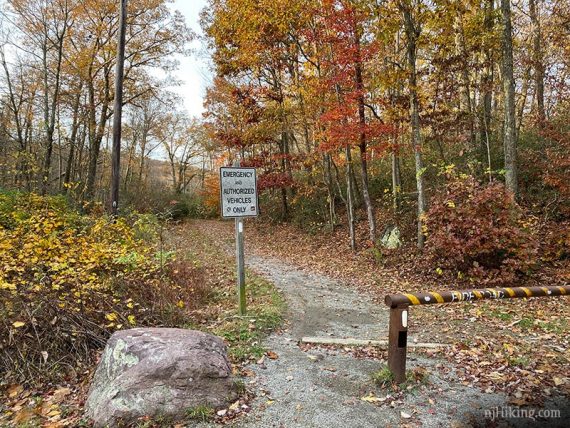
Roadside parking with room for several cars near a metal gate (do not block the gate).
If full, just down the road is another roadside pullout. Past that are few spots where the AT continues on the other side of the road.
Restrooms:
None. Ones at Millbrook Village may be open: continue on Millbrook Road/Rt 602 past the parking to where the road splits, the village is on the right.
Hike Directions:
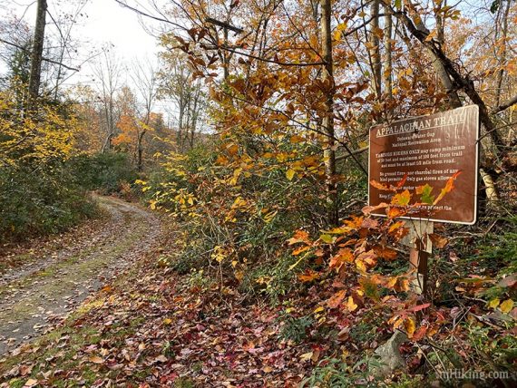
Overview: WHITE (Appalachian Trail)
0.0 – Pass the metal gate to start following WHITE (Appalachian Trail).
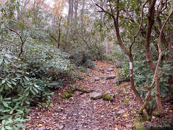
The trail follows a wide woods road at first. Continue following WHITE (Appalachian Trail) as the woods road turns right.
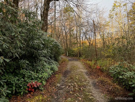
0.4 – Turn LEFT as WHITE (Appalachian Trail) leaves the woods road and starts following a trail. Keep following WHITE (Appalachian Trail) as it rejoins then leaves the woods road. (The trail and the woods road ends up at the same spot eventually).
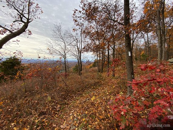
WHITE (Appalachian Trail) heads steadily uphill until leveling off at the fire tower.
Pass a casual side trail on the left that leads to a limited view. There are a few optional side trails like this that are not included in the mileage but are marked on the Interactive Map.
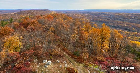
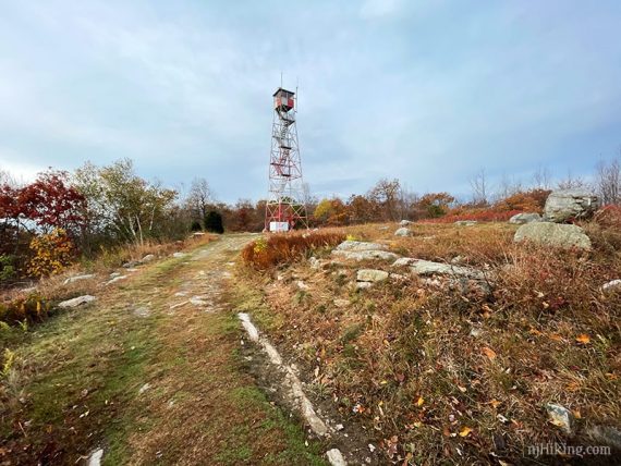
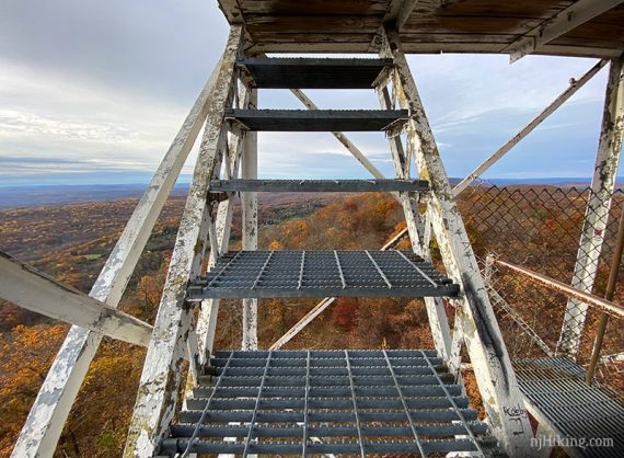
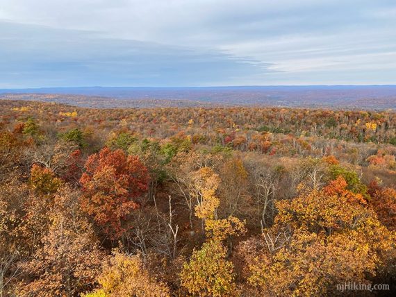
1.0 – Catfish Fire Tower and picnic table, with views in multiple directions over New Jersey.
View from near the picnic table:
Fun Facts: The 60-foot tower was built in 1922 and is manned during fire season, generally March – May and October – November. It’s not the tallest in New Jersey but is at the highest elevation: 1,555’.
For a great article about the Catfish Fire Tower and fire observers see “Smoke Detector“ (New Jersey Monthly Magazine).

The Kittatinny Ridge that the trail follows is prominent when looking at the Appalachian Trail traveling north.
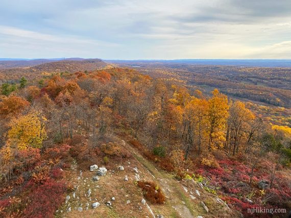
Looking at the Appalachian Trail traveling south.
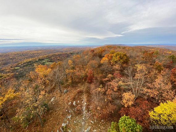
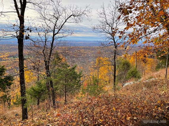
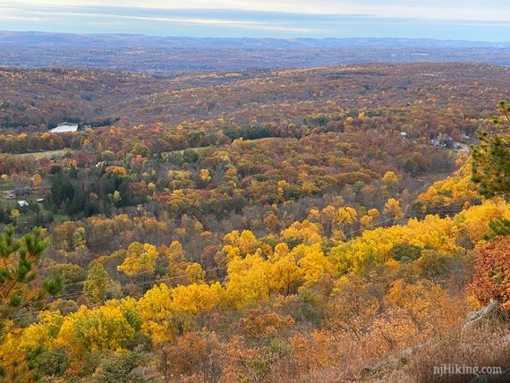
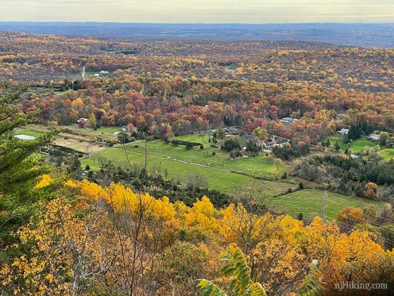
View east over New Jersey’s farms and forests.
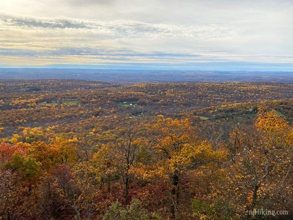
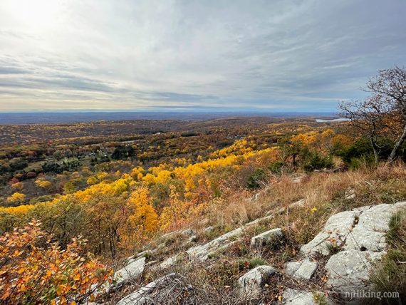
Looking west over the Delaware Water Gap National Recreation Area in New Jersey and over into Pennsylvania.
// Shorter: 2.0 miles total – turn around here. //
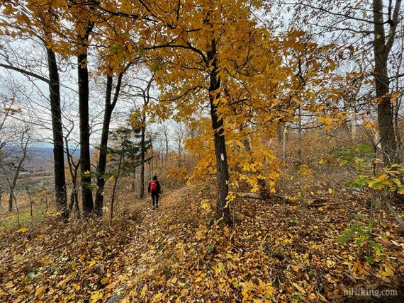
Continue following WHITE (Appalachian Trail). There are a few short casual side trails to limited viewpoints along the way.
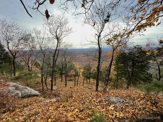
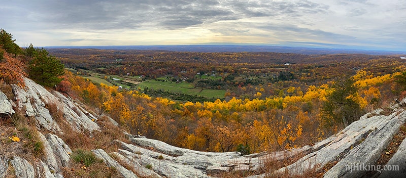
1.4 – A more open viewpoint over the valley and farms below.
Keep on truckin’ along WHITE (Appalachian Trail). The valley below is often visible even without a viewpoint.
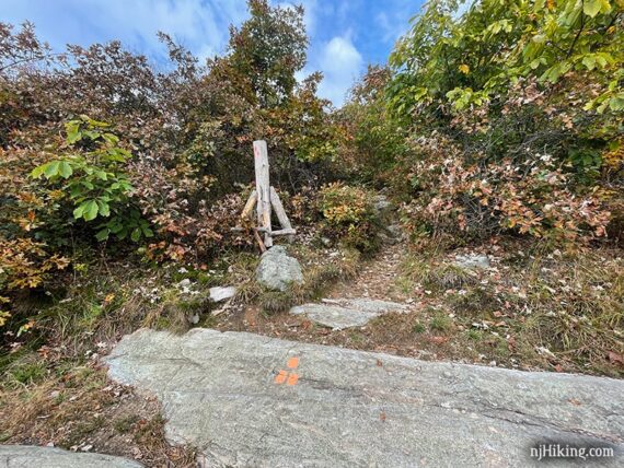
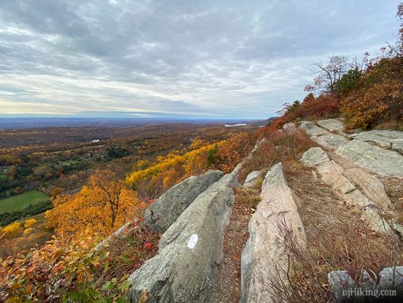
2.0 – Pass the junction with ORANGE (Rattlesnake Swamp) on the right, marked with wooden posts.
There is a nice wide view over farms and forest in the valley below and along the ridge.
Fun Facts: The Kittatinny Valley runs from the Kittatinny Ridge (what you’re standing on) to New Jersey’s Highlands region (Jenny Jump Mountain, Allamuchy Mountain).
“Kittatinny” is from the Lenape Indian word, kitahtëne, meaning endless or big mountain. [Source: Kittatinny Valley – Wikipedia].
The trail surface has rock ridges that make for interesting photos.
This makes for an obvious turnaround spot but we prefer to continue a bit further.
2.1 – Continue on the WHITE (Appalachian Trail) over more ridged rock slabs.
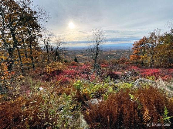
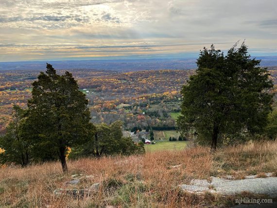
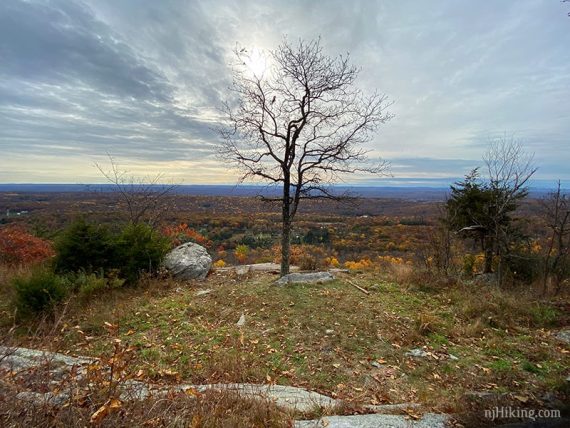
2.2 – Watch for an open area with a tree and a prominent rock as this is the turn around point.
This makes for a good break spot with a nice view, or there’s another nice viewpoint with a flat rock ledge to sit on is just before this. On our Interactive Map our waypoint here has been called “ShadyRock” for ages but it seems like this tree no longer will be providing shade… still a nice view though!
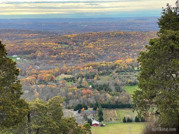
Photogenic rock and looking down to the valley below.
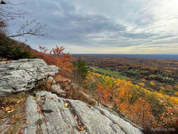
Looking towards Lower Yards Creek Reservoir in the distance. That is below Upper Yards Creek Reservoir, which is below Sunfish Pond (another great hike).
Retrace the route back to the parking area.

// Longer: The Appalachian Trail continues of course (south – all the way to Georgia).
There are some limited views before it drops down to the road for Mohican camp but we felt this is the last excellent viewpoint in this direction and so ended the route here.
—
Hiked: 10/20/24.
Hiked: 10/08/23. with Van Campens Glen.
Hiked: 10/25/20.