Chikahoki Falls, Otter Hole, and a 360° view from Wyanokie High Point, including NYC on a clear day.
Norvin Green State Forest is located in the New Jersey Highlands near the Wanaque Reservoir and offers a variety of rugged terrain for short hikes with outstanding views to long, challenging loops for the experienced hiker.
7.6 miles. Rugged, rocky, with a few decent elevation changes. There is an extensive trail system so it’s easy to create other shorter or longer loops.
| 7.6 miles | This hike guide: Detailed instructions, photos, and video follow below. |
| Shorter | 2.6 – Out-and-back to the amazing view at High Point. Noted below. |
| Same lot | Challenging variation: Wyanokie High Point, Carris Hill, Buck Mountain. |
| Same park | Torne Mountain/Osio Rock |
| Nearby | Governor Mountain; Horse Pond Mountain to Lake Sonoma Loop; Stonetown Circular; Lake Sonoma, Overlook Rock, Manaticut Point; Apshawa Preserve; Apshawa Waterfall. |
Our two cents:
Wyanokie High Point has one of the best views in the state, but Norvin Green State Forest also contains some of the most rugged terrain. Beginners or casual hikers may want to stick with a short hike to the view and back.
Chikahoki Falls, cascades along Posts Brook, and Otter Hole falls are most impressive after heavy rain but there may be wet sections on trails.
Updated: 1/2026 – Updated description/interactive map to reflect major trail reblazing throughout park, and that the beginning of the trail has been rerouted off Weis property and onto the road; not re-hiked. Older change log at page bottom.
Hike Info:
Map:
Norvin Green (south section) was entirely reblazed in the Fall of 2025. The physical location of the trails themselves are unchanged but the colored markers (blazes), and in some cases the names, are different.
Currently the only updated map available is here: “Norvin Green State Forest (southern section) Reblazing Complete“. Follow along on your smartphone with our Interactive Map link above.
Note! The current Northern New Jersey Highlands Trails Map (2021 edition), and the trail map (version dated 11/23) on the NJ State Park site are no longer accurate. In addition, that version of the NJ State Park site’s map has the location of Wyanokie High Point in the totally wrong spot, putting after the intersection with the WHITE (Lower) trail.
Related: Waterfalls in NJ / Best Waterfall Hikes in NJ
Books:
Different routes that include High Point are in 50 Hikes in New Jersey, Hiking New Jersey (2023), Hike of the Week, and Take a Hike New York City.
A longer, very challenging route is detailed in 60 Hikes Within 60 Miles: New York City. Hiking the Jersey Highlands contains 6 shorter hikes with trail descriptions and maps – but it’s now out of print and hard to find.
Parking: N41.06986° W74.32171°
139 Snake Den Rd, Ringwood, NJ 07456. Rt 287 to exit 55, take 511 N (Wanaque), continue through Wanaque for several miles. Make a left onto West Brook Rd. Continue across Reservoir.
At the T-intersection, turn left. Then make the 2nd left on to Snake Den Road. There should be a sign for The New Weis Center for Education, Arts & Recreation and the Highlands Natural Pool.
Continue uphill and bear left on Snake Den, past some houses until arriving at a dirt lot on the right-hand side. Note! Parking allowed from 9 am to dusk.
Restrooms:
Nothing at the parking lot and the restrooms at the New Weis Center are not open to hikers. Best bet is a gas station or store along Rt. 511.
Hike Directions:
Overview: PURPLE/BLACK (High Point Spur) – PURPLE (High Point Loop) – WHITE (Lower) – RED (Wyanokie Circle Loop) – RED/BLACK (Wyanokie Circular Spur) – RED (Wyanokie Circle Loop) – GREEN (Den) – PURPLE/BLACK (High Point Spur)
DESCRIPTION UPDATED BUT NOT RE-HIKED. BLAZE COLORS IN PHOTOS WILL NOT MATCH THE NEW TRAIL SYSTEM.
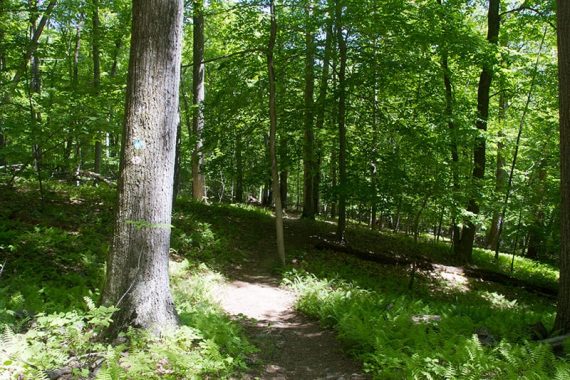
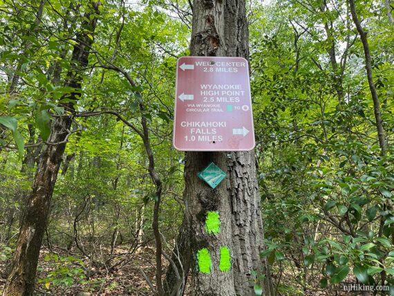
0.0 – Start following PURPLE/BLACK (High Point Spur) from the end of the parking lot, by the gate and some signs. The first portion of this hike is now along paved Snake Den Road. The trail no longer is on Weis Center property nor passes by the Highlands Pool.
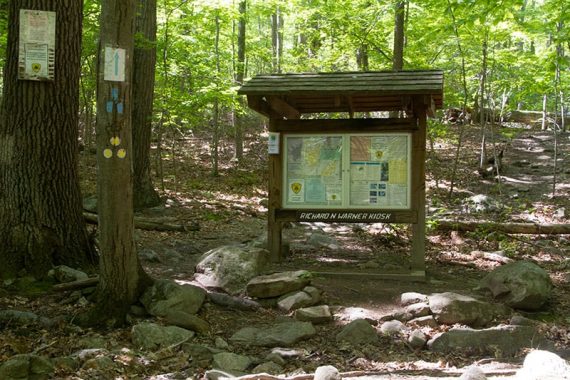
0.4 – At the trail kiosk (“Richard N Warner Kiosk”,) continue following PURPLE/BLACK (High Point Spur) [GREEN (Den) starts to the right, which will be the return route].
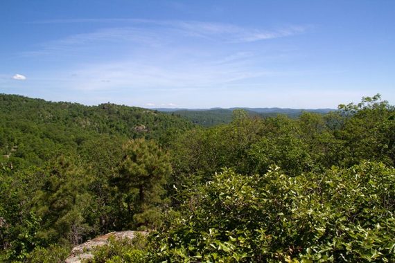
0.6 – Now follow PURPLE (High Point Loop) to the RIGHT. [It also goes to the left]. Continue steeply uphill past short side trails to several (limited) viewpoints – a preview of things to come.
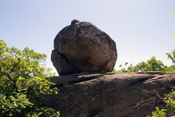
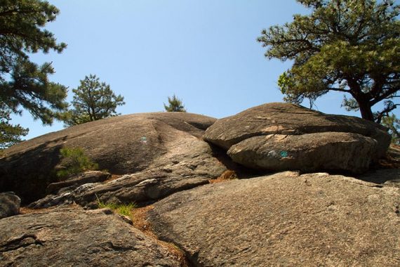
1.0 – Continue following PURPLE (High Point Loop). [Pass an unmarked trail on the right, formerly WHITE (Macopin)]. Head uphill past a large glacial erratic.
Scamper over bare rocks on the way to Wyanokie High Point.
1.2 – At an intersection with a large boulder, follow the HI POINT arrow sign towards the large rock painted with “HI POINT”. [TEAL DIAMOND (Highlands) is co-joined here and also goes to the right].
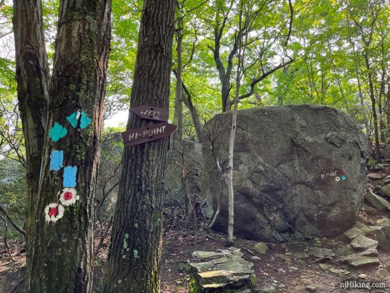
Continue following PURPLE (High Point Loop) by walking around the right side of the rock and scrambling up behind it.
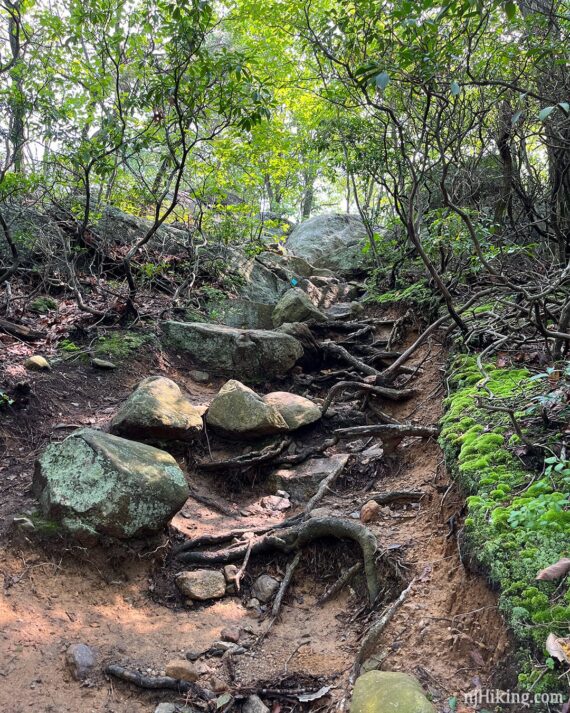
This next section is a little steep and more technical than an average trail but isn’t very long – and the payoff is worth it.
Continue up an eroded gully filled with exposed roots and large rocks.
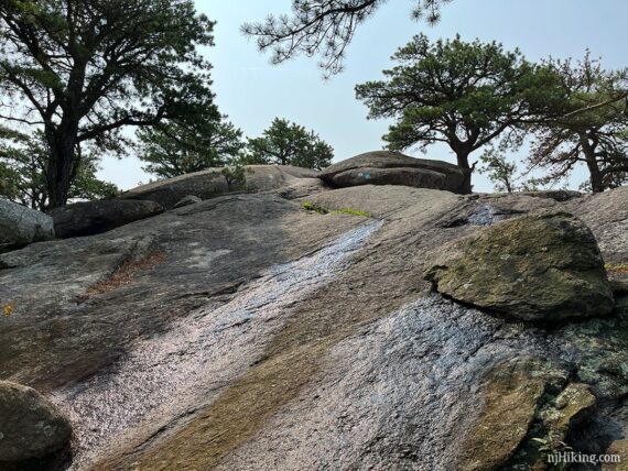
Then climb up a long slanted slab of bare rock, watching for any wet areas that may be slippery (this photo was after recent heavy rain).
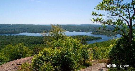
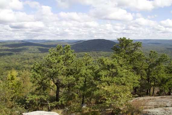
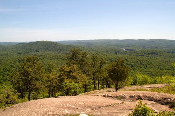
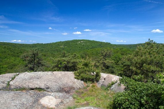
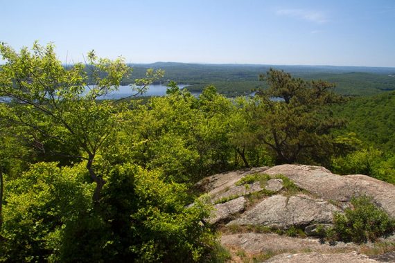
1.3 – Arrive at Wyanokie High Point for a 360-degree view and a large area of open rock slabs. This is a terrific spot for a break.
Fun Fact: Wyanokie is a variation of the Native American Lenape word Winaki. It was first written down by a Frenchman who spelled it phonetically, Wanaque. [Sources: The New Jersey Walk Book and Hiking New Jersey (2023)].
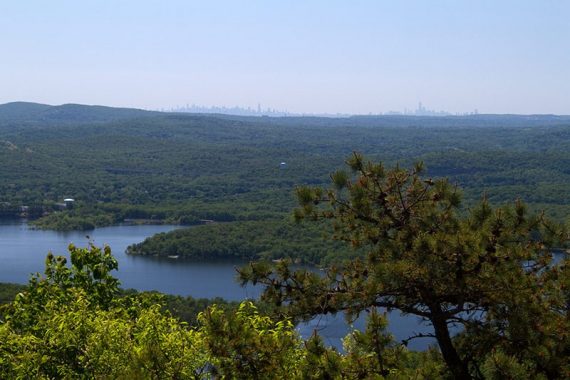
On a clear day, the New York City skyline is visible. From Wyanokie High Point looking towards New York City, and zoomed in to the skyline:
Fun Fact: Why is this park called Norvin Green State Forest? Because Norvin Hewitt Green donated the land to the State of New Jersey in 1946. Norvin was the nephew of Ringwood Manor owner Abram S. Hewitt (who also has a park named after him and includes other great hikes like Bearfort Ridge – Surprise Lake). [Source: The New Jersey Walk Book].
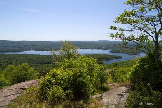
View of the Wanaque Reservoir from High Point.
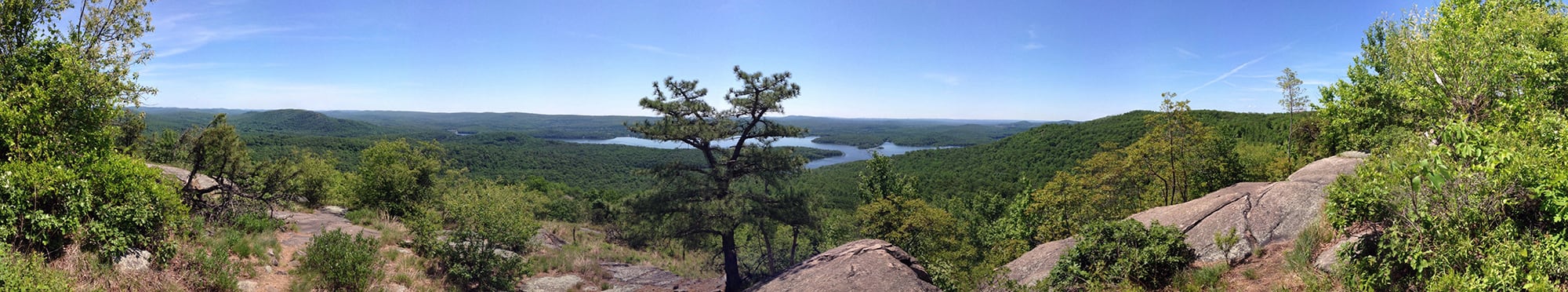
Panorama from Wyanokie High Point, with the Wanaque reservoir seen in the center:
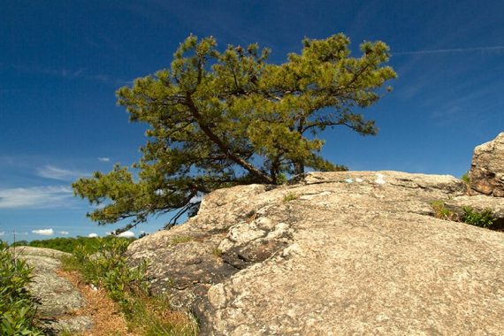
There are plenty of spots to take a break, and a few trees to sit under to keep out of the sun. Be sure to walk all around the rock slabs for different vantage angles.
Shorter, 2.6 miles total round trip: For many hikers, getting to High Point is the goal. Retrace the route back down from this point or continue following the Purple loop ahead and still get a rewarding hike in.
From Wyanokie High Point, continue following PURPLE (High Point Loop) markers on the rocks.
Steadily descend through an open area. A short side trail leads to a viewpoint (similar to what you’ve seen up top) before reentering the shade of the forest and leveling off. The beginning might be a little overgrown just coming off the viewpoint but soon opens up.
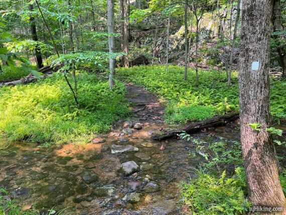
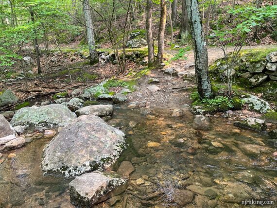
2.0 – Turn RIGHT to start following WHITE (Lower). This is just before a stream crossing.
Don’t continue straight on PURPLE (High Point Loop) over the stream. The intersection is well marked but it’s easy to waltz right on by the start of WHITE because the gurgling stream (and perhaps a little cascade) beckons you.
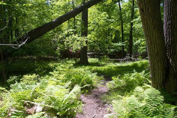
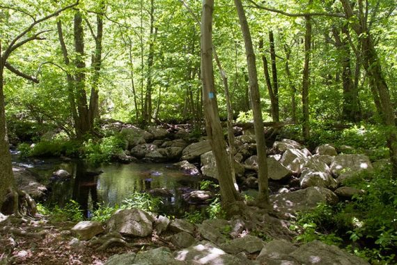
Continue following WHITE (Lower) as it meanders through the forest. There’s no views or anything in particular in this stretch to point out but it tends to be more peaceful than the more popular areas of the park.
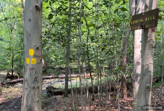
3.4 – Start following RED (Wyanokie Circle Loop) ahead at an intersection with wooden arrow signs for “Carris Hill” and “Weis 2.4 miles”. [RED (Wyanokie Circle Loop) also goes to the right and BLACK (Posts Brook) ends to the left].
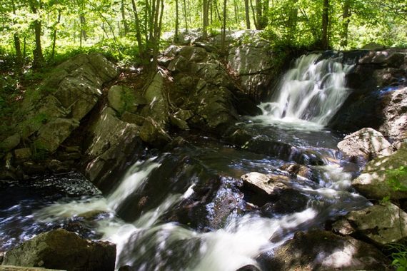
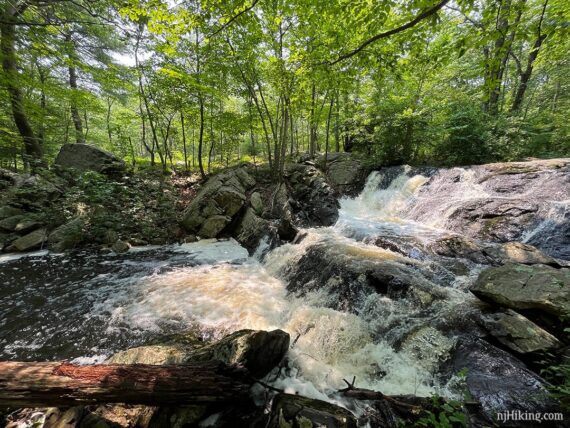
Continue following RED (Wyanokie Circle Loop), getting closer to Chikahoki Falls.
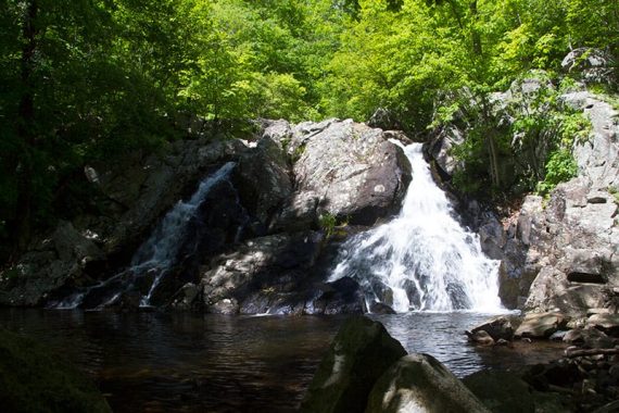
3.7 – Chikahoki Falls, seen from the side (and after heavy rain) when on RED (Wyanokie Circle Loop).
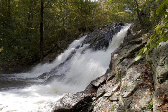
To view the falls from the front instead of the side requires a rock hop – if water level allows it. Years ago we used fallen trees or the occasional plank that would appear here but now there may be rocks piled into a walkway.
If the water level is enough that falls are really kickin’ then it’s probably not the best ideas to try to get in front.
This photo above was taken after recent heavy rain (July 2023) and while the rocks are visible we didn’t feel it was worth it to try dancing across them. But then we’ve also seen Chikahoki Falls a ton of times.
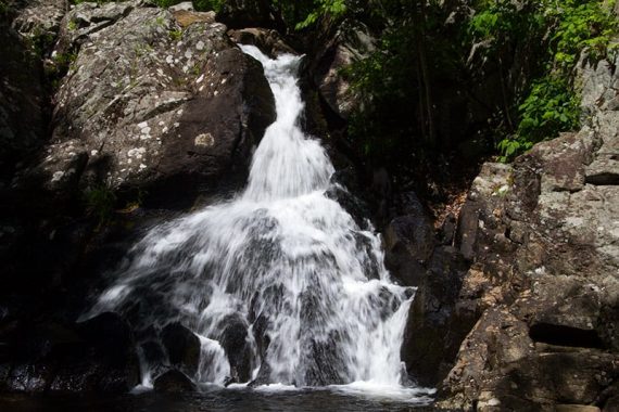
Continue following RED (Wyanokie Circle Loop) up sharply to the right as it passes by the top of the falls.
Posts Brook can be seen through the trees on the left before RED (Wyanokie Circle Loop) starts moving away from it. There may be several more large cascades on the stream when water is high.
3.8 – Continue following RED (Wyanokie Circle Loop), passing [RED/BLACK (Carris Hill Connector) on the right. There may be a wooden sign for “O-H PRKG” (Otter Hole parking).
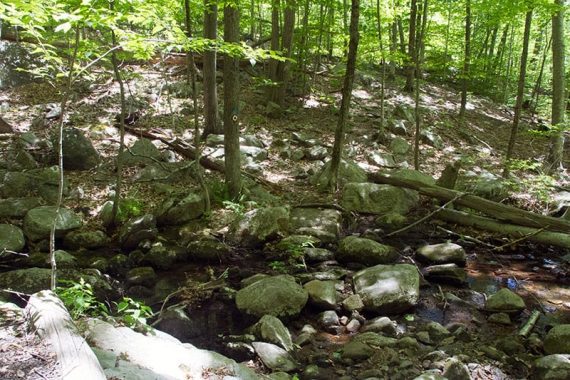
Soon after is a stream crossing on rocks or a log.
4.2 – Continue on RED (Wyanokie Circle Loop) as it crosses YELLOW (Wyanokie Crest) on the right and then left.
4.4 – Continue on RED (Wyanokie Circle Loop), passing an unmarked trail on left.
4.7 – Junction of RED (Wyanokie Circle Loop) and RED/BLACK (Wyanokie Circular Spur).
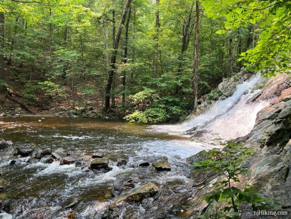
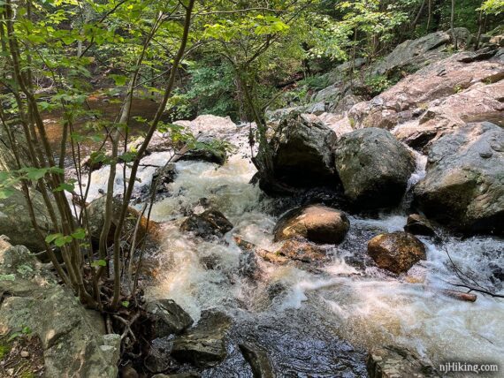
The hike will continue on RED (Wyanokie Circle Loop) to the RIGHT… but first turn LEFT for a short side trip on RED/BLACK (Wyanokie Circlular Spur) to check out Otter Hole – a nice water cascade that makes for a good break spot.
At the top of Otter Hole is a water crossing over a jumble of rocks – don’t continue over these. [Beyond the water crossing is the Otter Hole parking that leads to another great hike: Torne Mountain/Osio Rock.]
Instead, clamber down the left side of the rocks to view the cascades of Otter Hole.
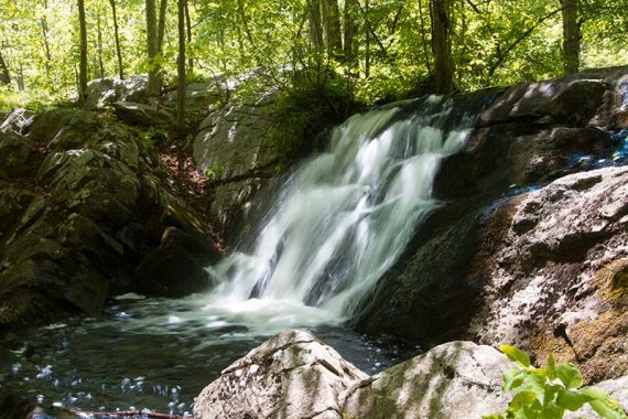
Like all waterfalls or cascades, the more water the merrier. The top photo is after heavy rain (July 2023), the second is with less flow.
Retrace to the junction. Continue following RED (Wyanokie Circle Loop) ahead, towards Weis Center (unsure if this sign is still here).
5.2 – Continue straight, still following RED (Wyanokie Circle Loop), where YELLOW (Wyanokie Crest) crosses the trail, andTEAL DIAMOND (Highlands) leaves to the left. There might still be another sign: Weis/Pkg is 1.6 miles.
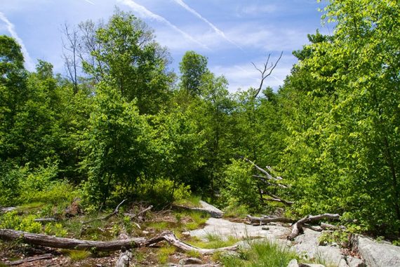
5.3 – A limited overlook on the left. Continue on RED (Wyanokie Circle Loop), mostly level with minor elevation change.
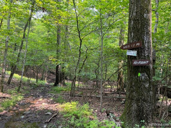
6.1 – Start following GREEN (DEN) to AHEAD/RIGHT. [GREEN (DEN) also veers LEFT and RED (Wyanokie Circle Loop) turns sharply back to the right]. There may be signs with “Weis 1.3 miles” and “HI-POINT”.
6.4 – Continue on GREEN (DEN), crossing an unmarked trail on either side. [The former WHITE (Macopin) started on the right and lead to High Point.]
Continue on GREEN (DEN) as it joins, leaves, and rejoins a rocky woods road. Pass stone building remains on the right. Cross Blue Mine Brook on rocks.
7.2 – At the trail kiosk from the beginning of the hike, follow PURPLE/BLACK (High Point Spur) back to the lot.
—
Hiked: 7/17/23.
Hiked: 7/2/16. Trail Blog: “Wyanokie High Point and Chikahoki Falls in Summer“
Hiked: 4/24/16. Variation, from Otter Hole lot. Trail Blog: “Otter Hole, Chikahoki Falls, Carris Hill, and High Point in Spring“
Hiked: 10/26/15. Variation, HP/Carris Hill/Mines/Ball Mtn.
Hiked: 6/1/14. Trail Blog: “Panoramic Views and Waterfalls“
Hiked: 8/30/13: Variation from Glenwild Ave. Trail Blog:”Wyanokie Crest, Carris Hill, High Point“
Hiked: 4/25/09. Trail Blog: “High Point, Chik Falls and Otter Hole loop”
Hiked: 1/5/08. 5.9m; Icy; variation. Trail Blog: “Norvin Green“.
Hiked: 10/29/06. 6.1m; variation. Trail Blog: “Wyanokie Crest Trail“
Hiked: 10/15/06. 8m; variation. Trail Blog: “Norvin Green – High Point“
Updated: 7/2023 – Page updated; adjusted for WHITE trail changes (end points of Lower and Post Brook changed); re-hiked. 2/2022 – Trail map info. 5/2020 – Page refreshed, not re-hiked. 8/2017 – Minor edits/updates. 7/2016 – New video added; re-hiked. 6/2014 – Revised description, new photos, and GPX; re-hiked.