A long hike over the ridge lines of the Jenny Jump Mountains to Lake Just-It.
10.9 or 5.8 or 2.8 miles. Trail surface is easy to moderate, not that rocky, some is on old woods roads. There are a few hills that are a steep later on in the hike.
| 10.9 miles | This hike guide: Detailed instructions, photos, and video follow below. |
| Shorter | 2.8 miles: To the viewpoint and back. Noted below. 5.8 miles: To cascades on a stream, and back. Noted below. |
| Longer | 16.6 miles: Use the trail map to take the trail further, to Rt. 617 near Mountain Lake. We have not done this. |
| Same park: | At another parking area, a minute away: Jenny Jump – Ghost Lake. |
| Nearby | Allamuchy Pond Trail; Allamuchy Mountain – Deer Park; Stephens State Park; White Lake; White Lake Kayak; Paulinskill Valley Trail – Cedar Ridge to Viaduct; Mt Tammany; Sunfish Pond; Mt. Tammany and Sunfish Pond. |
Our two cents:
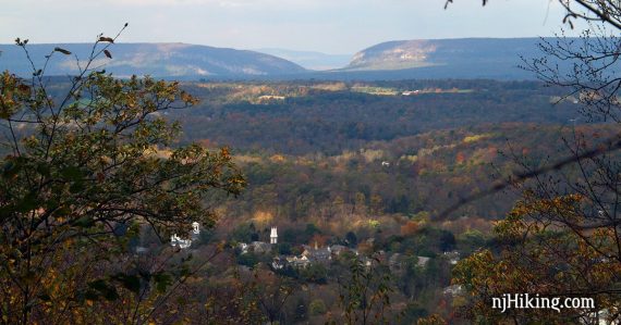
Wonderful view looking over the town of Hope towards the Delaware Water Gap, Mt. Tammany, and Mt. Minsi early on in the hike.
This is a route with options for all skill levels, and it’s nice to have in addition to hiking Ghost Lake in the other part of Jenny. Most hikers will want to do one of the shorter versions, either to just to the viewpoint (2.8) or cascades on a stream (5.8).
The full route is meant for avid hikers. After the initial viewpoint, the rest of the trail has no views but is in a nice forest that feels remote, even though you pop out and cross country roads a couple times. Undulating hills interspersed with long stretches of flatter trail makes this a good route to increase fitness or prep for a hiking-focused trip.
The trail continues further than this guide covers – a roundtrip hike all the way to Mountain Lake equals 16.6 miles.
Updated: 4/2025 – Re-hiked and updated. There is only one viewpoint now and the second viewpoint is gone (that used to be the main one). The trail was clear and appeared maintained. Older change log at page bottom.
Hike Info:
Map/Books:
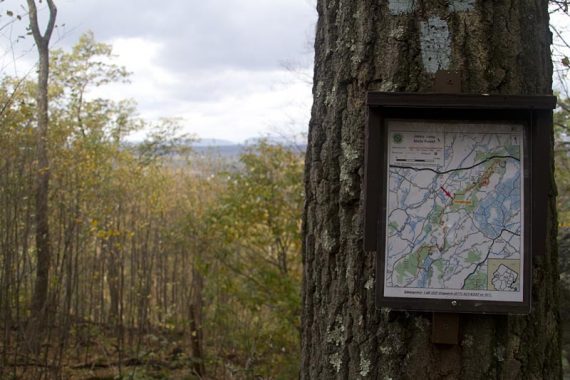
Print the park map or pick one up at the visitor center. Follow along on your smartphone with our Interactive Map link above.
A very similar version now appears in the 2024 edition Best Day Hikes in New Jersey (shorter version was in the original edition).
MAP NOTES: There are two map notes in the description indicating where reality is different to the park’s current trail map (versions dated: 5/2021 and 5/2018) and other maps/GPS apps.
When we originally hiked this in 2011, there were handy “you are here” maps along the way. In 2025 we spotted just a couple faded ones left on trees or the ground.
Parking: N40.91207° W74.92133°
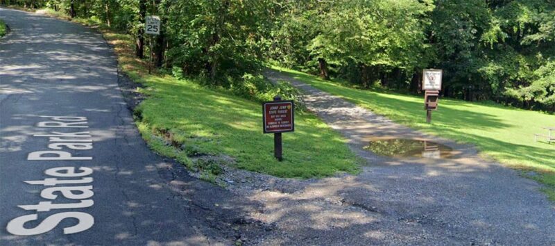
Jenny Jump State Forest, 330 State Park Rd, Hope, NJ 07844. This address directs to the park but not to the exact parking lot for the trailhead.
If approaching from Rt 80 W take exit 12 (Hope/Blairstown) for Rt 521 S. Turn L at the blinking light onto Rt 519. Turn R on Shiloh Road. Turn R onto State Park Road. There are several brown and white Jenny Jump State Forest signs marking the way.
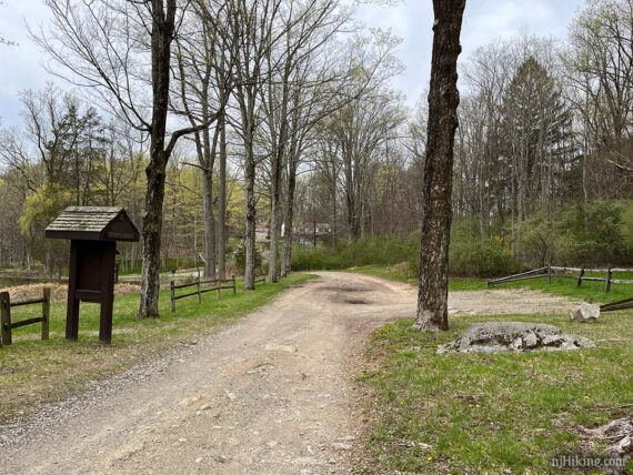
Follow State Park Road, passing an alpaca ranch on the right. At the Jenny Jump park sign, continue straight past. Almost immediately, veer RIGHT down the dirt/gravel road for the “Day Use Area” to a large parking lot with a Jenny Jump Trail sign at the far end.
If approaching from the south, you may be directed to via State Park Road the other way which will reverse the directions to the trailhead and bathrooms. There are also other parking areas along the Jenny Jump Trail that are marked on the park map.
One-way hike option: With two cars you could leave a car at the parking area at Lake Just-It (or another parking area). Out of curiosity we opened the Uber app while at Lake Just-It and rides were available. We didn’t have a strong signal and we can’t recommend relying on rides always being available is this area – but it’s worth a mention.
Restrooms:
Comfort station in the nearby cabin parking lot. When approaching from Rt 80 as above, instead of going straight past the Jenny Jump park sign – first turn LEFT towards the office.
Soon continue straight ahead (the park office is off to the left if you want to stop there first) towards the cabin area. Arrive at a small parking area with a restroom building. There are no other restrooms along the route.
Post-hike:
Nearby, town of Hope: A cafe/deli and antique and toy shops, and the Land of Make Believe amusement park. The alpaca sanctuary on State Park Road offers interactive experiences (booking required).
Enjoy craft beer? About 15 min. away in Hackettstown is Czig Meister and Man Skirt, and Jersey Girl is a bit further from that.
Jenny Jump is one of the few “dark sky” areas in the state. The United Astronomy Clubs of New Jersey has a observatory in the park, check the UACNJ’s website for free public programs that run on Saturdays from April through October.
Hike Directions:
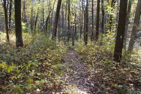
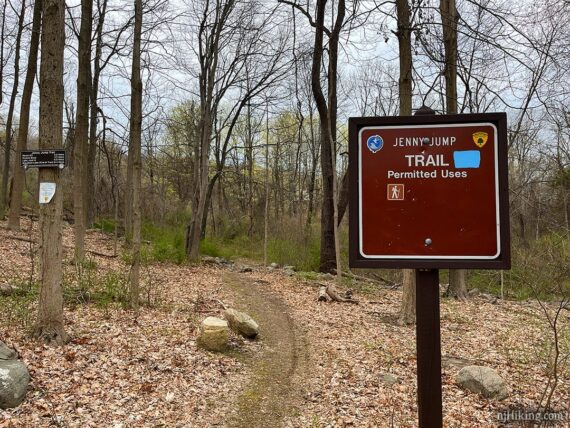
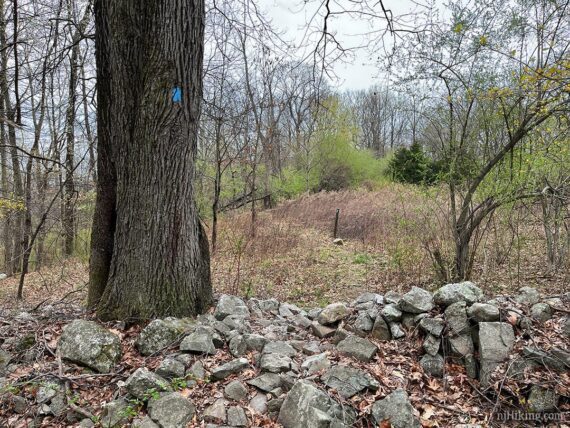
Overview: This route is entirely on the Jenny Jump Trail (BLUE), out and back. The trail is well marked and there aren’t any other marked trails that you pass.
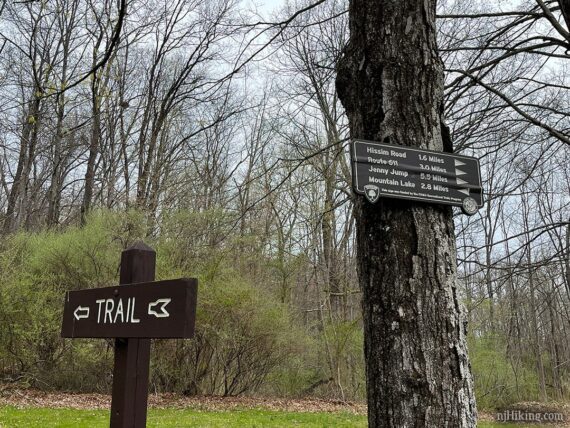
0.0 – The trailhead is at the far end of the parking lot has signs for Jenny Jump Trail and mileage for key points on the trail.
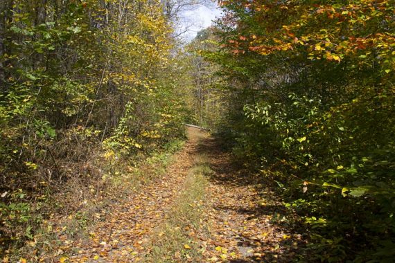
The trail varies between narrow trail and wider woods roads. While it has rocks it is not as rock-filled as other trails further north. There are old stone walls dotted throughout the route.
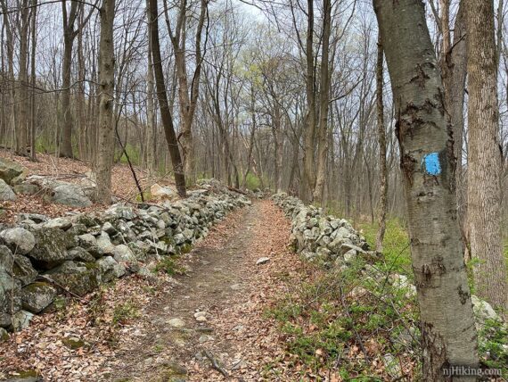
1.0 – Cross a woods road by turning LEFT then immediately RIGHT. Keep following the BLUE markers. There are several other woods roads along this route and we haven’t note them.
They aren’t marked on the trail map nor seem to be marked on other maps. BLUE was marked well and it was always obvious which way to go.
1.4 – Arrive at the wide-open viewpoint looking over the town below with the Kittatinny Mountain range in the distance.
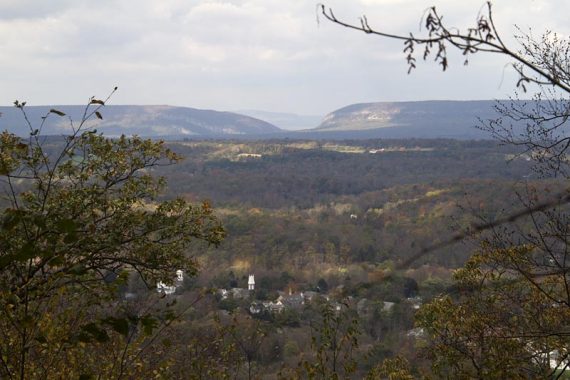
The prominent peak on the right is Mt. Tammany in New Jersey and on the left is Mt. Minsi in Pennsylvania. Between these is the “Delaware Water Gap” – a break in the mountain carved by the Delaware River.
Both of these peaks are fantastic hikes done on their own or tackle them together as an epic day hike we call Mind the Gap.
// Shorter, 2.8 miles total: Turn back at the viewpoint and retrace the route. //
1.6 – Waltz past an old side trail on the right that used to lead to a 2nd viewpoint – it’s not noticeable and you don’t need to look for it.
MAP NOTE: Only mentioning this side trail because it’s on the park’s current trail map (as well as other maps/apps) and I don’t want you to bother looking for something that is no longer there.
When we hiked in 2011 there were two viewpoints and this 2nd was the better one (more open while the first used to be limited. The first is now wide open). Now the only indication of a prior trail is a large flat rock leftover from a cairn.
Out of curiosity we followed our original GPS track to see what became of the old viewpoint and it was completely overgrown with trees as if a view never existed. Absolutely do not bother to do that.
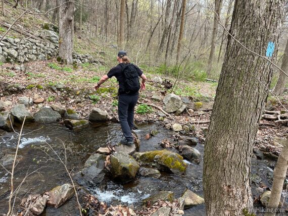
The trail starts heading steadily downhill, then levels off. Shortly after is an easy rock hop over a stream.
2.0 – After the stream crossing, BLUE turns to the RIGHT. Maps/apps may have an icon noting a THIRD viewpoint here (oddly, at the bottom of a hill) ignore that – it’s wrong.
MAP NOTE: This third viewpoint showing up on maps now made ZERO sense until I realized it’s OUR waypoint data – used incorrectly.
When we originally hiked this, I marked a waypoint to note the right turn. There were two blue markers – one on the trail and one on a woods road – which made the intersection unclear (it’s not marked like that now).
So it appears that our GPS data was downloaded from our site (without contacting us) and added to a map source with the waypoint incorrectly labeled as a viewpoint. Then this data has been used to create all sorts of maps without anyone verifying it, for many years (I found a 2015 map with it).
BLUE runs along the top of a hill with a stream down below on the right. There are lots of posted property signs off on the left. The trail approaches one of several road crossings.
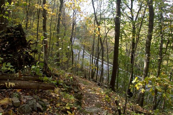
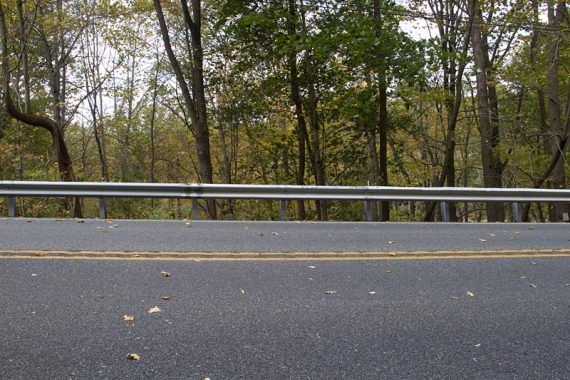
2.5 – Head steeply down stone slab steps to the road. It’s not clear what to do here, look across Hope Great Meadow Rd. and a bit to the right to find the BLUE marker painted on the guardrail.
Traffic moves kinda fast and there isn’t much shoulder on the other side. After climbing over the rail immediately go down steep stone steps.
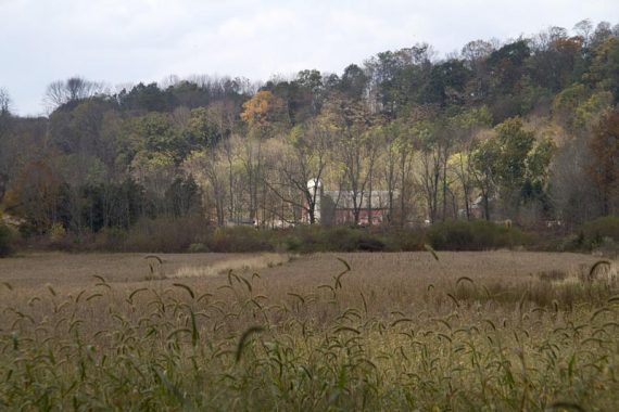
BLUE turns to the LEFT and runs along side a field. A farm house and silo can be seen across the field.
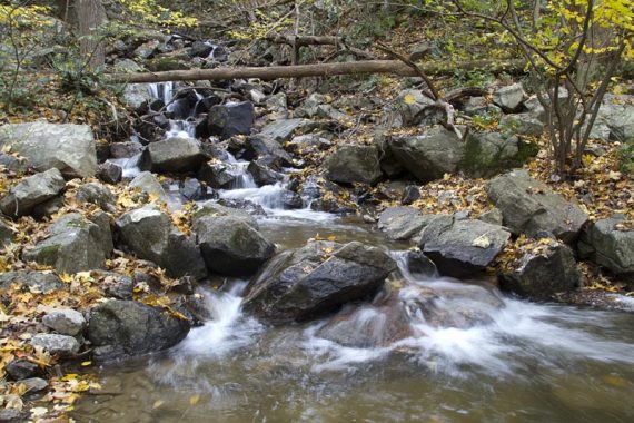
2.9 – Rock hop across a stream with nice water cascades. There are multiple large stones so finding a route isn’t very hard. And if for some reason it is, this is also a good turn around spot.
While it’s not technically a waterfall, there are multiple cascades along a decent sized stream tumbling down the hillside. A stone wall leftover from an old farm offers an obvious break spot.
// Shorter, 6.2 miles total: Instead, turn back at the cascades and retrace the route back. //
3.9 – BLUE continues and soon heads steadily uphill. Cross Hissim Road. There is hiker parking for a few cars along the road.
4.2 – Walk over a break in a stone wall… but, if you’re getting a bit tuckered out, this is a good spot to make the decision to turn back now or continue. Soon there will be a steep downhill (so uphill on the return), followed by long stretch of flat woods road (some dull sections) before arriving at the lake.
Lake Just-It is perfectly nice but is not the most enthralling break spot in the world. Technically, if you really want to see it, you can drive to that end afterward. Basically… if you’re pushing yourself right now just to get to Lake Just-It… just don’t.
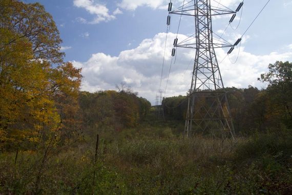
BLUE descends steeply. At the bottom of the hill, BLUE turns right to join a dirt/gravel woods road for a long stretch.
Continue, eventually passing a gated driveway on the right before crossing a power line cut.
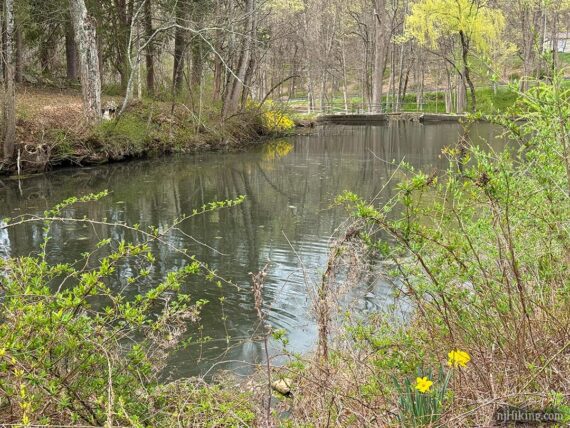
5.4 – Arrive at a parking area with smallish Lake Just-It on the left.
Believe all of this is new since we hiked in 2011, I’d noted there was nowhere to park back then and now there is all of this, plus they’ve rerouted the continuation of the trail off the road.
This is close to a road so houses are visible. It makes an OK break spot but it’s not overly scenic.
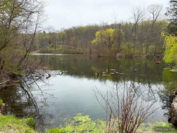
The water is split into two sections with a concrete structure; this is looking towards the road.
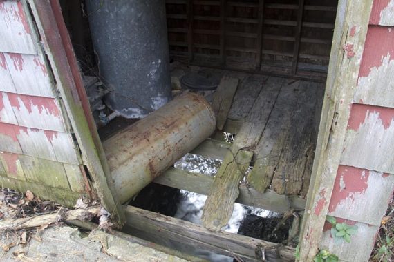
When we arrived here in 2011, there was a small old red building near the dam at the end of the lake.
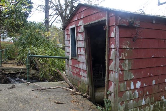
No idea how old it was but it was clearly disintegrating. In 2025 this structure was completely gone but I’m leaving these photos as an archive.
Just beyond the parking area is Lake Just-It Road but there is no reason to go all the way to the road. The trail used to continue along the road a bit before turning back into the woods – but it now the continuation is off of the parking area.
There are several large rocks at the edge of the parking area to take a break on. From here, retrace the route back to the lot.
// Longer, up to 16.6 miles round trip: Jenny Jump Trail (BLUE) continues from the parking area. There is a spur trail to parking at Mountain Lake and the JJT ends at a parking area on Rt. 617.
—
Hiked: 4/19/25.
Hiked: 10/15/11 Trail Blog: “Jenny Jump Trail in the Fall“
5/2024: One of the two viewpoints is clear and the trail is likely passable now. Appears in the 2024 edition of Best Day Hikes in New Jersey. We have not re-hiked and the directions are from 2011.
7/2020: Page refreshed, not re-hiked.
7/12/19 – We’ve gotten an update that the viewpoint of Mt. Tammany, Mt. Minsi, and the Delaware Water Gap in the distance early on in this hike – the highlight of this trail – is now non-existent due to overgrowth. [Thanks to Amy for the update]
6/10/14 – Trail conditions remain poor, the viewpoints are a little hard to find, and the section that continues past this hike, from Lake Just-It to Mountain Lake has no views of Mountain Lake and is just wet and buggy. [Thanks to TJK for the update]
11/5/13 – We’ve gotten a report that this trail is overgrown, in several spots large trees have come down over the trail which then requires working your way around through the underbrush, and overall is a very poorly maintained trail.
The second view point spur trail is no longer marked by a rock cairn because it was knocked over. [Thanks to Michael P. for the update].
10/15/11 – The trail was overgrown in many areas (ouuuch thorns) when we went (2011), but the trail may not have been officially open/completed yet.