Hike to the some of the most impressive views in New Jersey.
A point needs some height in order to provide a view, so the majority of these are located in the northern third of New Jersey (central and south are generally at lower elevations). Also included are a couple hikes in Pennsylvania that overlook New Jersey.
Each overview has links to our related hike guides with detailed directions, parking and restroom info, an interactive map, and photos and videos. Listed in no particular order – they’re all good!
Want a viewpoint with little or no hiking? Check out High Point Monument, Sunrise Mountain, Goat Hill Overlook, and The Palisades.
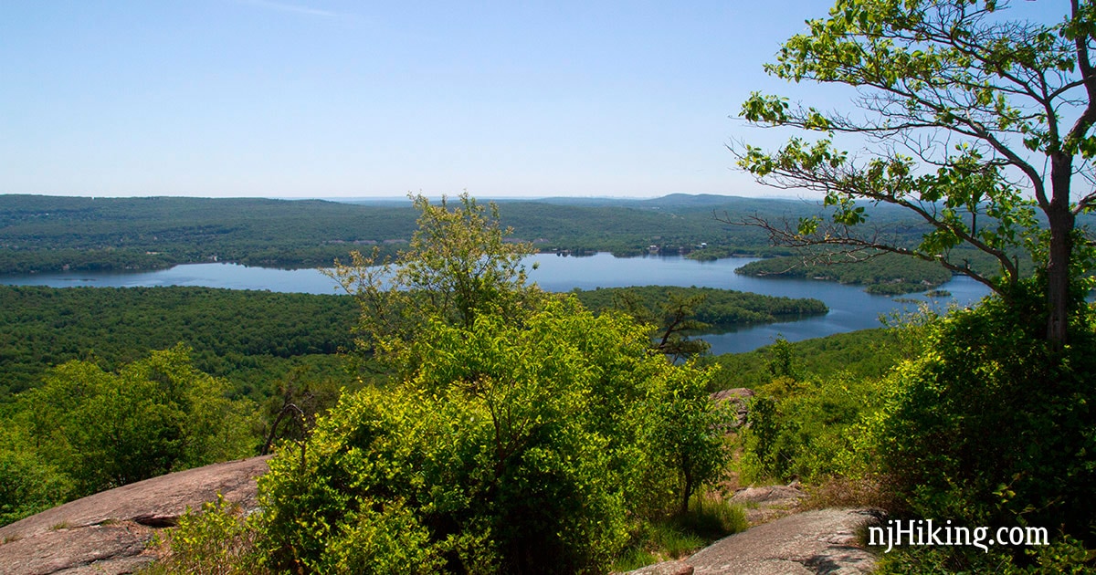
Wyanokie High Point
What you’ll see: From a wide-open rocky outcrop enjoy 360° panoramic views over the surrounding forest, hills, and Wanaque Reservoir. On a clear day the New York City skyline can be visible.
Location: Norvin Green State Forest in Passaic County, NJ.
Distance: 7.6 or 2.6 miles, total round trip.
This summit feels like a remote perch in the middle of a forest despite being in a densely populated area with a potential to spot the NYC skyline in the distance.
Our route combines the viewpoint with Chikahoki Falls and Otter Hole falls in a rugged 7.6 mile loop but includes instructions for a shorter, 2.6 mile out-and-back to just Wyanokie High Point.
Read the complete Wyanokie High Point hike guide.
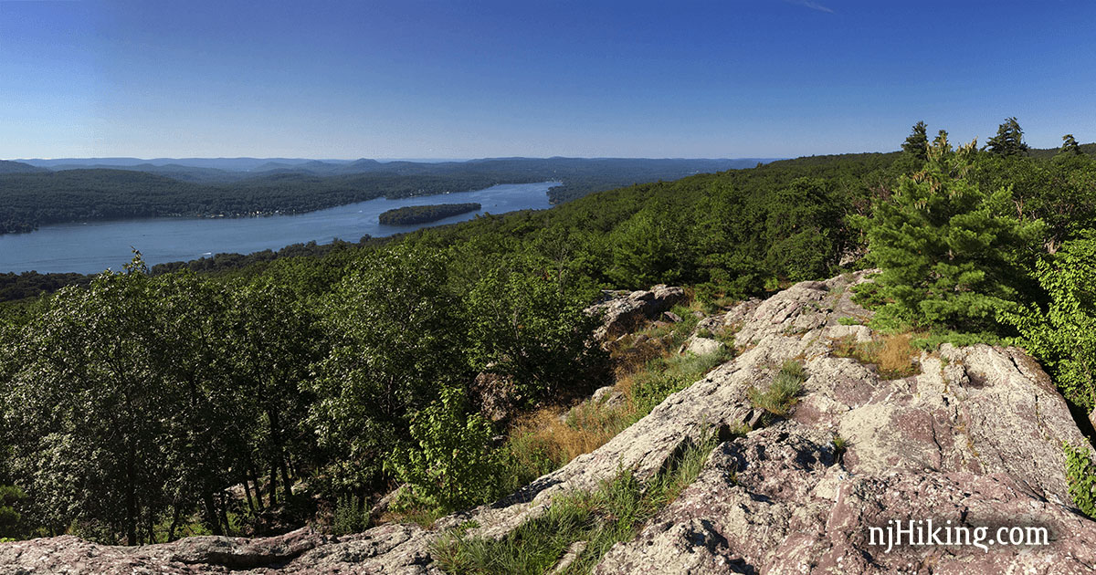
Greenwood Lake
What you’ll see: Impressive panorama over Greenwood Lake as it comes in from New York and crosses in to New Jersey, seen from the Ernest Walker Trail. Beyond the lake, spot a series of Jersey mountains in the distance (also full of great trails!).
Location: Abram S. Hewitt State Forest in Passaic County, NJ.
Distance: 4.1 or 2.0 miles, total round trip.
The most straightforward route is a steep 2.0 miles total, up-and-back, just to the view, with an option to extend it into a 4.1 mile loop that includes Surprise Lake.
We also have a longer variation starting from a different trailhead: Bearfort Ridge Loop – Surprise Lake hike guide. Both versions are solid picks.
Read the complete Greenwood Lake via State Line hike guide.
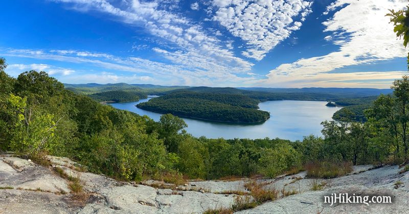
Monksville Reservoir from Horse Pond Mountain
What you’ll see: Distinctive horseshoe shaped Monksville Reservoir curving around Monks Mountain, with the many surrounding mountains in the area.
Location: Long Pond Ironworks State Park in Passaic County, NJ.
Distance: 1.2 or 8.2 miles, total round trip.
Climb just to the viewpoint and back for a short-n-steep 1.2 miles total or try our 8.2 mile loop that continues into the pretty Lake Sonoma area of Norvin Green State Forest. Doing the Burnt Meadow Loop (GREEN) is also an option (that is not on our site).
Whatever route you choose, pay attention to our directions to pass the first partial/limited view and get to the actual viewpoint.
Read the complete Monksville Reservoir from Horse Pond Mountain hike guide.
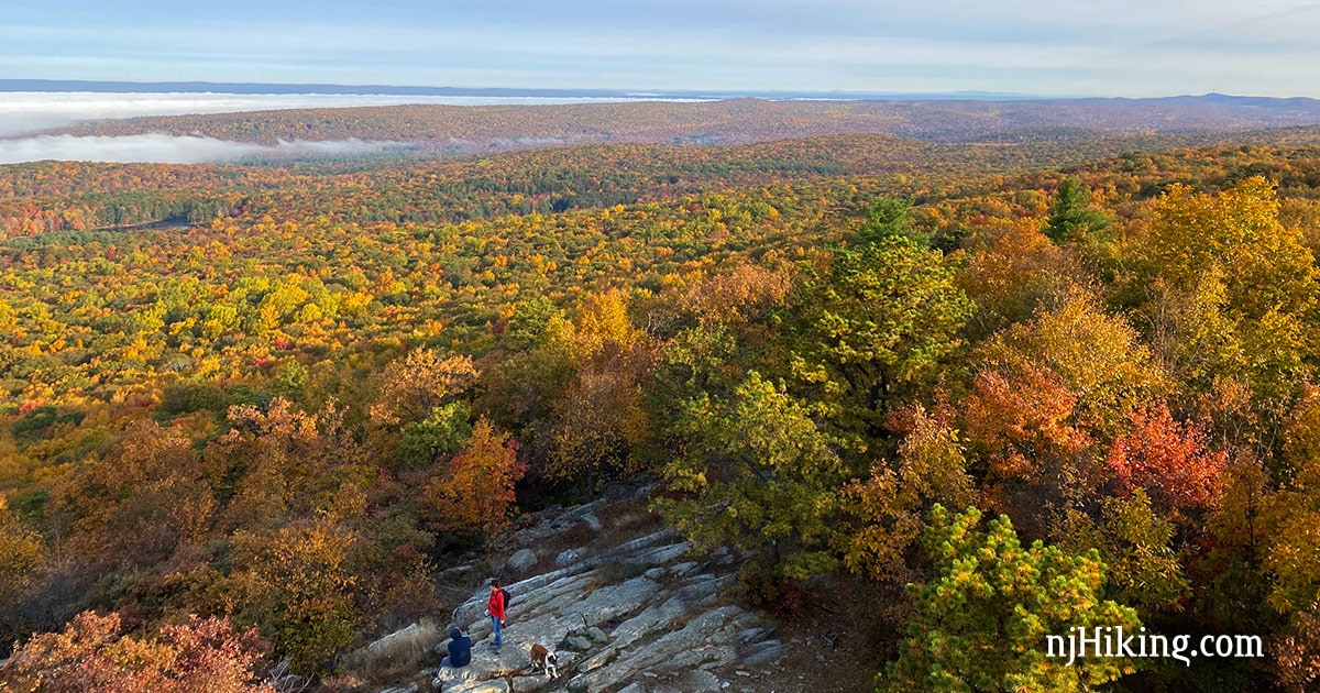
Culver Fire Tower
What you’ll see: Impressive views over beautiful Stokes State Forest and the Kittatinny Ridge.
Location: Appalachian Trail / Stokes State Forest in Sussex County, NJ.
Distance: 3.3 or 5.3 miles, total round trip.
A rewarding view, manageable mileage, and easy navigation makes this a solid pick. Optionally, extend it to a 5.3 mile loop to Stony Lake. Avid hikers could approach from Sunrise Mountain for a 7.1 mile out-and-back hike.
Read the complete Culver Fire Tower hike guide.
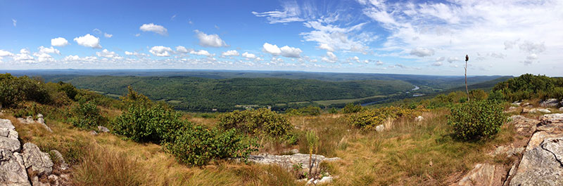
Raccoon Ridge
What you’ll see: Expansive view from Mount Mohican over New Jersey, the Delaware River, and Pennsylvania – plus a chance to spot hawks during migration.
Location: Delaware Water Gap NRA / Worthington S.F. in Warren County, NJ.
Distance: 5.5 or 6.2 miles, total round trip.
Easy navigation (out-and-back on the Appalachian Trail) packed with multiple viewpoints. Good trail to peep some fall foliage in season, with sweeping views before arriving at a 360° panorama from Raccoon Ridge (a hawk watch location in season).
Alternately, approach via steep Garvey Springs to Sunfish Pond to Raccoon Ridge for a 6.2 mile out-and-back (avid hikers could extend further).
Read the complete Raccoon Ridge hike guide.
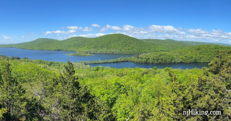
Governor Mountain
What you’ll see: Stunning view over the Wanaque Reservoir from a rock outcrop on the Cooper Union Trail.
Location: Ringwood State Park in Passaic County, NJ.
Distance: 7.3 or 2.2 miles, total round trip.
Manageable hike with a sweeping view as the reward. The shorter version delivers the same view for less effort – but our full route is a worthwhile ramble though a pretty forest. After your hike, explore nearby Ringwood Manor, the Victorian-era summer estate of Abram S. Hewitt.
Read the complete Governor Mountain hike guide.
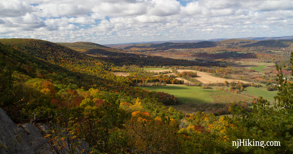
Stairway to Heaven to Pinwheel‘s Vista
What you’ll see: Forested hillsides and picturesque farms in the valley below, the Kittatinny Mountain range in the distance, and on a clear day – the High Point Monument.
Location: Wawayanda State Park in Sussex County.
Distance: 2.6 or 7.3 miles, total round trip.
Short but steep rocky hike with a stunning view as a reward, but this famous section of the Appalachian Trail is very popular.
Avid hikers can tackle the longer version of the hike, Stairway to Heaven: Pochuck Valley to Pinwheel Vista, a 7.3 mile out-and-back that adds the Pochuck boardwalk and suspension bridge section.
Read the complete Stairway to Heaven hike guide.
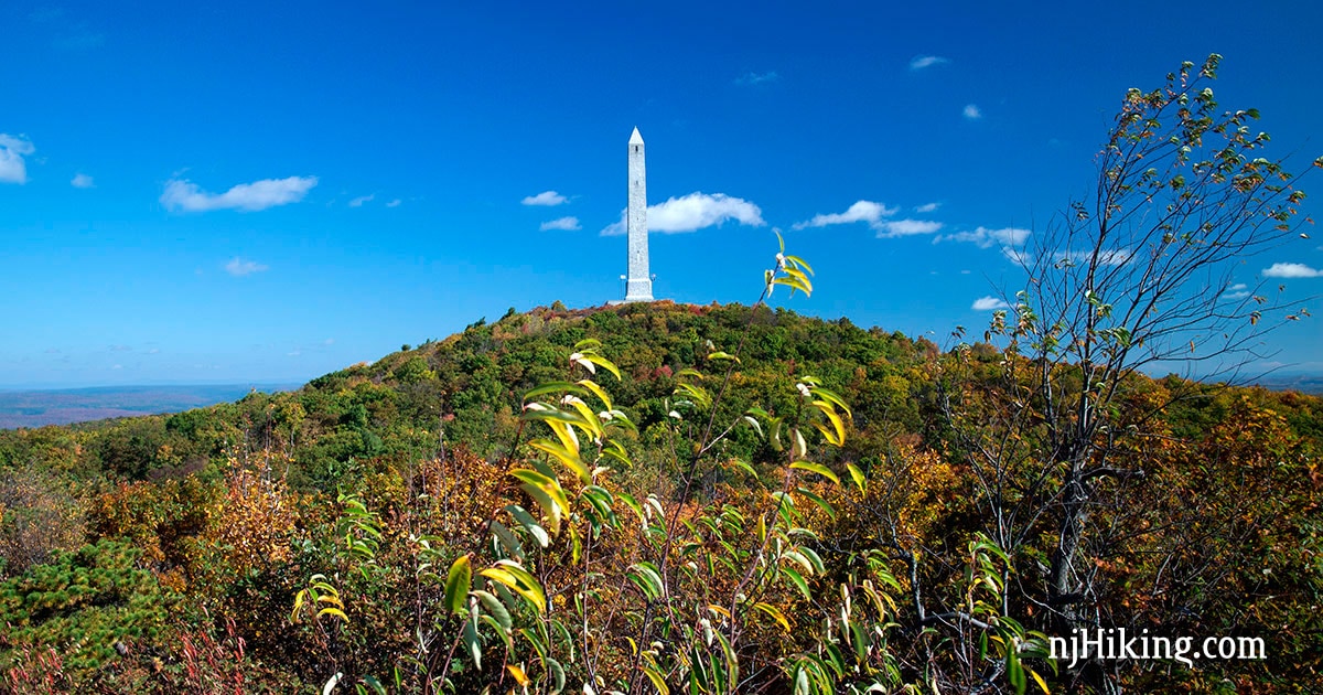
High Point Monument Loop
What you’ll see: Get 360° degree view from the highest elevation in the state (1,803′) and enjoy vast views of New Jersey, Pennsylvania, and New York.
Location: High Point State Park in Sussex County, NJ.
Distance: Minimal or 3.5 or 7.7 miles, total round trip.
In addition, explore an Atlantic cedar swamp, hike through some of the best fall color that New Jersey has to offer, and optionally tackle the obelisk’s 291 stairs to the top.
Of note, this hike starts at the monument’s parking lot – already at elevation – so the initial views can be seen without effort.
Extend your hike to a 7.7 mile loop with our Monument Trail via Appalachian Trail hike guide, or try a variation of the Monument Loop via Steeny Kill Lake.
Read the complete High Point Monument Loop hike guide.
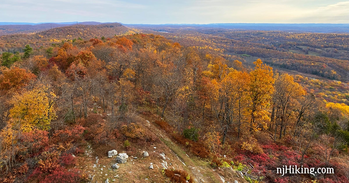
Catfish Fire Tower
What you’ll see: Panoramic view over the Kittatinny Ridge. Farms and fields are in the valley below and west looks over the Delaware Water Gap National Recreation Area in New Jersey and into Pennsylvania.
Location: Delaware Water Gap NRA in Warren County, NJ.
Distance: 4.4 or 2.0 miles, total round trip.
In addition to the 360° views from the tower, there are many views of the valley along this stretch of the Appalachian trail. This route is a direct out-and-back to one of the viewpoints along the A.T. but can be cut to 2.0 by turning around at the tower.
Alternately, make it a loop with our Rattlesnake Swamp – Catfish Fire Tower Loop hike guide, and avid hikers make want to tackle an extended version of that hike, Coppermines, Appalachian Trail, Catfish Fire Tower, Rattlesnake Swamp.
Read the complete Catfish Fire Tower hike guide.
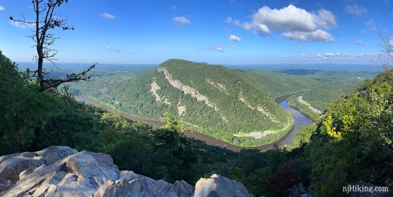
Mt. Tammany
What you’ll see: New Jersey, Pennsylvania, Mt. Minsi, and the Delaware River carving a “water gap” through the Kittatinny Mountain range.
Location: Worthington State Forest / Delaware Water Gap NRA in Warren County, NJ.
Distance: 3.5 miles, total round trip.
Mt. Tammany is on every “best of” list for hiking in New Jersey with good reason. While this classic hike looks over New Jersey and the Delaware River below, the mountain looming large, Mt. Minsi, actually sits on the Pennsylvania side of the Delaware Water Gap.
Avid hikers can extend this route by hiking Mt. Tammany and Sunfish Pond together. Or opt to do our “Mind the Gap” challenge by hiking Mt. Tammany and Mt. Minsi in one day.
Read the complete Mt. Tammany hike guide.
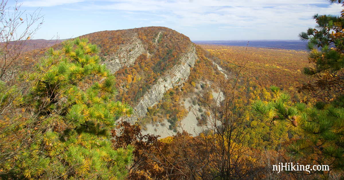
Mt. Minsi
What you’ll see: New Jersey, Mt. Tammany, the Delaware River carving a “water gap” through the Kittatinny Mountain range.
Location: Delaware Water Gap NRA in Pennsylvania (close to NJ border).
Distance: 5.1 miles, total round trip.
Hike up Mt. Minsi in order to view Mt. Tammany – and see how these two mountains are mirror images of each other. Plenty of rhododendron that bloom in July and great for fall foliage season.
Optionally extend the route by including Caldeno Falls and Table Rock. Or tackle Mt. Tammany and Mt. Minsi in one day in order to “Mind the Gap”.
Read the complete Mt. Minsi hike guide.
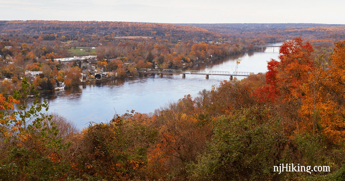
Goat Hill Overlook
What you’ll see: View over the Delaware River, Lambertville, NJ and New Hope, PA.
Location: Hunterdon County, NJ.
Distance: 1.0 or 2.4 miles, total round trip.
Short but popular walk with a nice payoff. Our full loop offers two more overlooks and should leave the crowds behind. Fall color peaks towards the end of October here, just as color up north is waning.
Bonus – five to ten minutes away from plenty of restaurants and shops in Lambertville, NJ and over the bridge in New Hope, PA.
Read the complete Goat Hill Overlook hike guide.
Sunrise Mountain
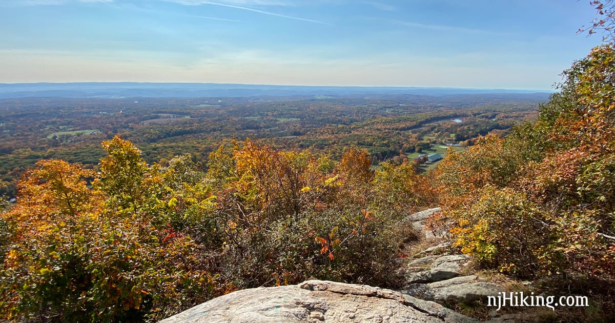
What you’ll see: Expansive view over farms and fields in the valley below the Kittatinny Ridge.
Location: Stokes State Forest in Sussex County, NJ.
Distance: 0.4 or 7.1 miles, total round trip.
This route rambles through Stokes from the Stony Lake area before climbing up to Sunrise Mountain and back down Stony Brook.
Alternately, start from the parking lot atop Sunrise Mountain and either walk to the pavilion viewpoint and back as part of a scenic drive around the park, or continue on the Appalachian Trail from Sunrise Mountain to the Culver Fire Tower and Culvers Gap.
Read the complete Sunrise Mountain hike guide.

The Palisades
What you’ll see: Dramatic cliffs plunging into the Hudson River with a panoramic view of New York.
Location: Palisades Interstate Park in Bergen County, NJ.
Distance: Nominal for viewpoints only or 5.5 miles, total round trip.
This long, skinny park is perched atop cliffs overlooking the river and has trails along the top and down at riverside, with steep connectors to make loops. Optionally, drive the Palisades Interstate Parkway and stop at the various lookouts such as Alpine or State Line.
In addition to this loop from Alpine to Huyler’s Landing, we have one in the opposite direction, Alpine to Forest View, as well as a guide to Peanut Leap Cascade and the challenging Giant Stairs.
Read the complete Palisades hike guide.
Apple Pie Hill
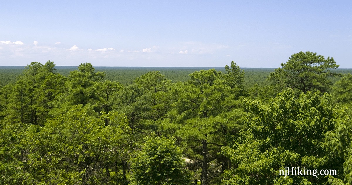
What you’ll see: An endless sea of pine trees in all directions from the top of a fire tower – one of the most unique vistas in the state. On clear days, the Atlantic City and Philly skylines may be visible.
Location: Wharton State Forest in Burlington County, NJ.
Distance: 8.4 miles, total round trip.
This is a nice Pine Barrens hike on a section of the Batona Trail starting at the Carranza Memorial – but note that the fire tower has been fenced off since 2016.
The tower may be accessible when staffed by a fire watcher and sometimes there are “open climb” days a few times per year – check with the park or the details on our hike guide before heading out.
Read the complete Apple Pie Hill hike guide.
Cliff Park
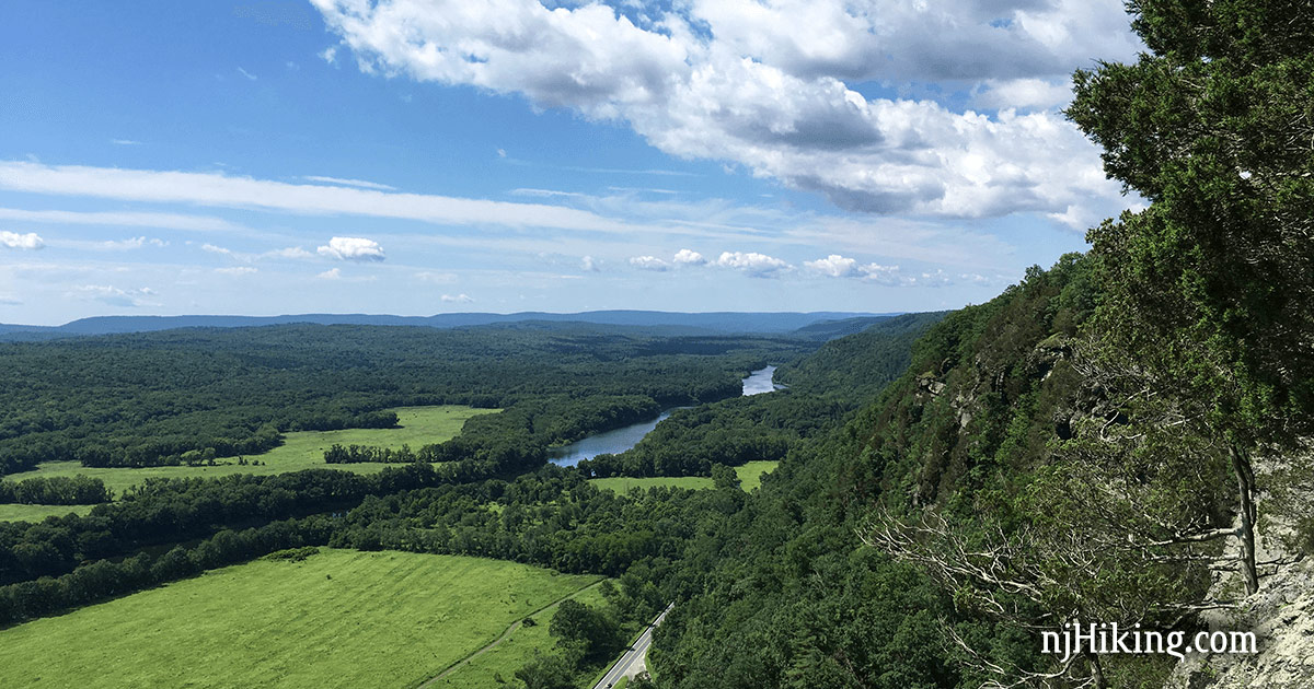
What you’ll see: From cliffside trail, enjoy multiple spectacular views of northern New Jersey, the Delaware River, and Pennsylvania. Possibly spot the High Point Monument in the distance.
Location: Delaware Water Gap NRA in Pennsylvania (close to NJ border).
Distance: 7.0 miles, or less, total round trip.
Forests, fields, rolling hills as far as the eye can see. At the end of the loop is an overlook of the town of Milford, PA. The valley below can have low clouds in the morning that look amazing but obscure the view a bit before they burn off.
Our route goes to the overlook at Milford Knob before continuing to Hackers Falls and back but can be lessened by turning back sooner or skipping the falls.
Read the complete Cliff Park hike guide.
For even more hike suggestions…
Check out the Top 10 Hikes in New Jersey, our big list of the Best Hikes in New Jersey and the specific lists for the Best Hikes in Central Jersey and the Best Hikes in South Jersey.
Try the Best Waterfall Hikes in springtime or after lots of rain, and the Best Foliage Hikes for autumn. Beginners can choose an easy hike while avid hikers might tackle a challenging hike. Also be sure to pop over to the Hike Finder Map and the list of all the hike guides on the site.